
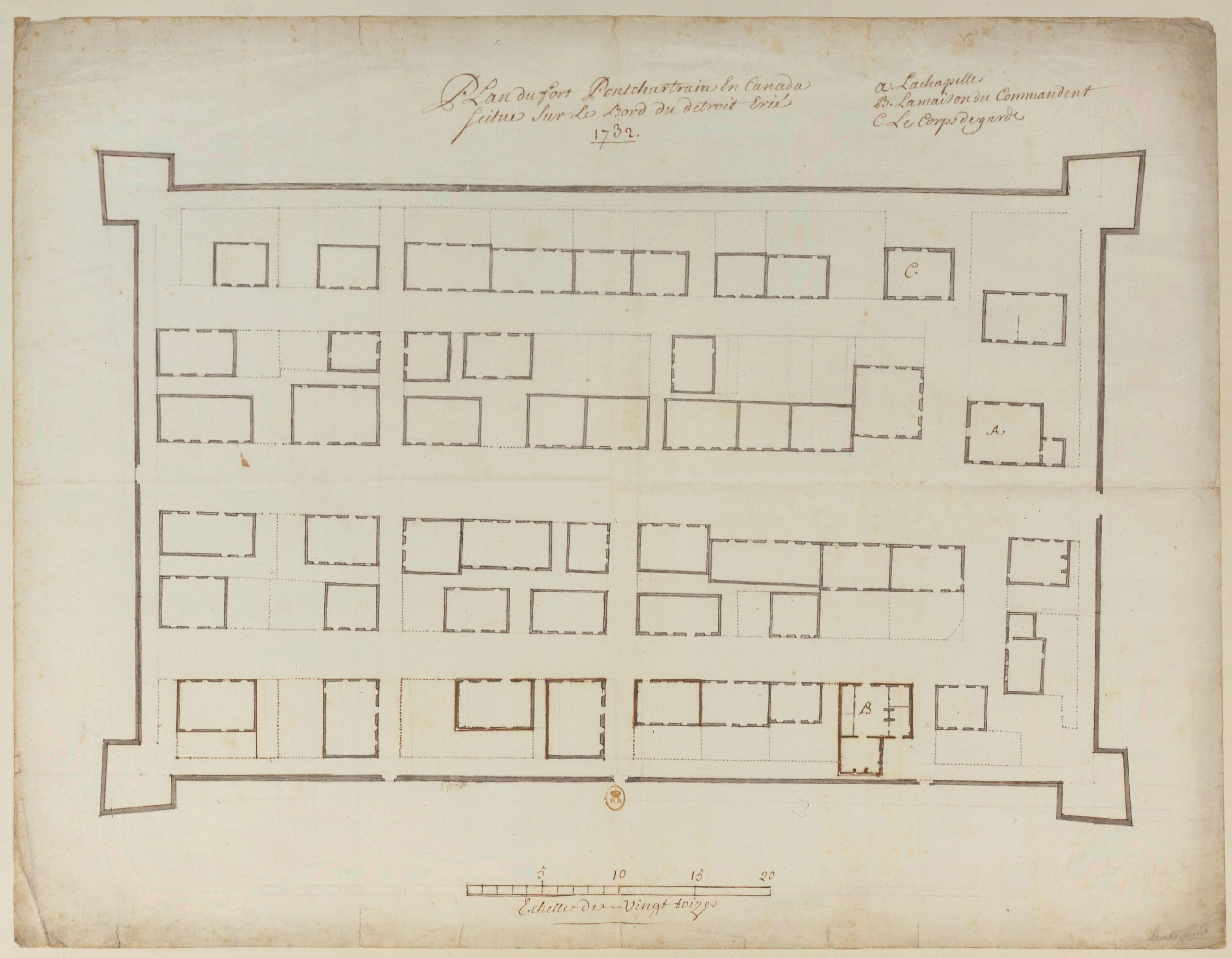
Map of Fort Pontchartrain In Canada, On the Strait of Lake Erie. (Plan Du Fort Pontchartrain En Canada Situé Sur Le Bord Du Détroit Erié) 1732
- Regular price
-
$49.95 - Regular price
-
$34.95 - Sale price
-
$49.95
Buy one map, get any other map in our collection for 50% OFF! Add to cart to see discount.
Couldn't load pickup availability
About This Map
Discover the timeless beauty of our fine art quality printed reproduction of this antique map. Perfect for history enthusiasts, collectors, and interior decorators.
Restored with meticulous attention to detail by our team with over a decade of experience, this stunning reproduction captures the intricate artistry and historical significance of the original map.
Whether you're a collector or seeking a unique decor piece, this archival-quality map reproduction is a timeless addition to any space. Order now to bring history to life!
Old map of Detroit, Michigan, United States of America.Clair in what is today the city of Detroit, Michigan, was established in 1701 by Antoine Laumet de Lamothe Cadillac, a French military officer. It was named in honor of France's navy minister, the Comte de Pontchartrain. Lamothe Cadillac was something of a visionary megalomaniac who hoped to make the post "the Paris of New France." The interior of the fort was arranged according to a grid plan, similar to a small town. During the 18th century, Detroit (which literally means "the strait") became the main French settlement in the Great Lakes region. In 1765 the population of the settlement included some 2,600 Indians and 800 persons of European origin, spread out over 15 kilometers on both sides of the Detroit River. Letters are used to indicate: the chapel (A); the house of the commandant (B); and the guardhouse (C). The scale of the map is in toises, a measurement used in prerevolutionary France and New France. One toise equaled a bit less than two meters.
- Title devised, in English, by Library staff.
- Original resource extent: 1 drawing : pen, ink wash, and watercolor ; 41 x 53.3 centimeters.
- Original resource at: National Library of France.
- Content in French.
- Description based on data extracted from World Digital Library, which may be extracted from partner institutions.
- For the best legibility, order your map in the original size or larger. Most maps have intricate detail and small text that is best appreciated when the print size hasn't been reduced.
- Sizes labeled "Fits a Standard Frame" will drop right into any frame that you purchase in that size. The sizes that we offer are commonly available online and at most retail stores.
- Our standard sizes are recommendations based on the aspect ratio of the original map, but still may require some added "white space" in one dimension to fit.
- Non-standard sizes will require custom framing, and we suggest taking your print to the frame shop of your choice after you receive it for the best results.
- Custom sizes are available, simply contact us for a quote.
Below is an approximation of the scale of a few standard sizes, and how they might appear in your space.

