
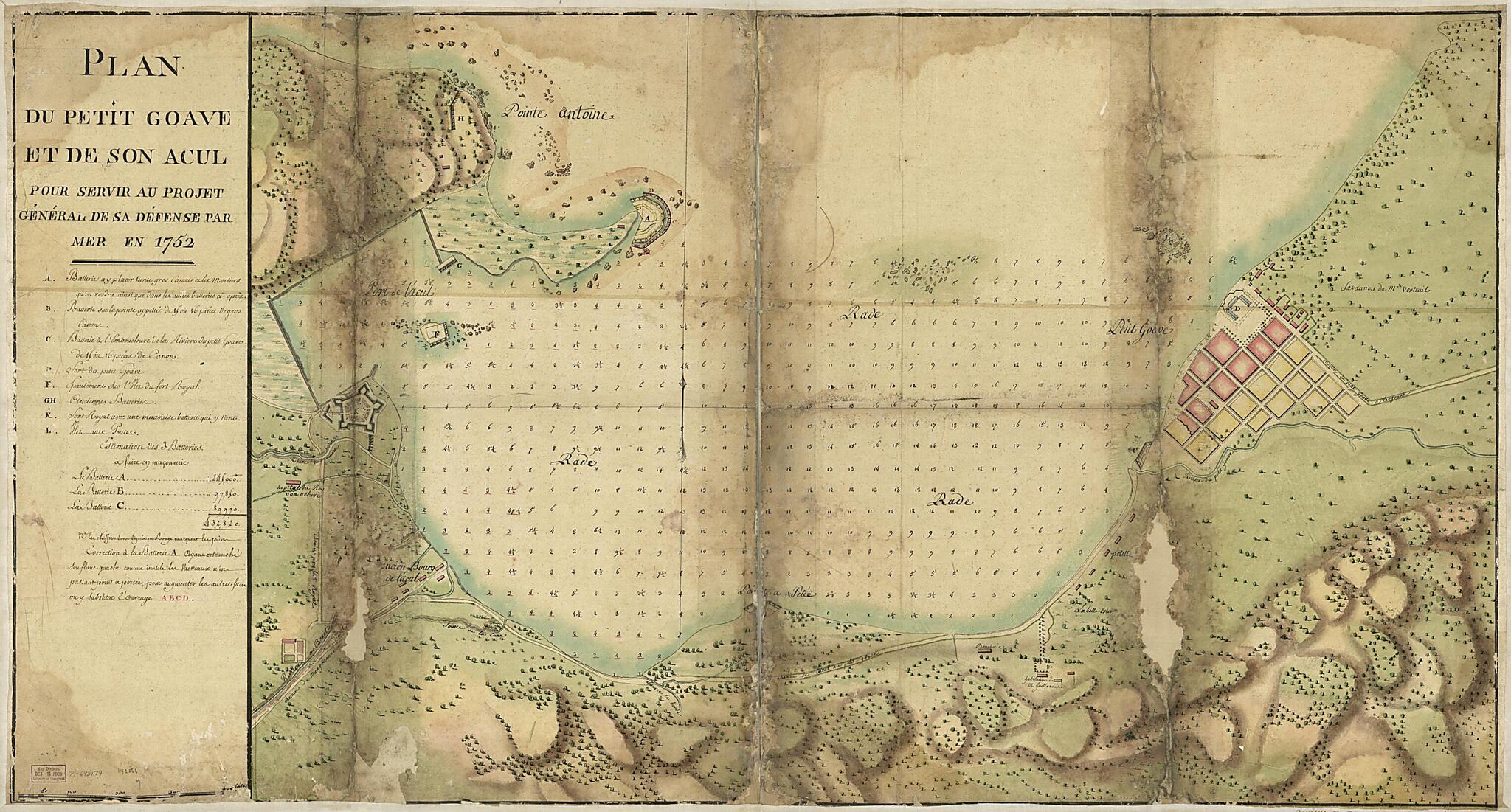
Plan Du Petit Goâve Et De Son Acul Pour Servir Au Projet Général De Sa Défense Par Mer En in 1752
- Regular price
-
$176.95 - Regular price
-
$171.95 - Sale price
-
$176.95
Shipping calculated at checkout.
Buy one map, get any other map in our collection for 50% OFF! Add to cart to see discount.
Couldn't load pickup availability
About This Map
Old early map / manuscript map of Haiti, Petit Goâve, Petit Goâve..
- Scale ca. 1:5,200.
- Manuscript, pen-and-ink and watercolor, on tracing paper.
- Has watermark.
- Relief shown by shading. Depths shown by soundings.
- This map has some imperfections: deteriorated and discolored along folds. We'll do our best to restore the image before printing.
- On verso, upper left corner: No. 22. [changed to] 12.
Map Subjects
Early Maps
Early Works To 1800
Fortification
Haiti
Harbors
Manuscript Maps
Petit Goâve
Petit Goâve (Haiti)
Petit Goâve.
1752
Map Sizing Information
- For the best legibility, order your map in the original size or larger. Most maps have intricate detail and small text that is best appreciated when the print size hasn't been reduced.
- Sizes labeled "Fits a Standard Frame" will drop right into any frame that you purchase in that size. The sizes that we offer are commonly available online and at most retail stores.
- Our standard sizes are recommendations based on the aspect ratio of the original map, but still may require some added "white space" in one dimension to fit.
- Non-standard sizes will require custom framing, and we suggest taking your print to the frame shop of your choice after you receive it for the best results.
- Custom sizes are available, simply contact us for a quote.
Below is an approximation of the scale of a few standard sizes, and how they might appear in your space.
