
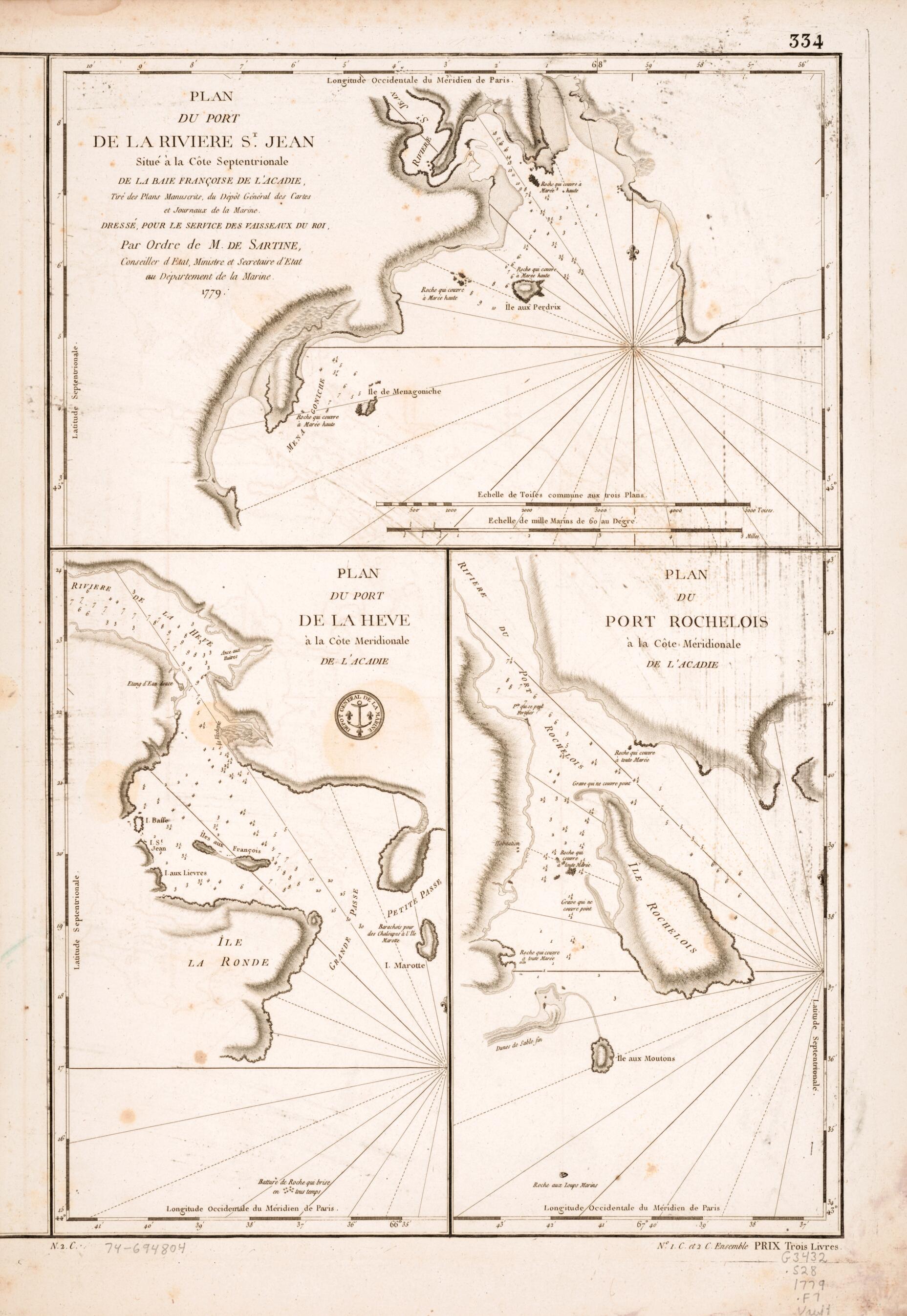
Plan Du Port De La Rivière St. Jean Situé à La Côte Septentrionale De La Baie Françoise De L'Acadie 1779
- Regular price
-
$52.95 - Regular price
-
$47.95 - Sale price
-
$52.95
Shipping calculated at checkout.
Buy one map, get any other map in our collection for 50% OFF! Add to cart to see discount.
Couldn't load pickup availability
About This Map
Old early map of Canada, La Have River, N.B, N.S, Nova Scotia, Saint John Harbour, Shelburne, Shelburne Harbour.
Created by France. Dépôt Des Cartes Et Plans De La Marine, Antoine De Sartine in 1779.
Created by France. Dépôt Des Cartes Et Plans De La Marine, Antoine De Sartine in 1779.
- Relief shown by hachures. Depths shown by soundings.
- "Longitude occidentale du méridien de Paris."
- "334" located above upper right corner of border.
- "N. 2.C." located below lower left corner of border.
- "No. 1.C. et 2.C. ensemble prix trois livres." located below lower right corner of border.
- Insets: Plan du port de la Heve à la côte meridionale de l'Acadie.--Plan du Port Rochelois à la côte méridionale de l'Acadie.
Map Sizing Information
- For the best legibility, order your map in the original size or larger. Most maps have intricate detail and small text that is best appreciated when the print size hasn't been reduced.
- Sizes labeled "Fits a Standard Frame" will drop right into any frame that you purchase in that size. The sizes that we offer are commonly available online and at most retail stores.
- Our standard sizes are recommendations based on the aspect ratio of the original map, but still may require some added "white space" in one dimension to fit.
- Non-standard sizes will require custom framing, and we suggest taking your print to the frame shop of your choice after you receive it for the best results.
- Custom sizes are available, simply contact us for a quote.
Below is an approximation of the scale of a few standard sizes, and how they might appear in your space.

