
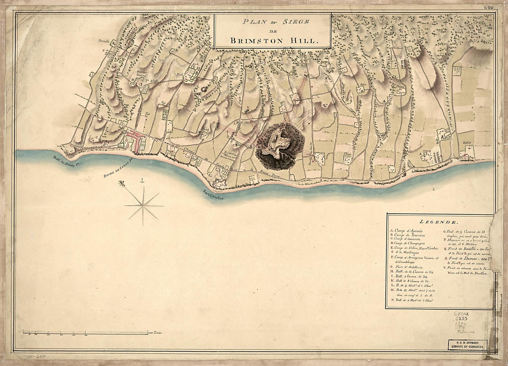
Plan Du Siege De Brimston Hill 1782
- Regular price
-
$69.95 - Regular price
-
$64.95 - Sale price
-
$69.95
Shipping calculated at checkout.
Buy one map, get any other map in our collection for 50% OFF! Add to cart to see discount.
Couldn't load pickup availability
About This Map
Old map of Brimstone Hill Fortress, Nevis, Saint Kitts.
- Scale ca. 1:14,440.
- Manuscript, pen-and-ink and watercolor.
- Hand colored.
- Accompanied by photocopy of map.
- Relief shown by shading.
- Copy This map has some imperfections: right margin deteriorated, part of legend wanting. We'll do our best to restore the image before printing.
- Shows siege of British citadel on St. Christopher Island by French forces.
- Indexed for military points of interest.
Map Subjects
Brimstone Hill Fortress
Brimstone Hill Fortress (Saint Kitts And Nevis)
Early Works To 1800
Saint Kitts
Siege
Nevis
1782
Map Sizing Information
- For the best legibility, order your map in the original size or larger. Most maps have intricate detail and small text that is best appreciated when the print size hasn't been reduced.
- Sizes labeled "Fits a Standard Frame" will drop right into any frame that you purchase in that size. The sizes that we offer are commonly available online and at most retail stores.
- Our standard sizes are recommendations based on the aspect ratio of the original map, but still may require some added "white space" in one dimension to fit.
- Non-standard sizes will require custom framing, and we suggest taking your print to the frame shop of your choice after you receive it for the best results.
- Custom sizes are available, simply contact us for a quote.
Below is an approximation of the scale of a few standard sizes, and how they might appear in your space.

