
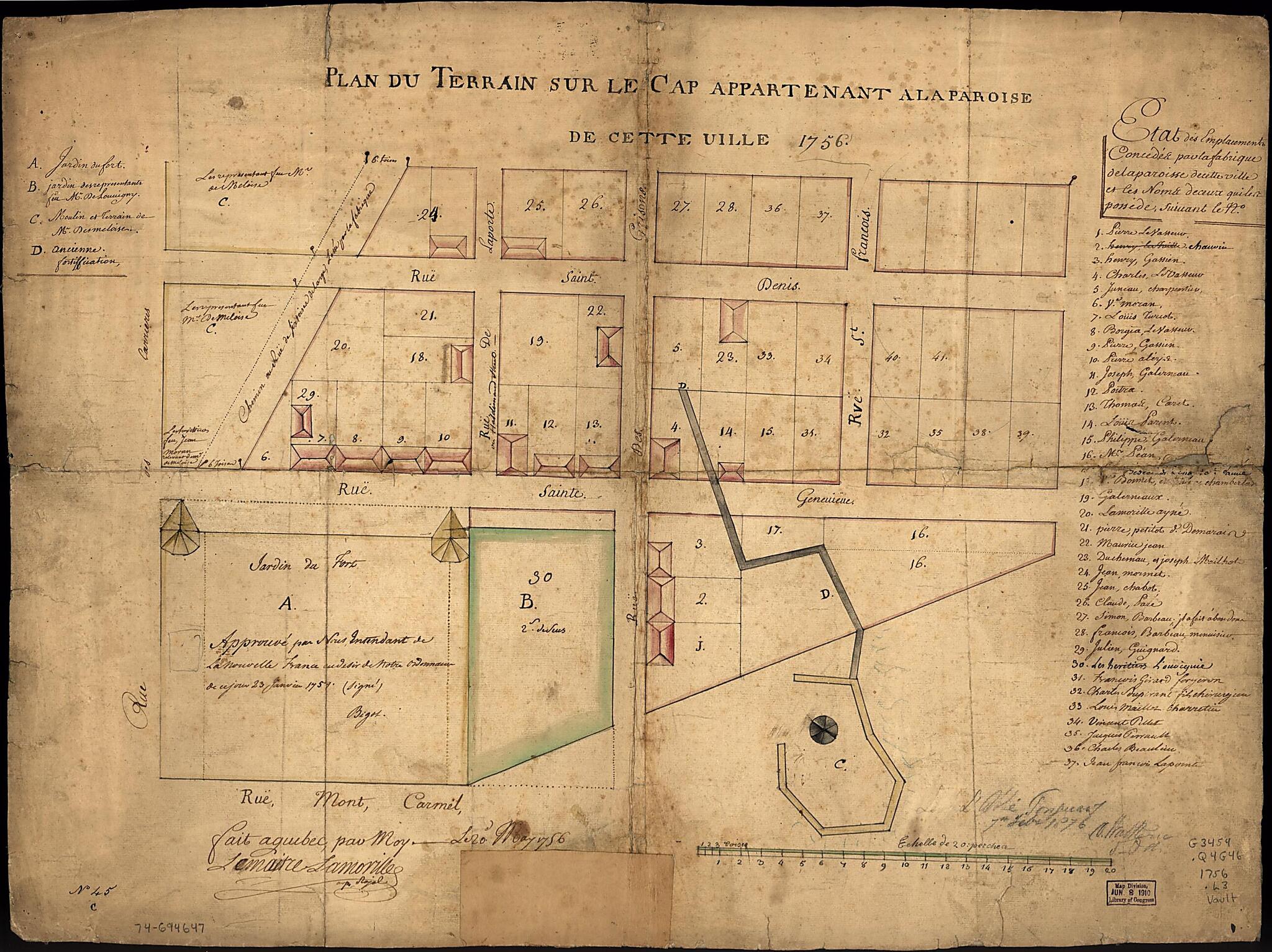
Plan Du Terrain Sur Le Cap Appartenant à La Paroise De Cette Uille 1756
- Regular price
-
$67.95 - Regular price
-
$62.95 - Sale price
-
$67.95
Shipping calculated at checkout.
Buy one map, get any other map in our collection for 50% OFF! Add to cart to see discount.
Couldn't load pickup availability
About This Map
Old map of Canada, Québec.
Created by Lemaitre Lamoville in 1756.
Created by Lemaitre Lamoville in 1756.
- Scale ca. 1:550.
- Manuscript, pen-and-ink and watercolor.
- The original manuscript plot of the top of the cape at Quebec, on which the Chateau St. Louis stood, where the Chateau Frontenac now stands, as well as the Wolfe-Montcalm monument; shows the amount of land occupied by each of those French Canadians then residing upon what is now the most aristocratic part of Quebec.
- "No. 45."
- Includes index to points of interest and list of 37 land owners.
Map Subjects
Canada
Early Works To 1800
Maps Manuscript
Québec
Québec (Province)
Québec (Québec)
Real Property
Lemaitre Lamoville
1756
Map Sizing Information
- For the best legibility, order your map in the original size or larger. Most maps have intricate detail and small text that is best appreciated when the print size hasn't been reduced.
- Sizes labeled "Fits a Standard Frame" will drop right into any frame that you purchase in that size. The sizes that we offer are commonly available online and at most retail stores.
- Our standard sizes are recommendations based on the aspect ratio of the original map, but still may require some added "white space" in one dimension to fit.
- Non-standard sizes will require custom framing, and we suggest taking your print to the frame shop of your choice after you receive it for the best results.
- Custom sizes are available, simply contact us for a quote.
Below is an approximation of the scale of a few standard sizes, and how they might appear in your space.

