
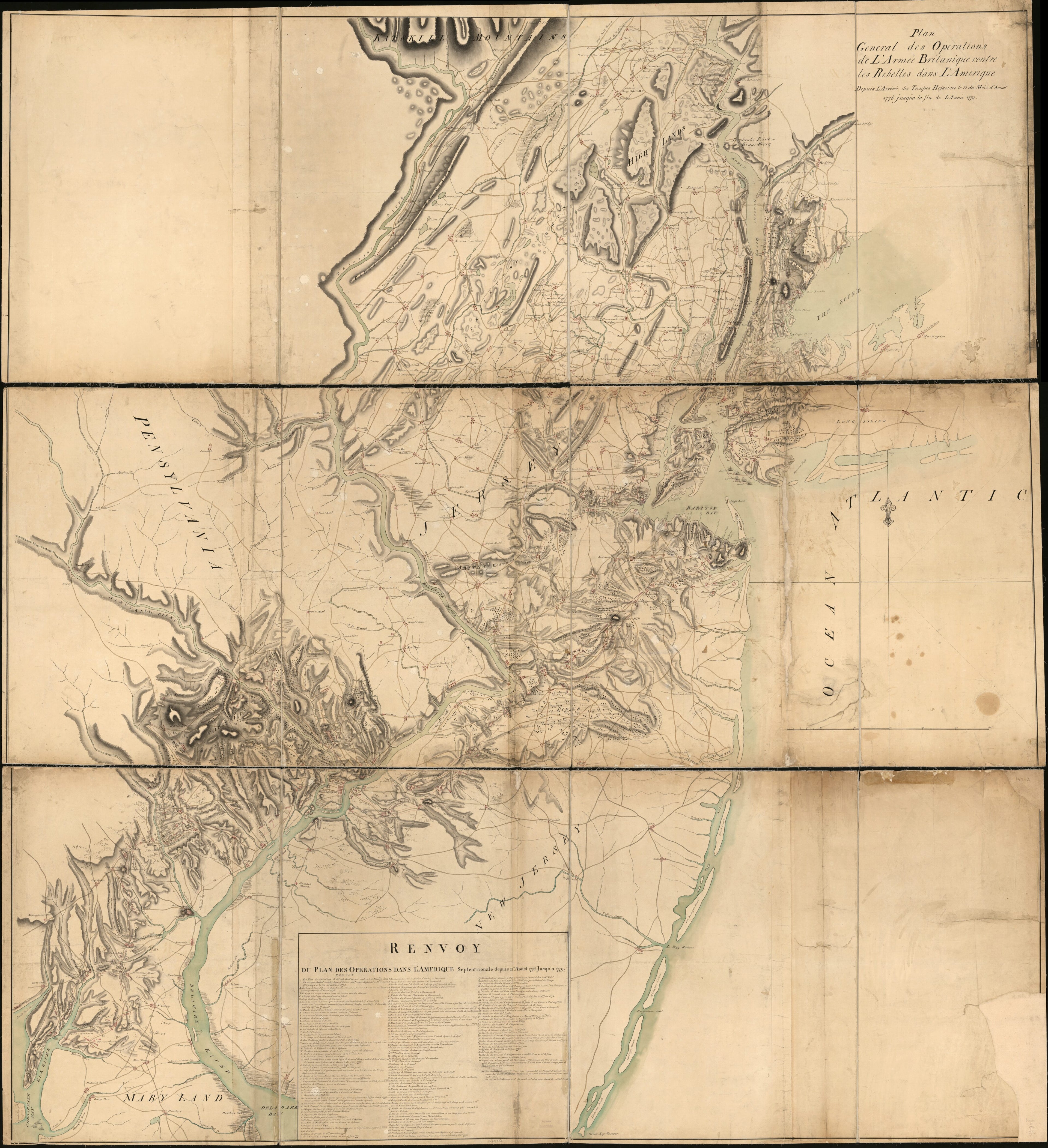
Plan General Des Operations De L'Armée Britanique Contre Les Rebelles Dans L'Amerique Depuis L'arrivée Des Troupes Hessoises Le 12 Du Mois D'aoust 1776 Jusqu'à La Fin De L'année 1779 in 1780
- Regular price
-
$214.95 - Regular price
-
$209.95 - Sale price
-
$214.95
Shipping calculated at checkout.
Buy one map, get any other map in our collection for 50% OFF! Add to cart to see discount.
Couldn't load pickup availability
About This Map
Old early map / manuscript map of Northeastern States, United States.
Created by Georges De Gironcourt in 1780.
Created by Georges De Gironcourt in 1780.
- Scale ca. 1:126,720.
- Relief shown by shading.
- Manuscript, pen-and-ink and watercolor.
- Covers area from West Point, N.Y. to Great Egg Harbor; Huntington and Jerusalem on Long Island to Chesapeake Bay and Sassafras River.
- Inset: Renvoy du Plan des operations dans l'Amérique Septentrionale depuis 12me aoust 1776 jusu'a 1779.
- Shows points of interest, troop movements, military emplacements and positions involving Hessian troops.
Map Sizing Information
- For the best legibility, order your map in the original size or larger. Most maps have intricate detail and small text that is best appreciated when the print size hasn't been reduced.
- Sizes labeled "Fits a Standard Frame" will drop right into any frame that you purchase in that size. The sizes that we offer are commonly available online and at most retail stores.
- Our standard sizes are recommendations based on the aspect ratio of the original map, but still may require some added "white space" in one dimension to fit.
- Non-standard sizes will require custom framing, and we suggest taking your print to the frame shop of your choice after you receive it for the best results.
- Custom sizes are available, simply contact us for a quote.
Below is an approximation of the scale of a few standard sizes, and how they might appear in your space.

