
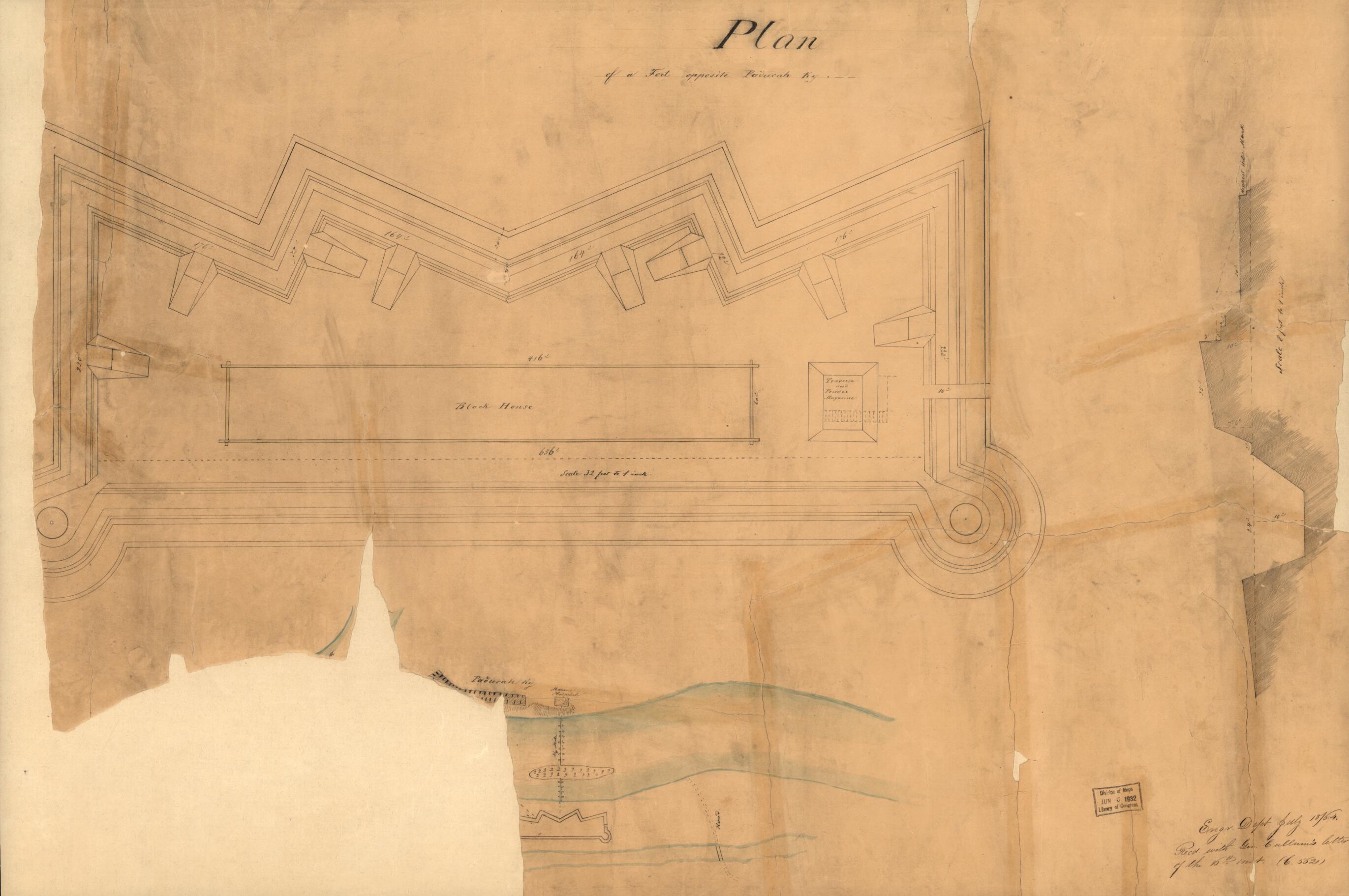
Plan of a Fort Opposite Paducah, Ky 1864
- Regular price
-
$85.95 - Regular price
-
$80.95 - Sale price
-
$85.95
Shipping calculated at checkout.
Buy one map, get any other map in our collection for 50% OFF! Add to cart to see discount.
Couldn't load pickup availability
About This Map
Old map of Illinois, Kentucky, Massac County, Paducah Region, Puducah Region, United States.
- Shows the environs of the proposed fort in Massac County, Illinois.
- In the lower right corner: Engr. Dept., July 18/64. recd. with Gen. Cullum's letter of the 16th inst. (C. 5621).
- Pen-and-ink, pencil, and watercolor.
- Civil War Map
- Includes a map of Paducah, Ky.
- Copy This map has some imperfections: part of map in lower left missing We'll do our best to restore the image before printing.
Map Sizing Information
- For the best legibility, order your map in the original size or larger. Most maps have intricate detail and small text that is best appreciated when the print size hasn't been reduced.
- Sizes labeled "Fits a Standard Frame" will drop right into any frame that you purchase in that size. The sizes that we offer are commonly available online and at most retail stores.
- Our standard sizes are recommendations based on the aspect ratio of the original map, but still may require some added "white space" in one dimension to fit.
- Non-standard sizes will require custom framing, and we suggest taking your print to the frame shop of your choice after you receive it for the best results.
- Custom sizes are available, simply contact us for a quote.
Below is an approximation of the scale of a few standard sizes, and how they might appear in your space.
