
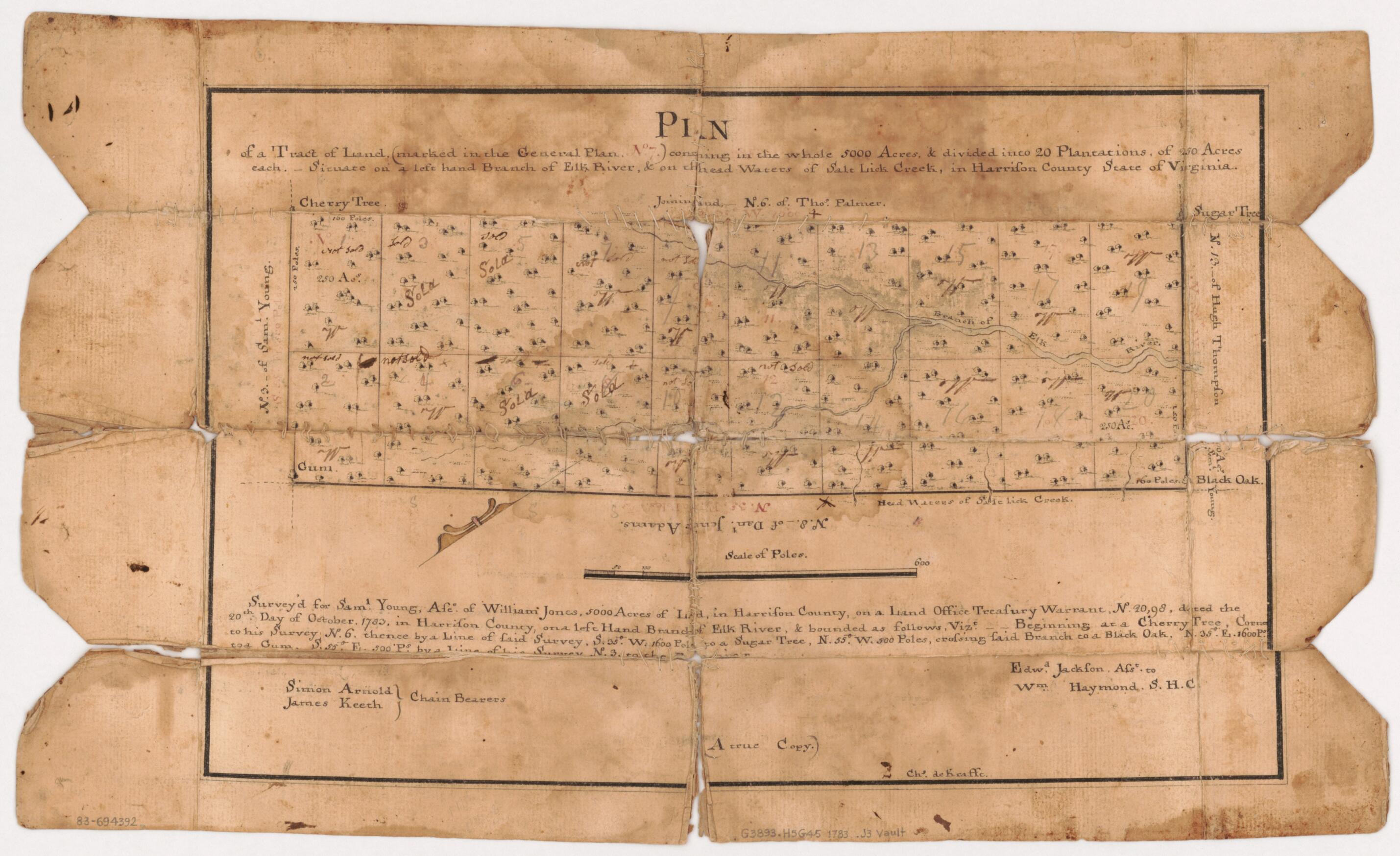
Plan of a Tract of Land (marked In the General Plan No. 7), Containing In the Whole 5000 Acres, & Divided Into 20 Plantations of 250 Acres Each, Situate On a Left Hand Branch of Elk River, & On the Head Waters of Salt Lick Creek, In Harrison County, S...
- Regular price
-
$49.95 - Regular price
-
$34.95 - Sale price
-
$49.95
Shipping calculated at checkout.
Buy one map, get any other map in our collection for 50% OFF! Add to cart to see discount.
Couldn't load pickup availability
About This Map
Old map of Harrison County, United States, W.V., West Virginia.
Created by Charles De Krafft, William Haymond, Edward Jackson in 1783.
Created by Charles De Krafft, William Haymond, Edward Jackson in 1783.
- Covers part of Harrison County (W.Va.)
- "Survey'd for Sam'l Young, Ase'e of William Jones, 5000 Acres of Land, in Harrison County, on a Land Office Treasury Warrant, no. 20,98, dated the 20th Day of October 1783 ..."
- Oriented with north toward the upper right.
- Pen-and-ink.
- Torn at fold lines; sections stitched together with thread.
- Includes text.
- Panel title: A plot of 5000 acers [sic] of land on Big Elk & head of Salt Lick Creak [sic]
- Acquisitions control no. 8-82
Map Sizing Information
- For the best legibility, order your map in the original size or larger. Most maps have intricate detail and small text that is best appreciated when the print size hasn't been reduced.
- Sizes labeled "Fits a Standard Frame" will drop right into any frame that you purchase in that size. The sizes that we offer are commonly available online and at most retail stores.
- Our standard sizes are recommendations based on the aspect ratio of the original map, but still may require some added "white space" in one dimension to fit.
- Non-standard sizes will require custom framing, and we suggest taking your print to the frame shop of your choice after you receive it for the best results.
- Custom sizes are available, simply contact us for a quote.
Below is an approximation of the scale of a few standard sizes, and how they might appear in your space.
