
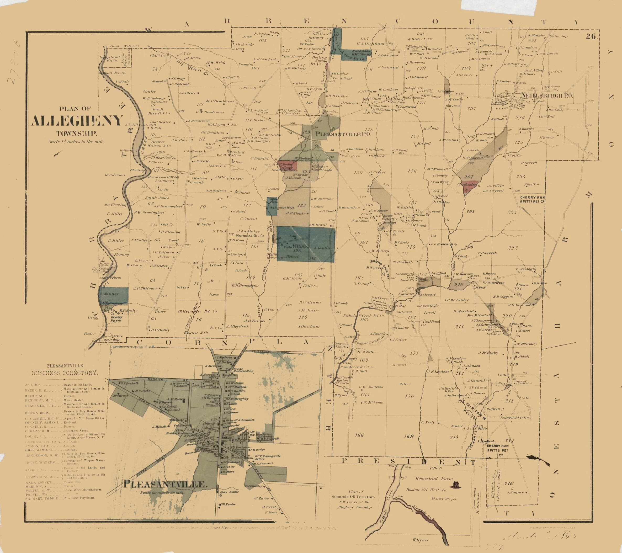
Plan of Allegheny Township 1865
- Regular price
-
$49.95 - Regular price
-
$29.95 - Sale price
-
$49.95
Shipping calculated at checkout.
Buy one map, get any other map in our collection for 50% OFF! Add to cart to see discount.
Couldn't load pickup availability
About This Map
Old cadastral map of Allegheny, Allegheny (Township), Pennsylvania, Pleasantville, Township, United States, Venango County.
Created by F.W. Beers & Co, Ferd. Mayer & Co in 1865.
Created by F.W. Beers & Co, Ferd. Mayer & Co in 1865.
- Township cadastral map showing warranty-deed survey tracts, tract numbers, real-property tracts, some landowners' names, rural buildings, and householders' names.
- Hand col. to indicate Pleasantville borough area and oil-company properties.
- "Entered according to Act of Congress in the year 1865 in the ... Southern District of New York by F.W. Beers & Co."
- Land Ownership Map
- Includes Pleasantville business directory, inset of Pleasantville borough, and inset "Plan of Simonds Oil Territory, N.W. cor. Tract 165, Allegheny township".
- 2 copies
Map Sizing Information
- For the best legibility, order your map in the original size or larger. Most maps have intricate detail and small text that is best appreciated when the print size hasn't been reduced.
- Sizes labeled "Fits a Standard Frame" will drop right into any frame that you purchase in that size. The sizes that we offer are commonly available online and at most retail stores.
- Our standard sizes are recommendations based on the aspect ratio of the original map, but still may require some added "white space" in one dimension to fit.
- Non-standard sizes will require custom framing, and we suggest taking your print to the frame shop of your choice after you receive it for the best results.
- Custom sizes are available, simply contact us for a quote.
Below is an approximation of the scale of a few standard sizes, and how they might appear in your space.

