
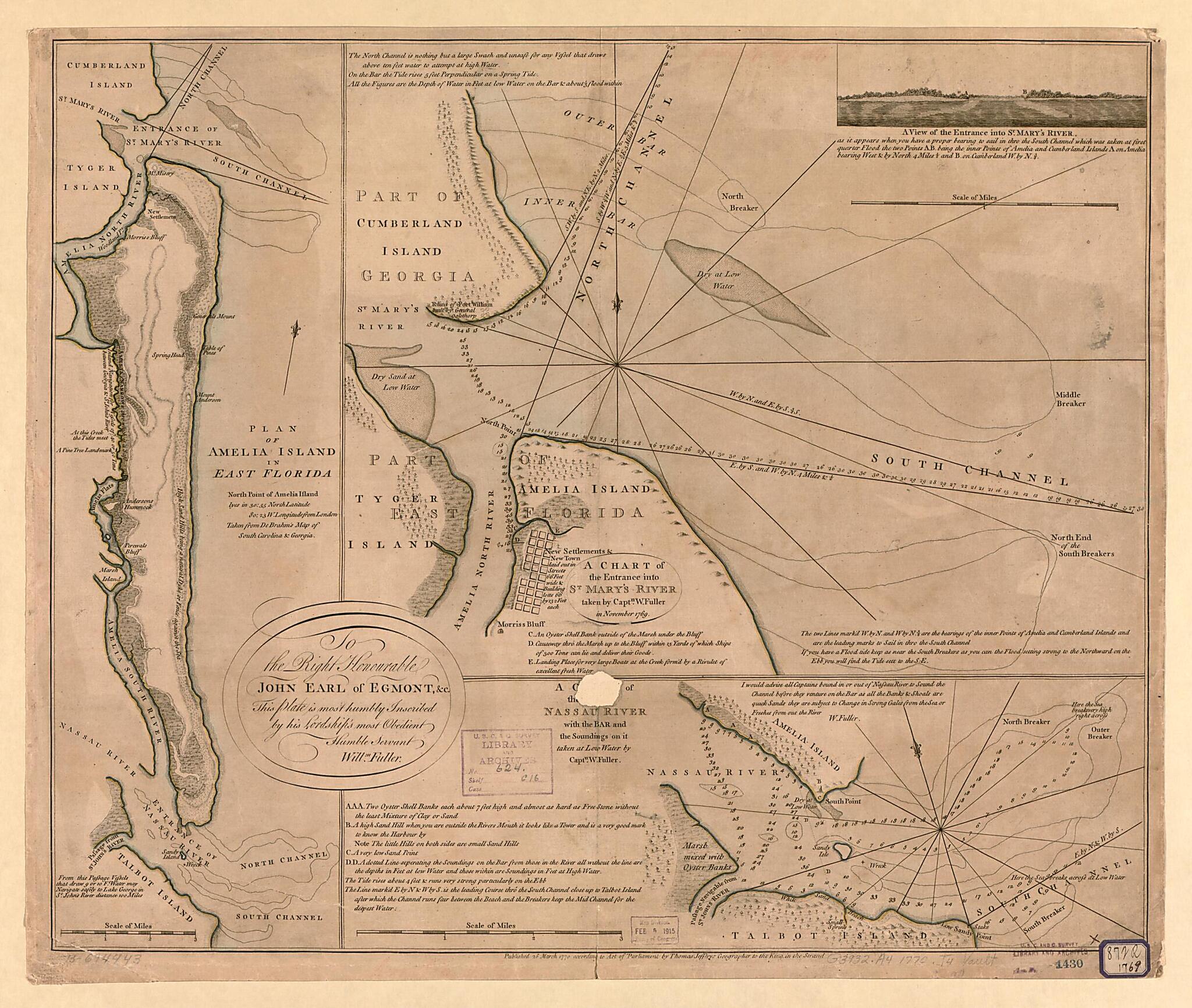
Plan of Amelia Island In East Florida, North Point of Amelia Island Lyes In 30:55 North Latitude 80:23 W. Longitude from London, Taken from De Brahm's Map of South Caroline & Georgia. a Chart of the Entrance Into St. Mary's River 1777
- Regular price
-
$69.95 - Regular price
-
$64.95 - Sale price
-
$69.95
Shipping calculated at checkout.
Buy one map, get any other map in our collection for 50% OFF! Add to cart to see discount.
Couldn't load pickup availability
About This Map
Old map of Amelia Island, Florida, United States.
Created by John Gerar William De Brahm, William Faden, William Fuller, Thomas Jefferys in 1777.
Created by John Gerar William De Brahm, William Faden, William Fuller, Thomas Jefferys in 1777.
- Scales vary.
- Relief shown pictorially and by hachures. Depths shown by soundings.
- Hand colored.
- From W. Faden's The North American atlas. 1777.
- Includes notes and "A view of the entrance into St. Mary's River."
Map Subjects
Amelia Island
Amelia Island (Fla.)
Early Works To 1800
Florida
Harbors
Nautical Charts
United States
John Gerar William De Brahm
William Faden
William Fuller
Thomas Jefferys
1777
Map Sizing Information
- For the best legibility, order your map in the original size or larger. Most maps have intricate detail and small text that is best appreciated when the print size hasn't been reduced.
- Sizes labeled "Fits a Standard Frame" will drop right into any frame that you purchase in that size. The sizes that we offer are commonly available online and at most retail stores.
- Our standard sizes are recommendations based on the aspect ratio of the original map, but still may require some added "white space" in one dimension to fit.
- Non-standard sizes will require custom framing, and we suggest taking your print to the frame shop of your choice after you receive it for the best results.
- Custom sizes are available, simply contact us for a quote.
Below is an approximation of the scale of a few standard sizes, and how they might appear in your space.

