
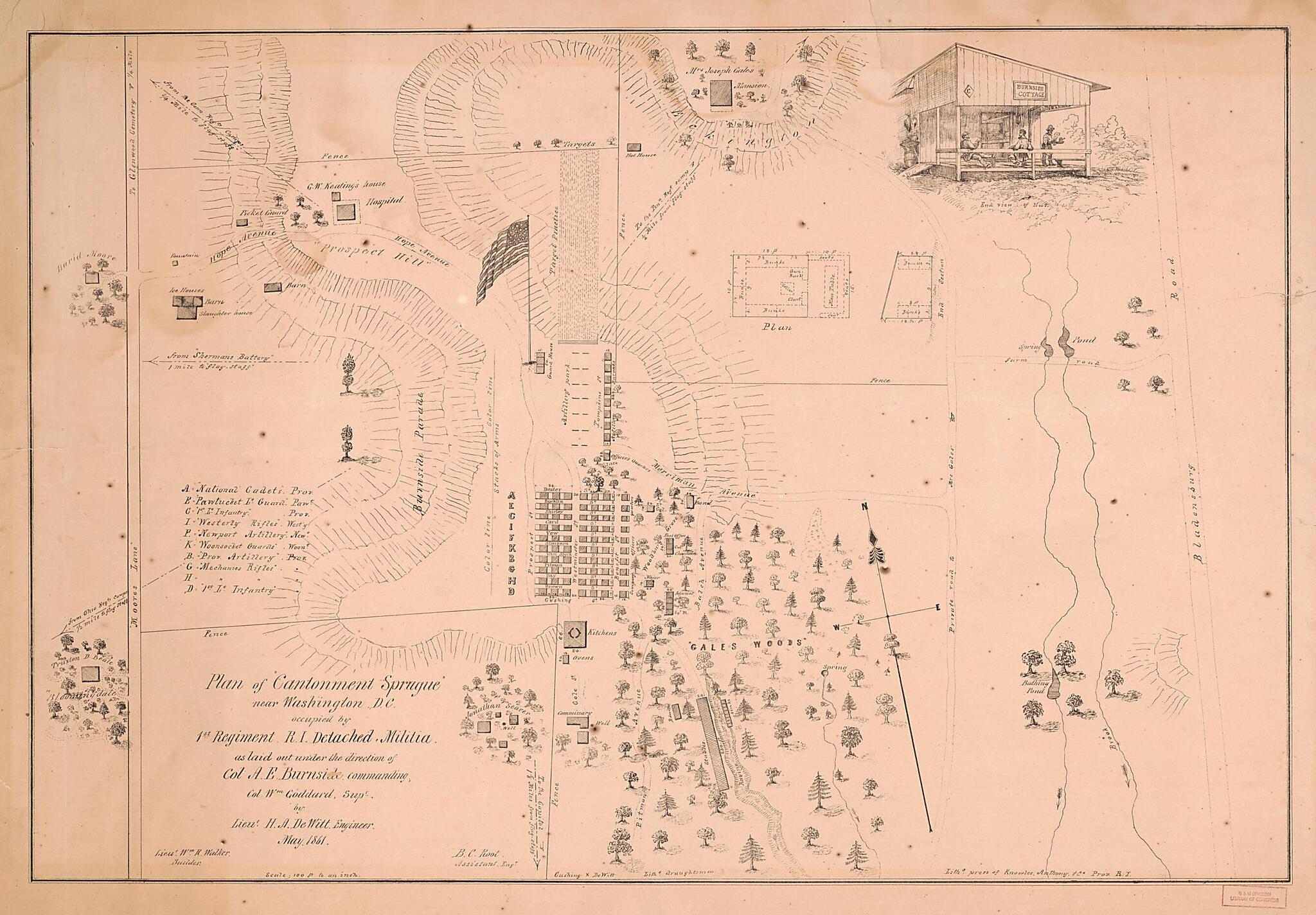
Plan of Cantonment Sprague Near Washington D.C. : Occupied by 1st Regiment R.I. Detached Militia (Cantonment Sprague) 1861
- Regular price
-
$80.95 - Regular price
-
$75.95 - Sale price
-
$80.95
Shipping calculated at checkout.
Buy one map, get any other map in our collection for 50% OFF! Add to cart to see discount.
Couldn't load pickup availability
About This Map
Old military map of Bladensburg Region, Maryland, United States.
Created by Ambrose Everett Burnside, H. A. De Witt, William Goddard, Anthony & Co Knowles in 1861.
Created by Ambrose Everett Burnside, H. A. De Witt, William Goddard, Anthony & Co Knowles in 1861.
- Shows temporary military encampment grounds and internal facilities near Bladensburg (Prince George's County, Md.) during the American Civil War.
- Also shows individual trees pictorially, building locations, and shooting range.
- Relief shown by hachures.
- Includes index of barracks (occupants' group names given for each), illustration of American flag on pole, perspective illustration of "End view of hut", floorplan (inset), and end plan (inset).
Map Subjects
Bladensburg Region
Civil War
History
Maryland
Maryland Campaign
Military Camps
Military Maps
United States
Ambrose Everett Burnside
H. A. De Witt
William Goddard
Anthony & Co Knowles
1861
Map Sizing Information
- For the best legibility, order your map in the original size or larger. Most maps have intricate detail and small text that is best appreciated when the print size hasn't been reduced.
- Sizes labeled "Fits a Standard Frame" will drop right into any frame that you purchase in that size. The sizes that we offer are commonly available online and at most retail stores.
- Our standard sizes are recommendations based on the aspect ratio of the original map, but still may require some added "white space" in one dimension to fit.
- Non-standard sizes will require custom framing, and we suggest taking your print to the frame shop of your choice after you receive it for the best results.
- Custom sizes are available, simply contact us for a quote.
Below is an approximation of the scale of a few standard sizes, and how they might appear in your space.
