
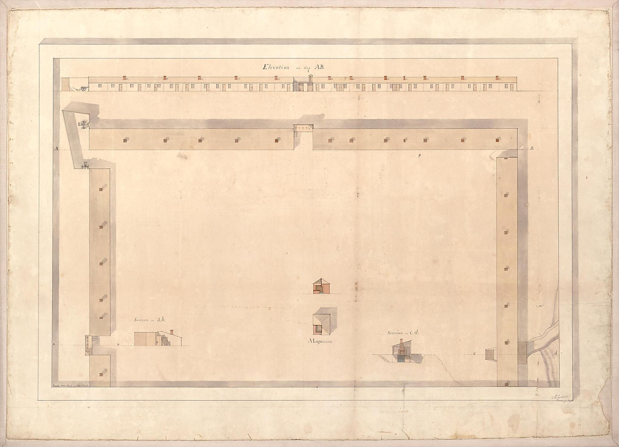
Plan of Fort Atkinson, Nebraska. (Defence sic at St. Louis) 1819
- Regular price
-
$81.95 - Regular price
-
$76.95 - Sale price
-
$81.95
Shipping calculated at checkout.
Buy one map, get any other map in our collection for 50% OFF! Add to cart to see discount.
Couldn't load pickup availability
About This Map
Old map of Fort Atkinson, Nebraska, United States.
Created by Andrew Talcott in 1819.
Created by Andrew Talcott in 1819.
- Title supplied by cataloger.
- Misidentified in the 1st ed. of Stephenson's Civil War Maps under CW 303.
- Pen-and-ink and watercolor.
- Includes 4 profiles.
- On verso in pencil at upper left: Catalogued W.
- This map has some imperfections: fold-lined, mounted on cloth, edged with cloth tape. We'll do our best to restore the image before printing.
Map Subjects
Fort Atkinson
Fort Atkinson (Neb.)
Fortification
Maps Manuscript
Nebraska
United States
Andrew Talcott
1819
Map Sizing Information
- For the best legibility, order your map in the original size or larger. Most maps have intricate detail and small text that is best appreciated when the print size hasn't been reduced.
- Sizes labeled "Fits a Standard Frame" will drop right into any frame that you purchase in that size. The sizes that we offer are commonly available online and at most retail stores.
- Our standard sizes are recommendations based on the aspect ratio of the original map, but still may require some added "white space" in one dimension to fit.
- Non-standard sizes will require custom framing, and we suggest taking your print to the frame shop of your choice after you receive it for the best results.
- Custom sizes are available, simply contact us for a quote.
Below is an approximation of the scale of a few standard sizes, and how they might appear in your space.

