
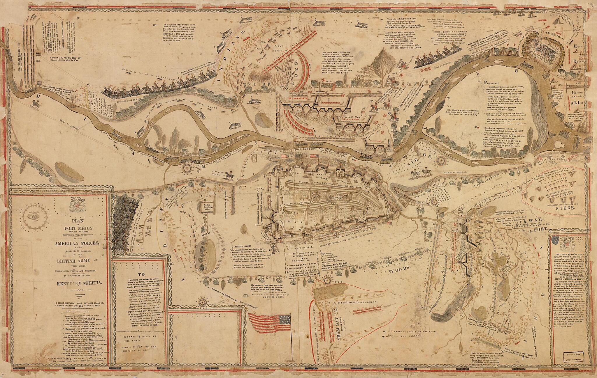
Plan of Fort Meigs' and Its Environs : Compricing sic the Operations of the American Forces, Under Genl. W.H. Harrison, and the British Army and Their Allies, Under Genl. Proctor and Tecumseh 1813
- Regular price
-
$96.95 - Regular price
-
$91.95 - Sale price
-
$96.95
Shipping calculated at checkout.
Buy one map, get one map 50% off!
Couldn't load pickup availability
About This Map
Old pictorial map / manuscript map of Fort Meigs, Ohio, United States.
Created by William Sebree in 1813.
Created by William Sebree in 1813.
- Ms. pictorial map showing troop positions during the Siege of Fort Meigs, Perrysburg (Ohio), 1813.
- Pen-and-ink and watercolors.
- Text, descriptive notes, and poem are mechanically printed on the sheet.
- Brittle, missing sections of margin/border, mounted on cloth backing.
- Originally drawn on 2 sheets.
- Includes text, notes, poem, and col. ill. of U.S. flag.
Map Subjects
Fort Meigs
Fort Meigs (Ohio)
Manuscript Maps
Ohio
Pictorial Maps
Siege
United States
William Sebree
1813
Map Sizing Information
- For the best legibility, order your map in the original size or larger. Most maps have intricate detail and small text that is best appreciated when the print size hasn't been reduced.
- Sizes labeled "Fits a Standard Frame" will drop right into any frame that you purchase in that size. The sizes that we offer are commonly available online and at most retail stores.
- Our standard sizes are recommendations based on the aspect ratio of the original map, but still may require some added "white space" in one dimension to fit.
- Non-standard sizes will require custom framing, and we suggest taking your print to the frame shop of your choice after you receive it for the best results.
- Custom sizes are available, simply contact us for a quote.
Below is an approximation of the scale of a few standard sizes, and how they might appear in your space.
