
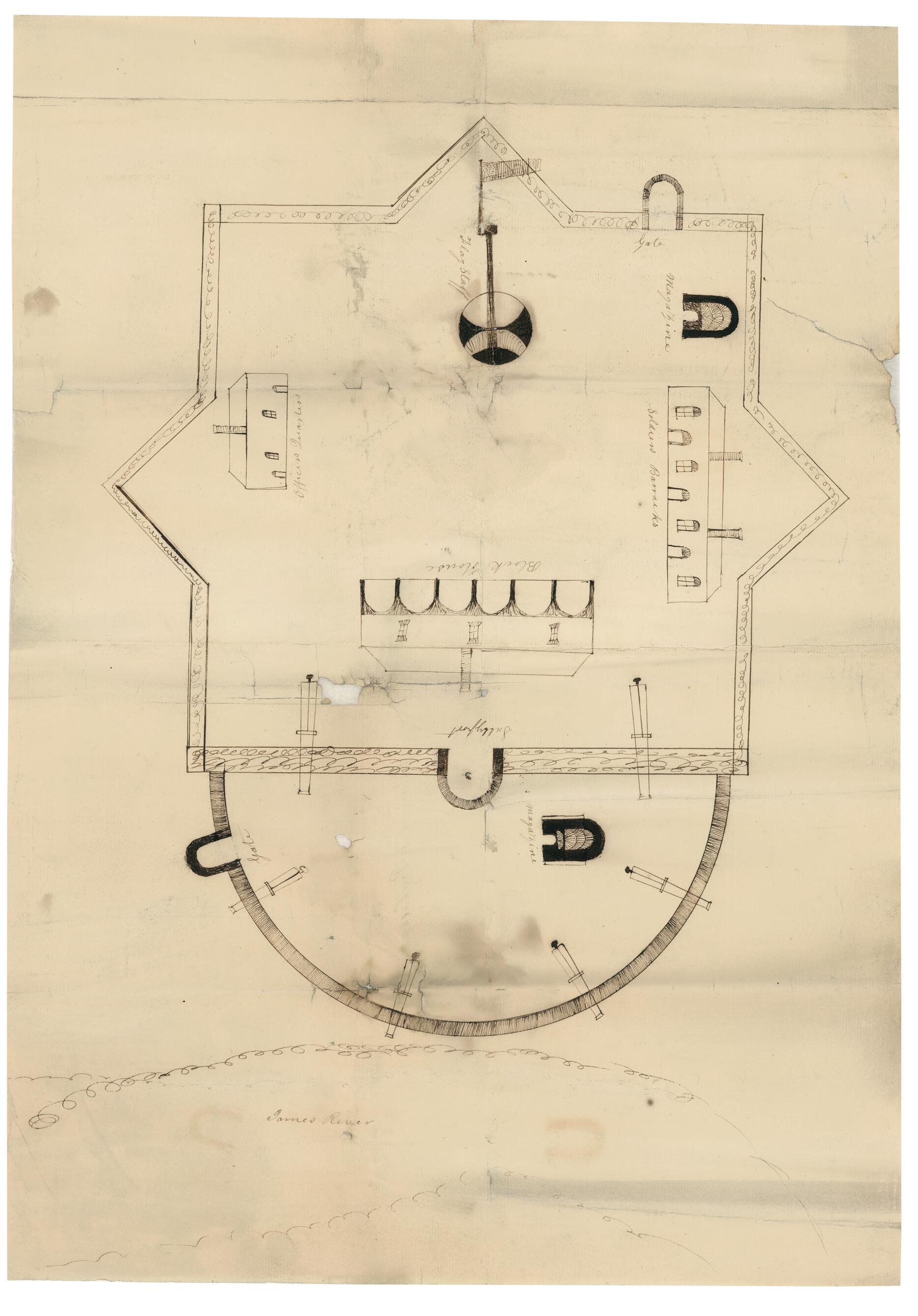
Plan of Fort Powhatan, Prince George County, Virginia 1819
- Regular price
-
$57.95 - Regular price
-
$40.95 - Sale price
-
$57.95
Shipping calculated at checkout.
Buy one map, get any other map in our collection for 50% OFF! Add to cart to see discount.
Couldn't load pickup availability
About This Map
Old map of Fort Powhatan, Fort Powhatan (Prince George County), Prince George County, United States, Virginia.
Created by Elijah Brown in 1819.
Created by Elijah Brown in 1819.
- Original map located in House of Delegates, Office of the Speaker, Executive Communications, Oversized, Box 9, Folder 14. Although included in a report of 1821, this plan represents the fort as it looked in 1819, before the cannon was removed.
- This item is in the Map Collection of the Library of Virginia; please contact the Library's Archives Research Services department for more information.
- C. 1, Sept. 1969, photocopy, LVA; c. 2, 2004, color ink jet, LVA (original in Archives); March 2004, Map Cataloging Team.
- Civil War project no.: lva00190.
- Conservation: Etherington Conservation Center, Jan. 2004.
- Digital image available: 22 x 15.7 in.
- Previously filed as: 755.61 M6 1861-1865 1819 (1).
Map Sizing Information
- For the best legibility, order your map in the original size or larger. Most maps have intricate detail and small text that is best appreciated when the print size hasn't been reduced.
- Sizes labeled "Fits a Standard Frame" will drop right into any frame that you purchase in that size. The sizes that we offer are commonly available online and at most retail stores.
- Our standard sizes are recommendations based on the aspect ratio of the original map, but still may require some added "white space" in one dimension to fit.
- Non-standard sizes will require custom framing, and we suggest taking your print to the frame shop of your choice after you receive it for the best results.
- Custom sizes are available, simply contact us for a quote.
Below is an approximation of the scale of a few standard sizes, and how they might appear in your space.

