
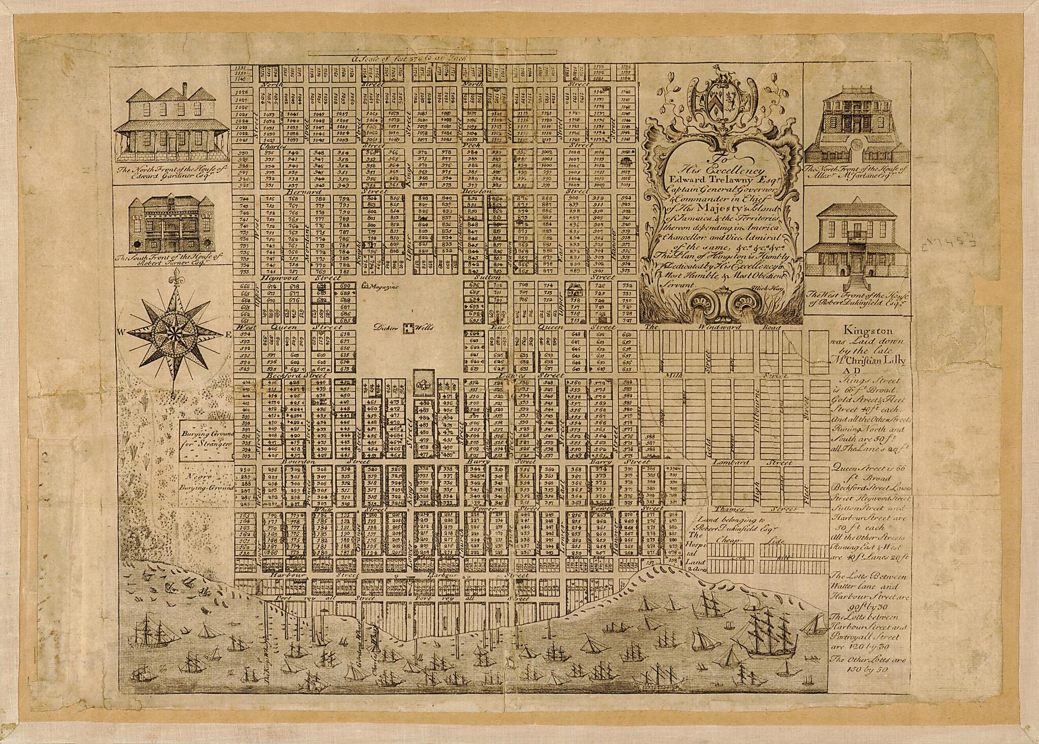
Plan of Kingston 1745
- Regular price
-
$49.95 - Regular price
-
$34.95 - Sale price
-
$49.95
Shipping calculated at checkout.
Buy one map, get any other map in our collection for 50% OFF! Add to cart to see discount.
Couldn't load pickup availability
About This Map
Old map of Jamaica, Kingston.
Created by Michael Hay in 1745.
Created by Michael Hay in 1745.
- Cadastral map showing lot numbers.
- Title supplied by cataloger.
- Annotated in black ink on verso: No. 73. Plan of Kingston, Jamaica.
- Includes text and ill.
- Latin American port cities no. 38
Map Subjects
Early Works To 1800
Jamaica
Kingston
Real Property
Michael Hay
1745
Map Sizing Information
- For the best legibility, order your map in the original size or larger. Most maps have intricate detail and small text that is best appreciated when the print size hasn't been reduced.
- Sizes labeled "Fits a Standard Frame" will drop right into any frame that you purchase in that size. The sizes that we offer are commonly available online and at most retail stores.
- Our standard sizes are recommendations based on the aspect ratio of the original map, but still may require some added "white space" in one dimension to fit.
- Non-standard sizes will require custom framing, and we suggest taking your print to the frame shop of your choice after you receive it for the best results.
- Custom sizes are available, simply contact us for a quote.
Below is an approximation of the scale of a few standard sizes, and how they might appear in your space.

