
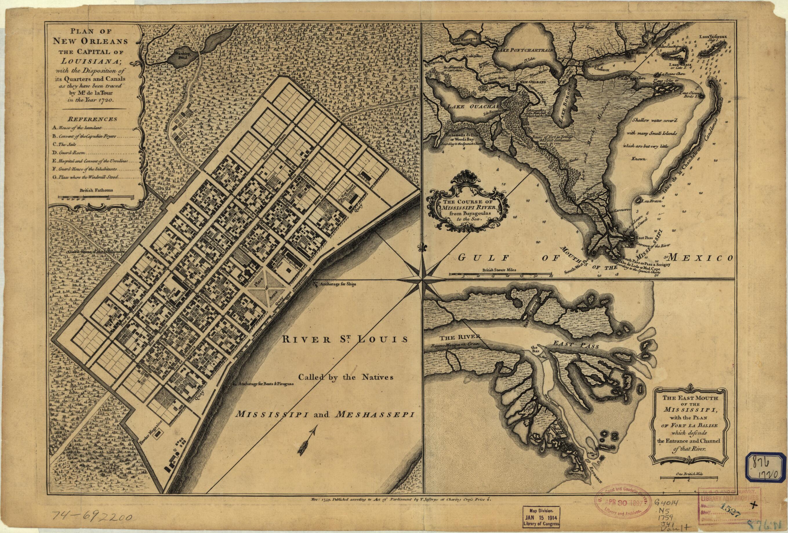
Plan of New Orleans the Capital of Louisiana; With the Disposition of Its Quarters and Canals As They Have Been Traced by Mr. De La Tour In the Year 1720 1759
- Regular price
-
$49.95 - Regular price
-
$34.95 - Sale price
-
$49.95
Shipping calculated at checkout.
Buy one map, get any other map in our collection for 50% OFF! Add to cart to see discount.
Couldn't load pickup availability
About This Map
Old map of Louisiana, New Orleans, United States.
Created by Louis Brion De La Tour, Thomas Jefferys in 1759.
Created by Louis Brion De La Tour, Thomas Jefferys in 1759.
- Scale ca. 1:5,000.
- Insets: The course of Mississipi River, from Bayagoulas to the sea [ca. 1:800,000]--The east mouth of the Mississipi, with the plan of Fort la Balise which defends the entrance and channel of that river [ca. 1:40,000]
Map Sizing Information
- For the best legibility, order your map in the original size or larger. Most maps have intricate detail and small text that is best appreciated when the print size hasn't been reduced.
- Sizes labeled "Fits a Standard Frame" will drop right into any frame that you purchase in that size. The sizes that we offer are commonly available online and at most retail stores.
- Our standard sizes are recommendations based on the aspect ratio of the original map, but still may require some added "white space" in one dimension to fit.
- Non-standard sizes will require custom framing, and we suggest taking your print to the frame shop of your choice after you receive it for the best results.
- Custom sizes are available, simply contact us for a quote.
Below is an approximation of the scale of a few standard sizes, and how they might appear in your space.
