
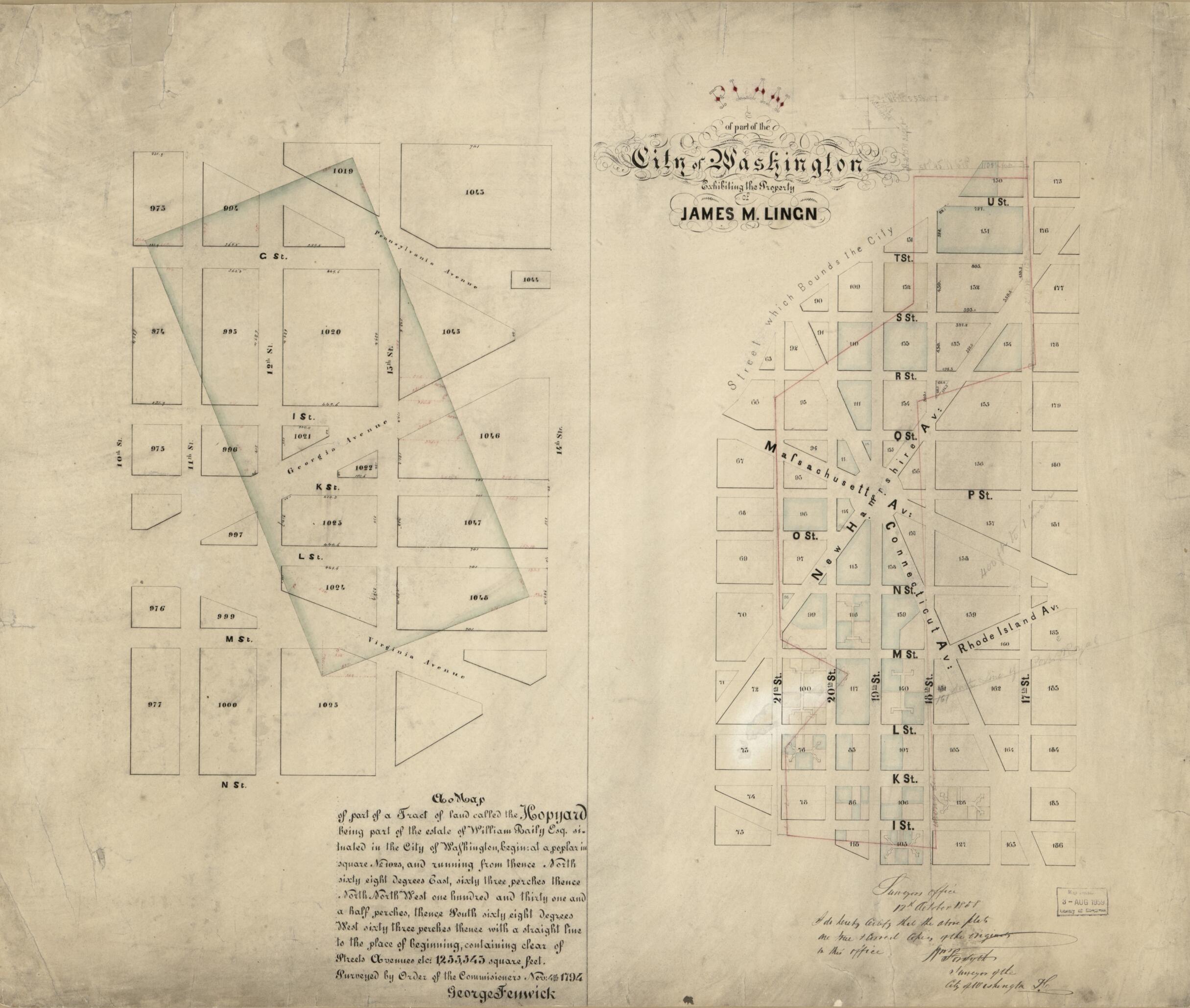
Plan of Part of the City of Washington Exhibiting the Property of James M. Lingan ; a Map of Part of a Tract of Land Called the Hopyard : Being Part of the Estate of William Baily Esq. Situated In the City of Washington ... : Surveyed by Order of the ...
- Regular price
-
$74.95 - Regular price
-
$69.95 - Sale price
-
$74.95
Shipping calculated at checkout.
Buy one map, get any other map in our collection for 50% OFF! Add to cart to see discount.
Couldn't load pickup availability
About This Map
Old map of District of Columbia, United States, Washington, Washington D.C..
Created by District of Columbia. Office of the Surveyor, George Fenwick, William Forsyth in 1794.
Created by District of Columbia. Office of the Surveyor, George Fenwick, William Forsyth in 1794.
- Cadastral maps showing original landholdings with 1858 street system superimposed.
- Lingan map covers area bounded by W, 16th, H, 22nd, and Boundary streets N.W. Baily map covers area bounded by F, 14th, N, and 10th streets S.E.
- Black and red inks, watercolor, and lead pencil.
- Soiled, missing small sections along edges, and mounted on cloth backing.
- Includes text and statement of certification headed: Surveyors Office, 12th October 1858.
Map Sizing Information
- For the best legibility, order your map in the original size or larger. Most maps have intricate detail and small text that is best appreciated when the print size hasn't been reduced.
- Sizes labeled "Fits a Standard Frame" will drop right into any frame that you purchase in that size. The sizes that we offer are commonly available online and at most retail stores.
- Our standard sizes are recommendations based on the aspect ratio of the original map, but still may require some added "white space" in one dimension to fit.
- Non-standard sizes will require custom framing, and we suggest taking your print to the frame shop of your choice after you receive it for the best results.
- Custom sizes are available, simply contact us for a quote.
Below is an approximation of the scale of a few standard sizes, and how they might appear in your space.

