
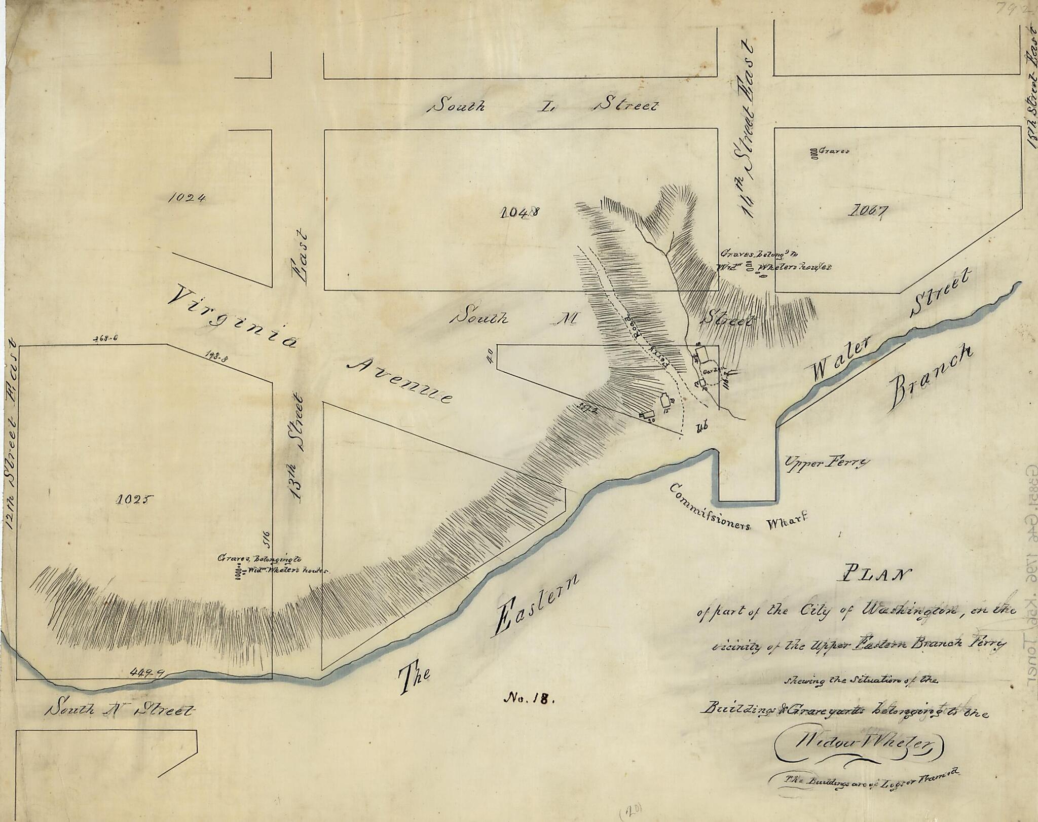
Plan of Part of the City of Washington, In the Vicinity of the Upper Eastern Branch Ferry, Shewing the Situation of the Buildings & Grave Yards Belonging to the Widow Wheler 1796
- Regular price
-
$49.95 - Regular price
-
$29.95 - Sale price
-
$49.95
Shipping calculated at checkout.
Buy one map, get any other map in our collection for 50% OFF! Add to cart to see discount.
Couldn't load pickup availability
About This Map
Old map of District of Columbia, United States, Washington, Washington D.C..
Created by N. (Nicholas) King in 1796.
Created by N. (Nicholas) King in 1796.
- Covers area bounded by 12th, L, 15th streets, and Anacostia River waterfront S.E.
- Shows block numbers and outlines, buildings, and block and building dimensions.
- Relief shown by hachures.
- Pen-and-ink and blue wash on tracing linen.
- Traced by Dr. Joseph M. Toner from the original map by Nicholas King ca. 1796.
- Has circular cameo impression: [Profile of head with] Toner Library.
- Includes note.
- "No. 18."
Map Subjects
District Of Columbia
Early Works To 1800
Homes And Haunts
Manuscript Maps
Maps Manuscript
Real Property
United States
Washington
Washington (D.C.)
Waterfronts
Wheler Elizabeth
Washington D.C.
N. (Nicholas) King
1796
Map Sizing Information
- For the best legibility, order your map in the original size or larger. Most maps have intricate detail and small text that is best appreciated when the print size hasn't been reduced.
- Sizes labeled "Fits a Standard Frame" will drop right into any frame that you purchase in that size. The sizes that we offer are commonly available online and at most retail stores.
- Our standard sizes are recommendations based on the aspect ratio of the original map, but still may require some added "white space" in one dimension to fit.
- Non-standard sizes will require custom framing, and we suggest taking your print to the frame shop of your choice after you receive it for the best results.
- Custom sizes are available, simply contact us for a quote.
Below is an approximation of the scale of a few standard sizes, and how they might appear in your space.

