
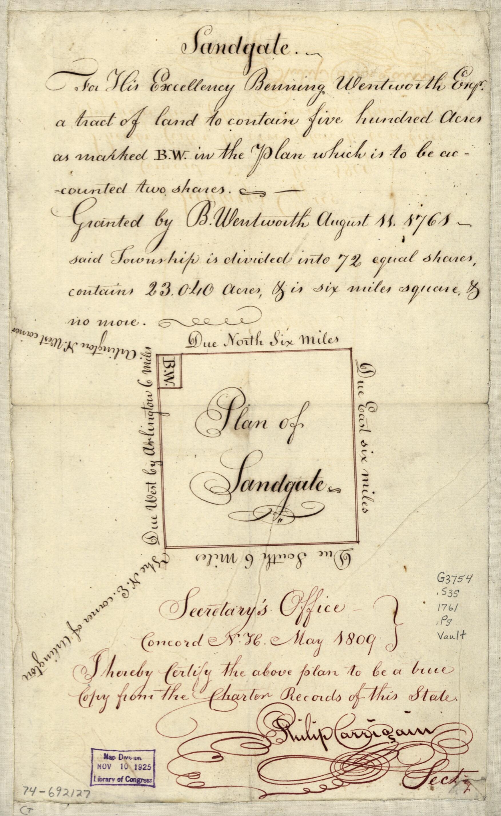
Plan of Sandgate 1809
- Regular price
-
$49.95 - Regular price
-
$29.95 - Sale price
-
$49.95
Shipping calculated at checkout.
Buy one map, get any other map in our collection for 50% OFF! Add to cart to see discount.
Couldn't load pickup availability
About This Map
Old map of Sandgate, United States, Vermont.
Created by Benning Wentworth in 1809.
Created by Benning Wentworth in 1809.
- Scale ca. 1:126,000.
- Manuscript, pen-and-ink.
- Watermark: MB [over the date] 1802.
- Inscription above the plan: Sandgate. For His Excellency Benning Wentworth, Esqr., a tract of land to contain five hundred acres as marked B. W. in the plan which is to be accounted two shares. Granted by B. Wentworth August 11, 1761, said township is divided into 72 equal shares, contains 23,040 acres, & is six miles square, & no more.
- Certification below plan: Secretary's office, Concord, N.H., May 1809: I hereby certify the above plan to be a true copy from the charter records of this state. Philip Carrigain, sect'y.
Map Sizing Information
- For the best legibility, order your map in the original size or larger. Most maps have intricate detail and small text that is best appreciated when the print size hasn't been reduced.
- Sizes labeled "Fits a Standard Frame" will drop right into any frame that you purchase in that size. The sizes that we offer are commonly available online and at most retail stores.
- Our standard sizes are recommendations based on the aspect ratio of the original map, but still may require some added "white space" in one dimension to fit.
- Non-standard sizes will require custom framing, and we suggest taking your print to the frame shop of your choice after you receive it for the best results.
- Custom sizes are available, simply contact us for a quote.
Below is an approximation of the scale of a few standard sizes, and how they might appear in your space.

