
Plan of Square No. 378 : Showing the True Course of the Creek Running Through It at the Time It Was Changed In Eighteen Hundred & Twenty Six, & the Present Direction, Since the Change 1828
- Regular price
-
$57.95 - Regular price
-
$40.95 - Sale price
-
$57.95
Shipping calculated at checkout.
Buy one map, get any other map in our collection for 50% OFF! Add to cart to see discount.
Couldn't load pickup availability
About This Map
Old map of District of Columbia, United States, Washington, Washington D.C..
Created by F. C. De Krafft, District of Columbia. Office of the Surveyor, Andrew Ellicott, Peter Force, Samuel Hill in 1828.
Created by F. C. De Krafft, District of Columbia. Office of the Surveyor, Andrew Ellicott, Peter Force, Samuel Hill in 1828.
- Cadastral map of block bounded by 10th, E, 9th, and D streets N.W.
- "Copy from the original record in my office, F.C. de Krafft S.C.W., July 5, 1828."
- Watermark: Budgen, (fleur-de-lis under crown).
- Pen-and-ink, green and blue watercolors.
- Fold-lined and cracked at edges.
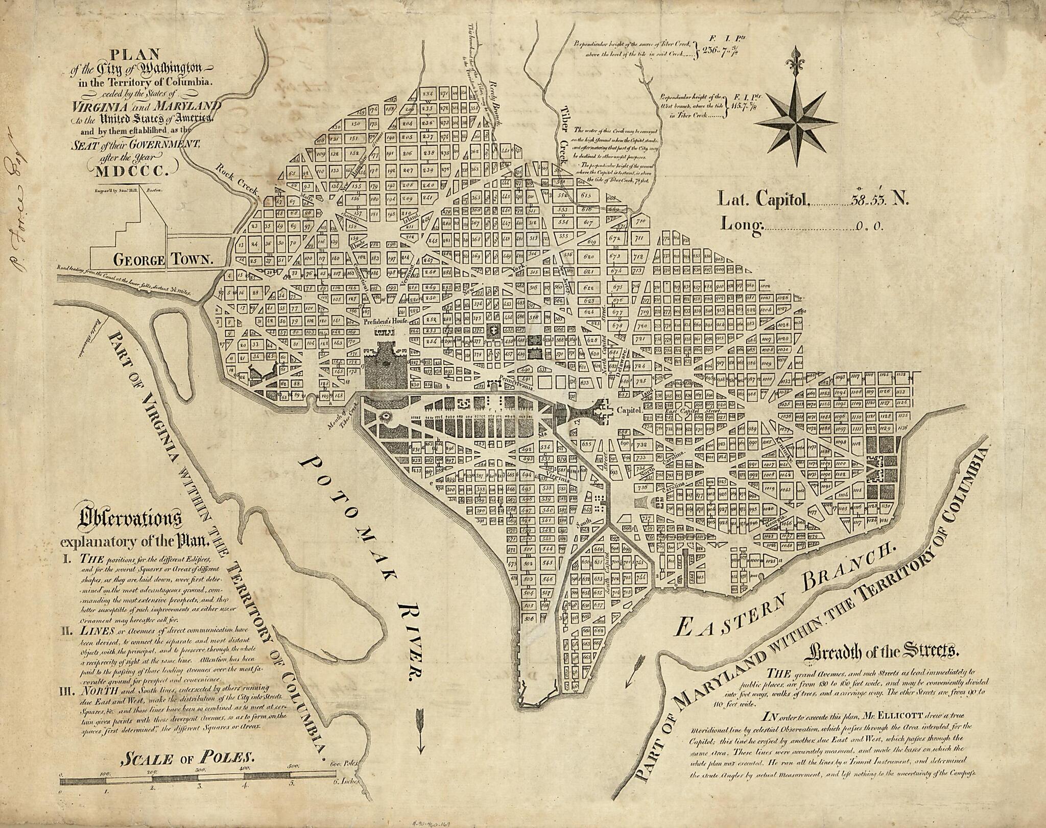
- Printed 1792 Ellicott map on verso: Plan of the city of Washington in the territory of Columbia : ceded by the states of Virginia and Maryland to the United States of America ... after the year MDCCC / engrav'd by Sam'l Hill, Boston ; in order to execute this plan, Mr. Ellicott drew a true meridional line ...
- On verso in ink: P. Force Eng'r.
- Phillips. Washington, 905
Map Subjects
District Of Columbia
Manuscript Maps
Maps Manuscript
Real Property
To 1800
United States
Washington
Washington (D.C.)
Washington D.C.
F. C. De Krafft
District Of Columbia. Office Of The Surveyor
Andrew Ellicott
Peter Force
Samuel Hill
1828
Map Sizing Information
- For the best legibility, order your map in the original size or larger. Most maps have intricate detail and small text that is best appreciated when the print size hasn't been reduced.
- Sizes labeled "Fits a Standard Frame" will drop right into any frame that you purchase in that size. The sizes that we offer are commonly available online and at most retail stores.
- Our standard sizes are recommendations based on the aspect ratio of the original map, but still may require some added "white space" in one dimension to fit.
- Non-standard sizes will require custom framing, and we suggest taking your print to the frame shop of your choice after you receive it for the best results.
- Custom sizes are available, simply contact us for a quote.
Below is an approximation of the scale of a few standard sizes, and how they might appear in your space.

