
Plan of Ternate : Dutch East Indies 1807
- Regular price
-
$128.95 - Regular price
-
$123.95 - Sale price
-
$128.95
Shipping calculated at checkout.
Buy one map, get any other map in our collection for 50% OFF! Add to cart to see discount.
Couldn't load pickup availability
About This Map
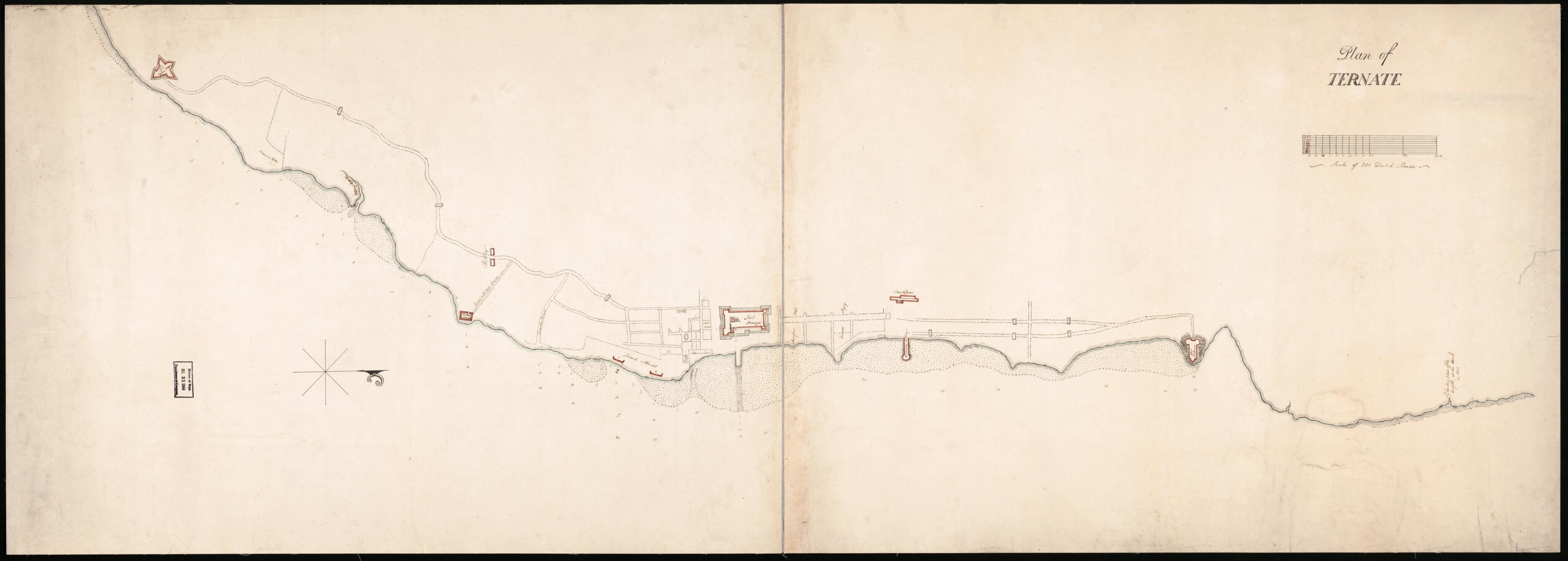
Old topographic map / manuscript map of Indonesia, Ternate.
Created by Gilbert Elliot Minto in 1807.
Created by Gilbert Elliot Minto in 1807.
- Ms. topographic map of the town of Ternate (on Ternate Island, Dutch East Indies) showing streets, roads, fortifications, beaches, and gates across roads. Does not cover entire Ternate Island.
- Shows British flag in "Fort Orange".
- Depths shown by soundings.
- Watermark: Crown over unidentified escutcheon dated [1807?-date unclear, accompanying wording unclear].
- One of the ms. maps of the Indonesian archipelago formerly in the possession of Gilbert Elliot, 1st Earl of Minto, and Governor General of India, 1807-1814.
- Oriented with north to the right.
- Manuscript: Pen-and-ink and watercolors (gray, light blue, and red outlines of fortifications).
- Sheet halved and mounted on cloth backing.
- Includes bar "Scale of 200 Dutch roods".
- Filed in the Minto Collection drawer--G8090 area of vault maps.
Map Sizing Information
- For the best legibility, order your map in the original size or larger. Most maps have intricate detail and small text that is best appreciated when the print size hasn't been reduced.
- Sizes labeled "Fits a Standard Frame" will drop right into any frame that you purchase in that size. The sizes that we offer are commonly available online and at most retail stores.
- Our standard sizes are recommendations based on the aspect ratio of the original map, but still may require some added "white space" in one dimension to fit.
- Non-standard sizes will require custom framing, and we suggest taking your print to the frame shop of your choice after you receive it for the best results.
- Custom sizes are available, simply contact us for a quote.
Below is an approximation of the scale of a few standard sizes, and how they might appear in your space.
