
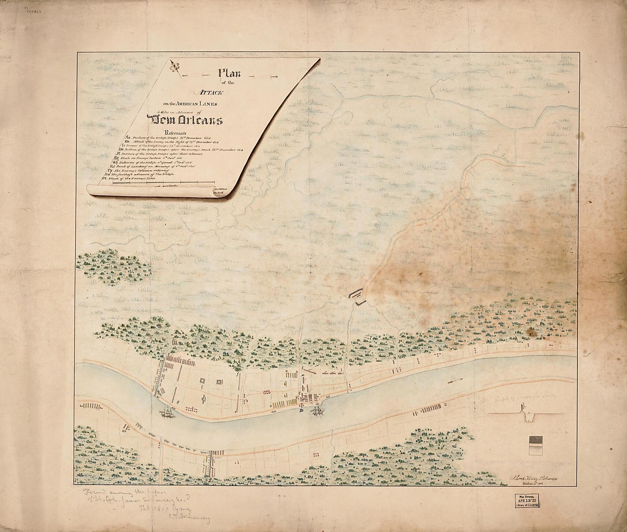
Plan of the Attack On the American Lines 5 Miles In Advance of New Orleans 1816
- Regular price
-
$68.95 - Regular price
-
$63.95 - Sale price
-
$68.95
Shipping calculated at checkout.
Buy one map, get any other map in our collection for 50% OFF! Add to cart to see discount.
Couldn't load pickup availability
About This Map
Old military map of Louisiana, New Orleans, United States.
Created by Alured Henry L'estrange in 1816.
Created by Alured Henry L'estrange in 1816.
- Relief shown pictorially.
- Pen-and-ink, pencil, and watercolor.
- Includes references to troop locations and movements.
- Annotation in lower left margin: "Found among the papers of Lt. Col. James de Lancey recd. Feb. 1867 by me L.J. de Lancey."
- Minimal level cataloging record.
Map Subjects
History
Louisiana
Military Maps
New Orleans
New Orleans (La.)
New Orleans Battle Of New Orleans LA
United States
War Of 1812
Alured Henry L'estrange
1816
Map Sizing Information
- For the best legibility, order your map in the original size or larger. Most maps have intricate detail and small text that is best appreciated when the print size hasn't been reduced.
- Sizes labeled "Fits a Standard Frame" will drop right into any frame that you purchase in that size. The sizes that we offer are commonly available online and at most retail stores.
- Our standard sizes are recommendations based on the aspect ratio of the original map, but still may require some added "white space" in one dimension to fit.
- Non-standard sizes will require custom framing, and we suggest taking your print to the frame shop of your choice after you receive it for the best results.
- Custom sizes are available, simply contact us for a quote.
Below is an approximation of the scale of a few standard sizes, and how they might appear in your space.

