

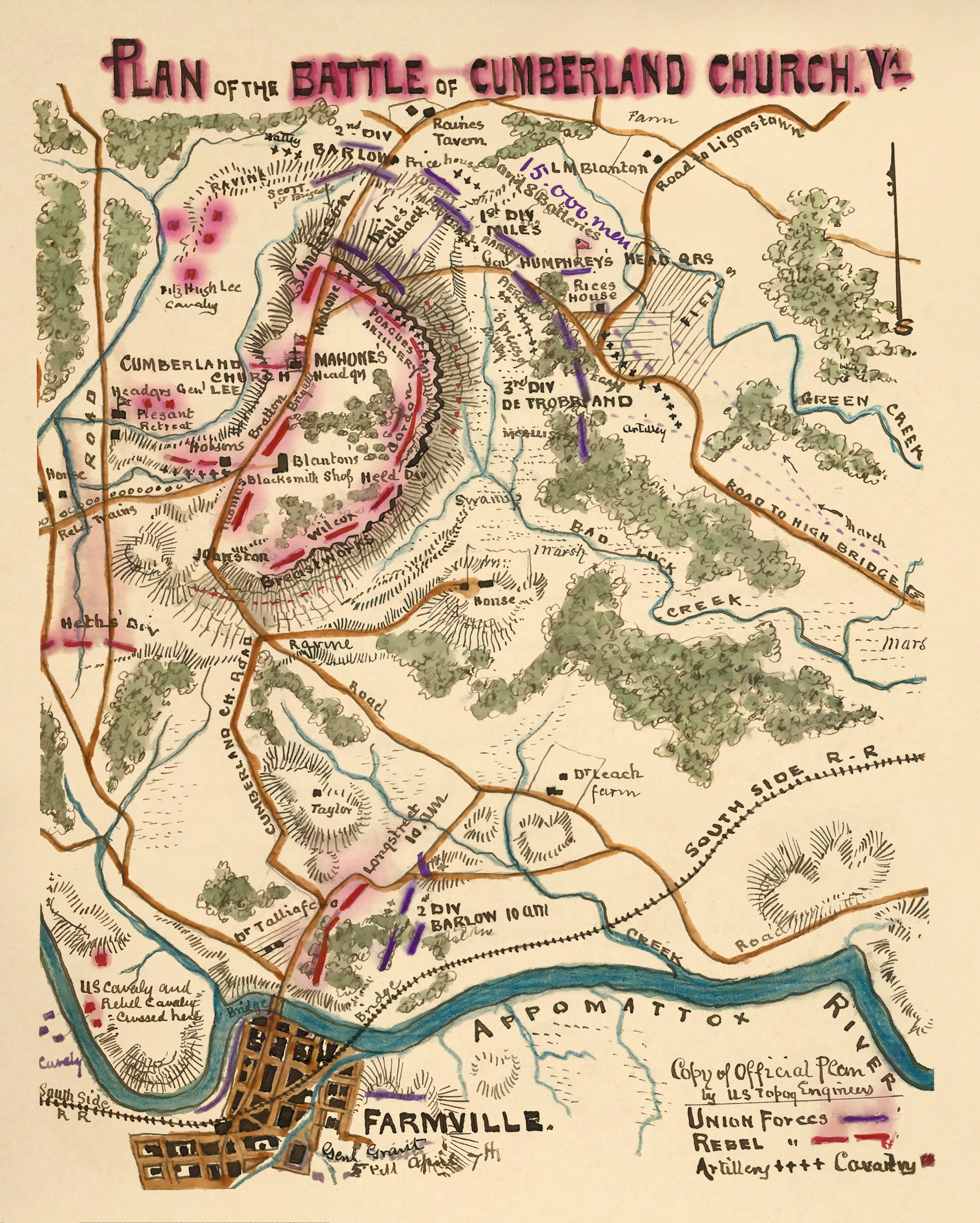
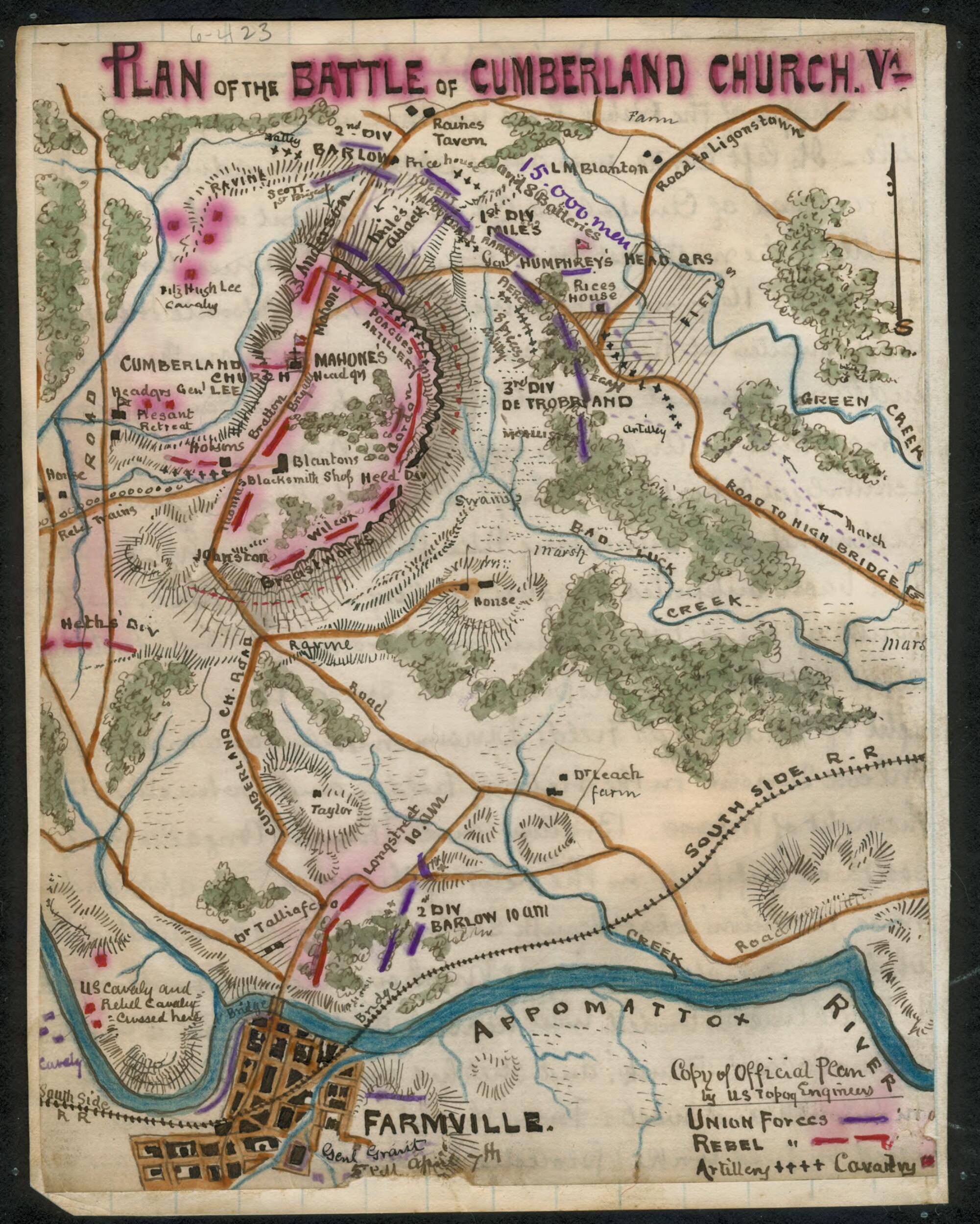
Plan of the Battle of Cumberland Church, Va in 04-07
- Regular price
-
$49.95 - Regular price
-
$29.95 - Sale price
-
$49.95
Shipping calculated at checkout.
Buy one map, get any other map in our collection for 50% OFF! Add to cart to see discount.
Couldn't load pickup availability
About This Map
Old map of Appomattox River, Cumberland County, Prince Edward County, United States, Virginia.
Map shows the location of Confederate Gen. R. E. Lee's troops at Cumberland Church and Union Gen. U. S. Grant's troops south near Farmville, Va., along the Appomattox River. This was a small skirmish in Cumberland County on April 7, 1865, just following action at Highbridge and Rice's Station and just preceding Lee's surrender at Appomattox Courthouse.
Created by Robert Knox Sneden in 04-07.
- Color coding indicates the location of Union and Confederate forces.
- Relief shown hachures.
- This item is from the collections of the Virginia Historical Society; please contact the institution for more information.
- In the Robert Knox Sneden Diary (Mss5:1 Sn237:1 v. 6, p. 423).
- Manuscripts
Map Sizing Information
- For the best legibility, order your map in the original size or larger. Most maps have intricate detail and small text that is best appreciated when the print size hasn't been reduced.
- Sizes labeled "Fits a Standard Frame" will drop right into any frame that you purchase in that size. The sizes that we offer are commonly available online and at most retail stores.
- Our standard sizes are recommendations based on the aspect ratio of the original map, but still may require some added "white space" in one dimension to fit.
- Non-standard sizes will require custom framing, and we suggest taking your print to the frame shop of your choice after you receive it for the best results.
- Custom sizes are available, simply contact us for a quote.
Below is an approximation of the scale of a few standard sizes, and how they might appear in your space.

