
Plan of the Battle of Kelly's Ford, Va. : Fought 7th November 1863 11-07
- Regular price
-
$49.95 - Regular price
-
$29.95 - Sale price
-
$49.95
Shipping calculated at checkout.
Buy one map, get any other map in our collection for 50% OFF! Add to cart to see discount.
Couldn't load pickup availability
About This Map
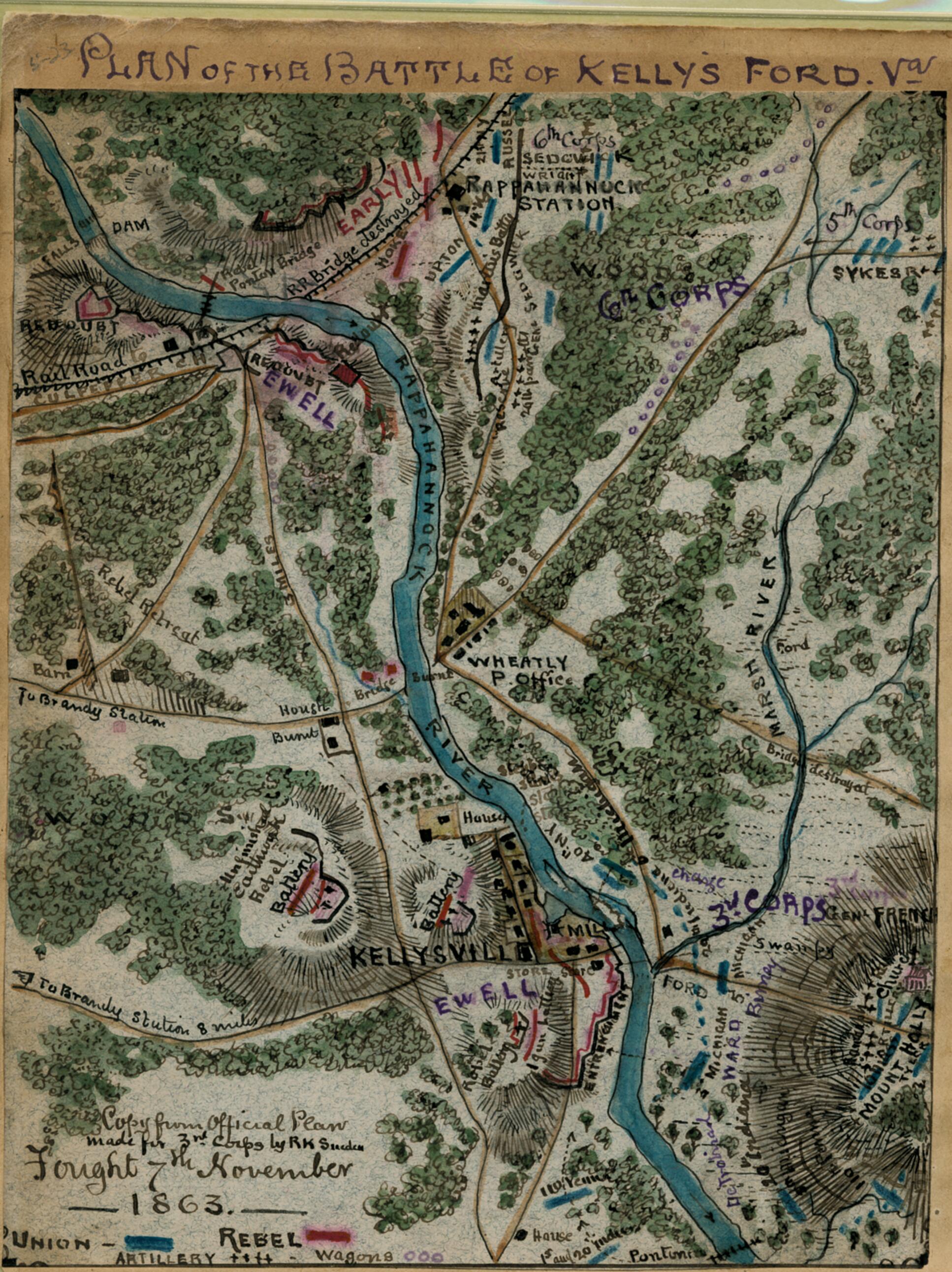
Old map of Culpeper County, Fauquier County, Rappahannock River, United States, Virginia.
Focuses on a small portion of the Rappahannock River close to the line dividing Culpeper and Fauquier counties, Va., and about 8 miles (as indentified by Sneden) from Brandy Station where the Battle of Kelly's Ford occurred on 7 November 1863. Confederate positions are noted as well as the placement of the 3rd, 5th, and 6th corps of the Union Army of the Potomac.
Created by Robert Knox Sneden in 11-07.
- Lower left corner of map: "Copy from Official Plan made for 3rd Corps by R.K. Sneden."
- This item is from the collections of the Virginia Historical Society; please contact the institution for more information.
- Robert Knox Sneden scrapbook (Mss5:7 Sn237:1), Virginia Historical Society.
- In the Robert Knox Sneden diary, 1861-1865 (v. 5, p. 23).
- Manuscripts
Map Sizing Information
- For the best legibility, order your map in the original size or larger. Most maps have intricate detail and small text that is best appreciated when the print size hasn't been reduced.
- Sizes labeled "Fits a Standard Frame" will drop right into any frame that you purchase in that size. The sizes that we offer are commonly available online and at most retail stores.
- Our standard sizes are recommendations based on the aspect ratio of the original map, but still may require some added "white space" in one dimension to fit.
- Non-standard sizes will require custom framing, and we suggest taking your print to the frame shop of your choice after you receive it for the best results.
- Custom sizes are available, simply contact us for a quote.
Below is an approximation of the scale of a few standard sizes, and how they might appear in your space.

