
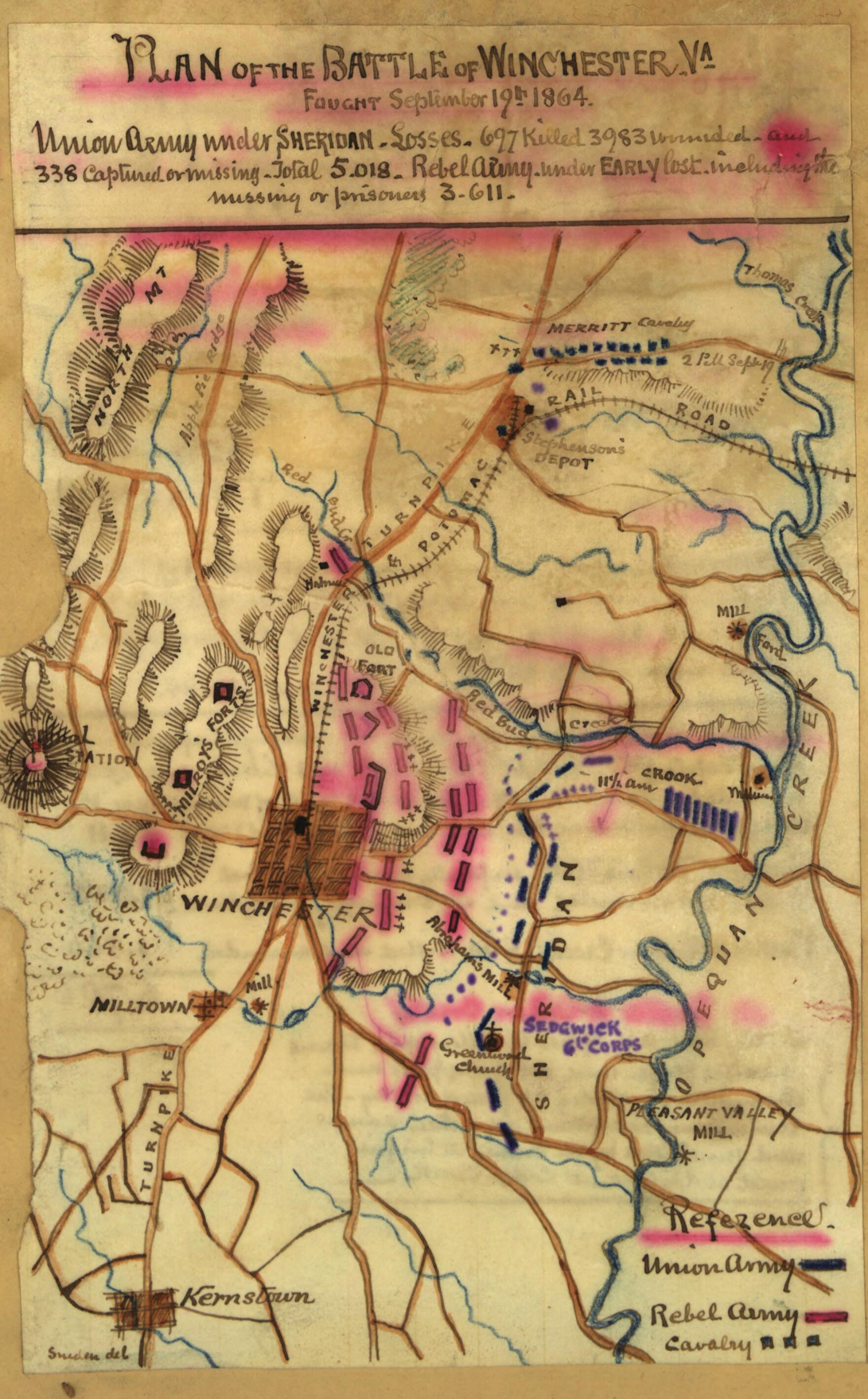
Plan of the Battle of Winchester, Va. Fought September 19th, 1864 in 09-19
- Regular price
-
$49.95 - Regular price
-
$29.95 - Sale price
-
$49.95
Shipping calculated at checkout.
Buy one map, get any other map in our collection for 50% OFF! Add to cart to see discount.
Couldn't load pickup availability
About This Map
Old map of United States, Virginia, Winchester.
Detail of Winchester, Va., and environs includes roads, railroads, creeks, mills, fords, and the locations of the Confederate Signal Station, "Millroy's Forts," Milltown, Kernstown, Stephenson's Depot, and Greenwood Church., The Confederate line, with Early commanding, is in front of Winchester. Union forces under Gen. Sheridan are shown east of the town, while the Union cavalry is located to the north at Stephenson's Depot. The Union forces were able to push Early's Confederates back toward the town and to the south, but were unsuccessful in their attempt to flank his right, thereby allowing him to retreat up the valley toward Strasburg.
Created by Robert Knox Sneden in 09-19.
- Color coding indicates the location of Union and Confederate forces.
- Relief shown by hachures.
- This item is from the collections of the Virginia Historical Society; please contact the institution for more information.
- In the Robert Knox Sneden Scrapbook (Mss5:7 Sn237:1 p. 416).
- Manuscripts
Map Sizing Information
- For the best legibility, order your map in the original size or larger. Most maps have intricate detail and small text that is best appreciated when the print size hasn't been reduced.
- Sizes labeled "Fits a Standard Frame" will drop right into any frame that you purchase in that size. The sizes that we offer are commonly available online and at most retail stores.
- Our standard sizes are recommendations based on the aspect ratio of the original map, but still may require some added "white space" in one dimension to fit.
- Non-standard sizes will require custom framing, and we suggest taking your print to the frame shop of your choice after you receive it for the best results.
- Custom sizes are available, simply contact us for a quote.
Below is an approximation of the scale of a few standard sizes, and how they might appear in your space.

