Skip to product information
1 of 1

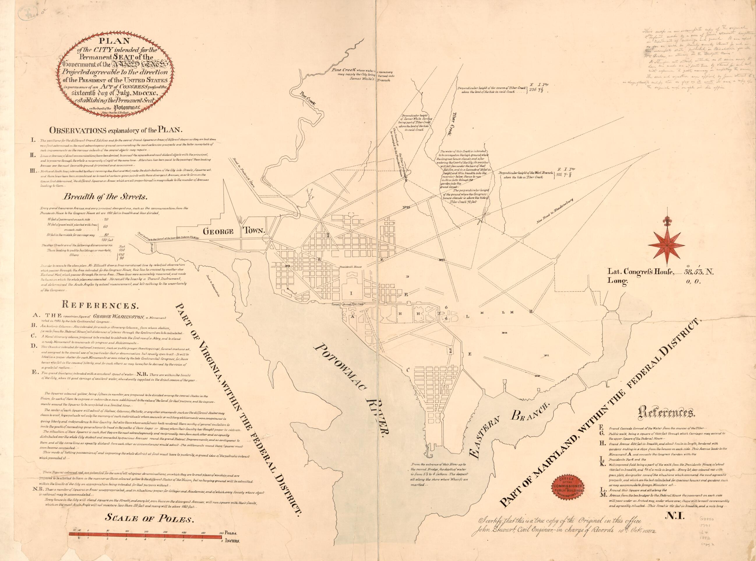
Plan of the City Intended for the Permanent Seat of the Government of the United States : Projected Agreeable to the Direction of the President of the United States, In Pursuance of an Act of Congress Passed the Sixteenth Day of July, MDCCXC, Establis...

Regular price
$125.95
Regular price
$176.95
Sale price
$125.95
Map Description
Old map of District of Columbia, United States, Washington, Washington D.C..

Created by Pierre Charles L'enfant, John Stewart, United States. Commissioner of Public Buildings in 1791.
  • "I certify that this is a true copy of the original in this office, John Stewart, civil engineer in charge of records, 10th Oct'r 1882."
  • Facsim. of the L'Enfant plan showing part of the street system of the original.
  • Original version: [1791].
  • Includes text, notes, and descriptive index of "References."
  • At lower right: N.I.
  • Halved and mounted on cloth backing. Copy 2 also annotated in lead pencil to give textual data about John Stewart and his role in preparing the facsim.
  • 2 copies

Map Tags

1791

District Of Columbia

Early Works To 1800

Facsimiles

John Stewart

Map

Maps

Pierre Charles L'enfant

United States

United States. Commissioner Of Public Buildings

Washington

Washington (D.C.)

Fine Art Quality Printed on heavyweight (230 gsm) archival paper with a classic matte finish
Professionally Restored For the best presentation, your map will be carefully retouched by our experienced team
Free Shipping Orders of $75 or more ship for free and arrive in 3-5 business days
Proudly Made in the USA All of our maps are custom printed to order in Portland, Maine
Help with Choosing a Map Size
Secure Checkout
Lifetime Warranty
Money-Back Guarantee
This old map of Plan of the City Intended for the Permanent Seat of the Government of the United States : Projected Agreeable to the Direction of the President of the United States, In Pursuance of an Act of Congress Passed the Sixteenth Day of July, MDC