
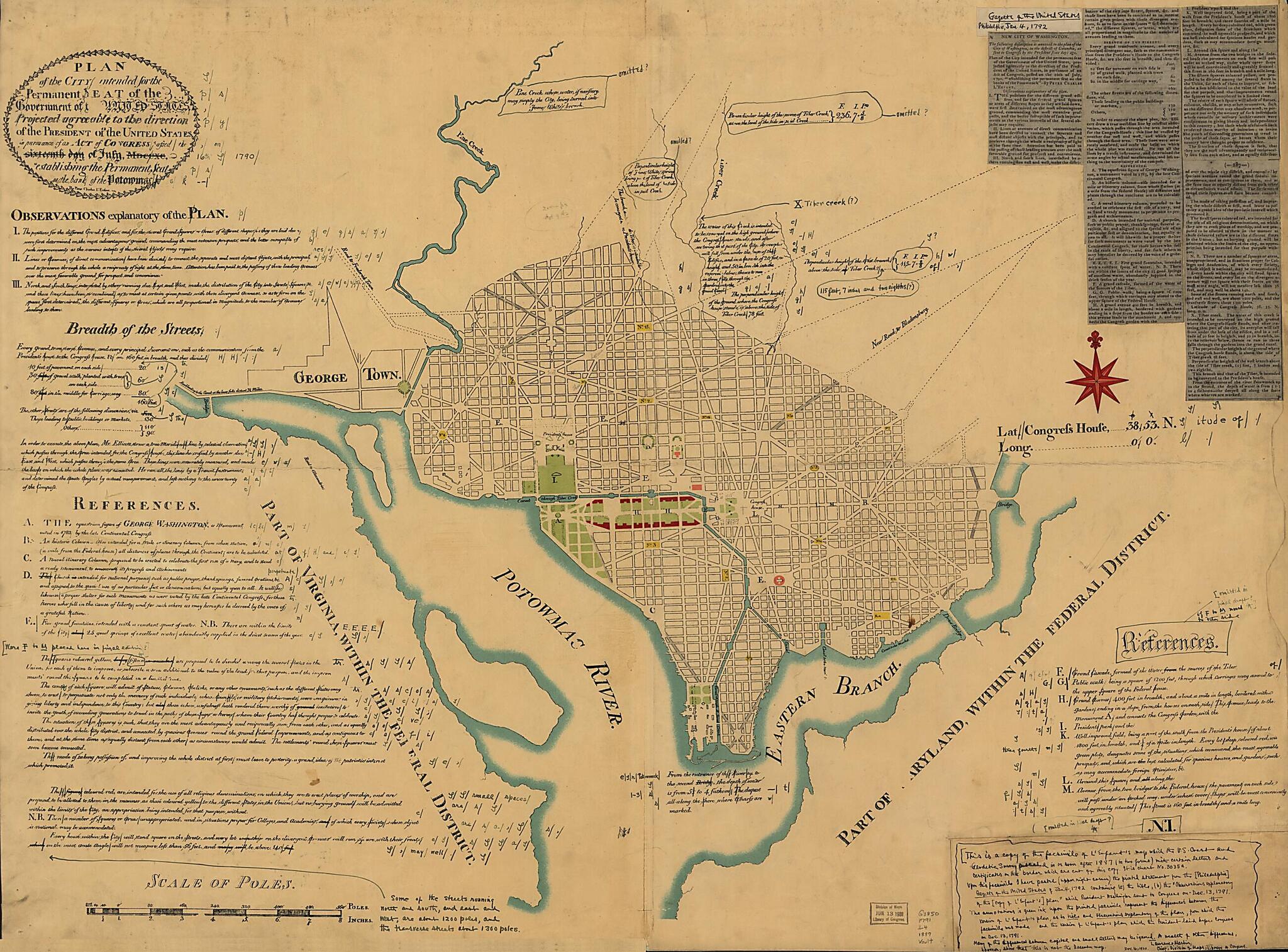
Plan of the City Intended for the Permanent Seat of the Government of The United States : Projected Agreeable to the Direction of the President of the United States, In Pursuance of an Act of Congress Passed the Sixteenth Day of July, MDCCXC, establis...
- Regular price
-
$123.95 - Regular price
-
$118.95 - Sale price
-
$123.95
Shipping calculated at checkout.
Buy one map, get any other map in our collection for 50% OFF! Add to cart to see discount.
Couldn't load pickup availability
About This Map
Old map of District of Columbia, United States, Washington, Washington D.C..
Created by Pierre Charles L'enfant, Lawrence Martin, U.S. Coast and Geodetic Survey in 1791.
Created by Pierre Charles L'enfant, Lawrence Martin, U.S. Coast and Geodetic Survey in 1791.
- Photocopy of a facsim. of the 1791 L'Enfant plan.
- Includes text, indexed "References," and photocopied newspaper article titled "New city of Washington," from the Gazette of the United States, Philadelphia, Jan. 4, 1792.
- At lower right: N.I.
Map Subjects
District Of Columbia
Early Works To 1800
Facsimiles
United States
Washington
Washington (D.C.)
Washington D.C.
Pierre Charles L'enfant
Lawrence Martin
U.S. Coast And Geodetic Survey
1791
Map Sizing Information
- For the best legibility, order your map in the original size or larger. Most maps have intricate detail and small text that is best appreciated when the print size hasn't been reduced.
- Sizes labeled "Fits a Standard Frame" will drop right into any frame that you purchase in that size. The sizes that we offer are commonly available online and at most retail stores.
- Our standard sizes are recommendations based on the aspect ratio of the original map, but still may require some added "white space" in one dimension to fit.
- Non-standard sizes will require custom framing, and we suggest taking your print to the frame shop of your choice after you receive it for the best results.
- Custom sizes are available, simply contact us for a quote.
Below is an approximation of the scale of a few standard sizes, and how they might appear in your space.

