
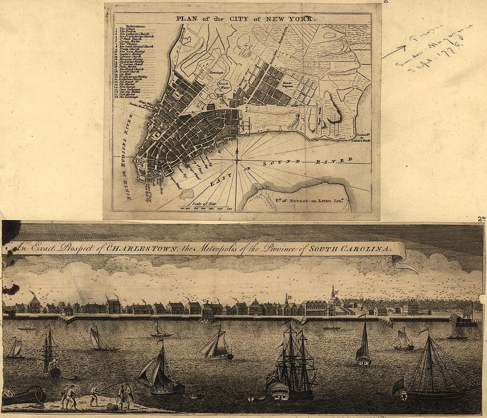
Plan of the City of New York ; an Exact Prospect of Charlestown : the Metropolis of the Province of South Carolina 1762
- Regular price
-
$49.95 - Regular price
-
$29.95 - Sale price
-
$49.95
Shipping calculated at checkout.
Buy one map, get any other map in our collection for 50% OFF! Add to cart to see discount.
Couldn't load pickup availability
About This Map
Old map of Charleston, New York, New York (State), New York City, South Carolina, United States.
- New York City map shows streets, wharves, ferries, principal buildings, and built-up area.
- Charleston view is panorama of waterfront and quays with principal buildings lettered for identification (no index present).
- Relief shown by hachures on New York City map.
- New York City map removed from London Magazine, Sept. 1776; Charleston view removed from London Magazine, 1762.
- This map has some imperfections: charleston view ink-stained at upper left. We'll do our best to restore the image before printing.
- New York City map includes index to points of interest.
Map Subjects
Aerial Views
Charleston
Charleston (S.C.)
Early Works To 1800
New York
New York (N.Y.)
New York (State)
South Carolina
United States
New York City
1762
Map Sizing Information
- For the best legibility, order your map in the original size or larger. Most maps have intricate detail and small text that is best appreciated when the print size hasn't been reduced.
- Sizes labeled "Fits a Standard Frame" will drop right into any frame that you purchase in that size. The sizes that we offer are commonly available online and at most retail stores.
- Our standard sizes are recommendations based on the aspect ratio of the original map, but still may require some added "white space" in one dimension to fit.
- Non-standard sizes will require custom framing, and we suggest taking your print to the frame shop of your choice after you receive it for the best results.
- Custom sizes are available, simply contact us for a quote.
Below is an approximation of the scale of a few standard sizes, and how they might appear in your space.

