
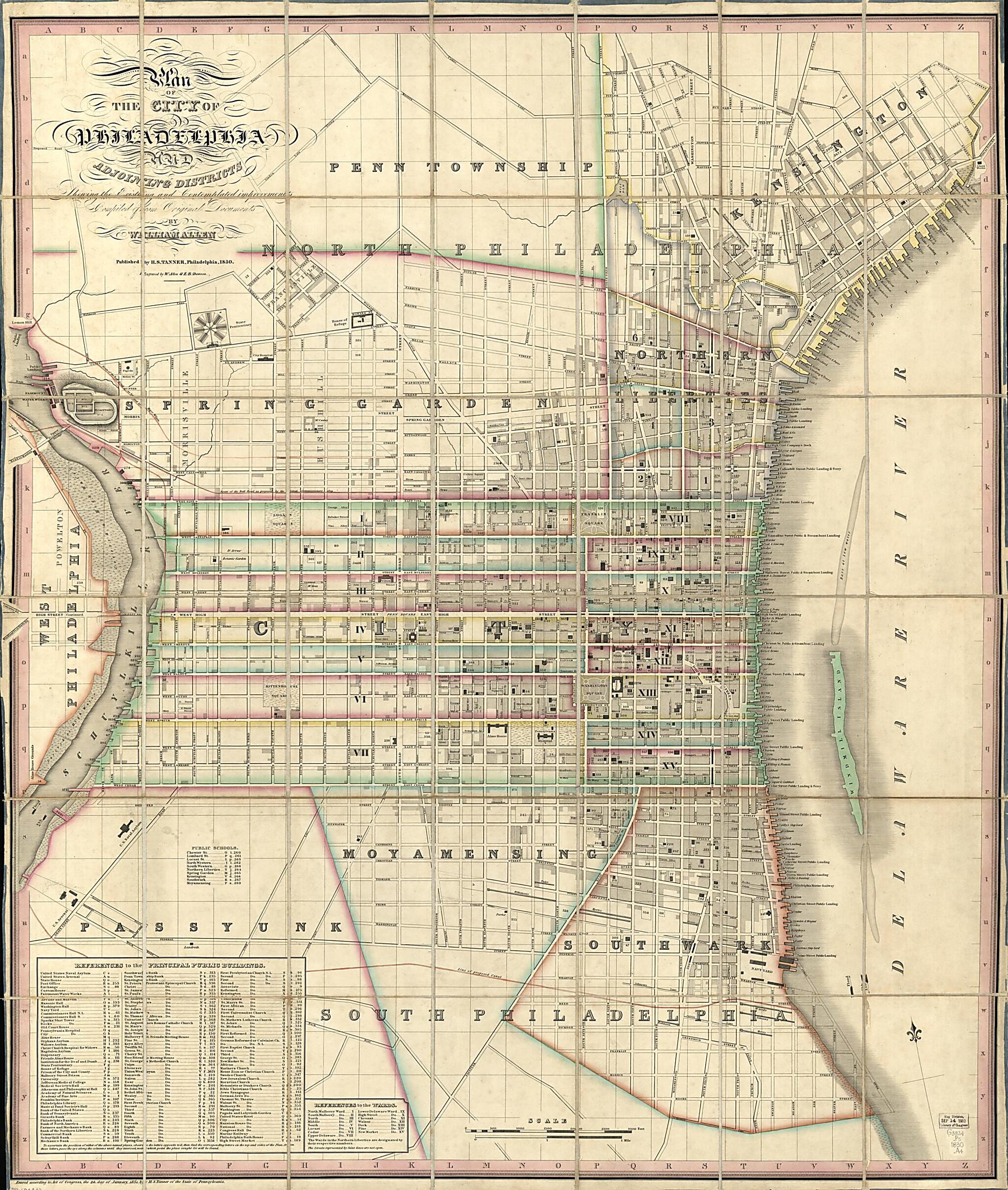
Plan of the City of Philadelphia and Adjoining Districts : Shewing the Existing and Contemplated Improvements 1830
- Regular price
-
$162.95 - Regular price
-
$157.95 - Sale price
-
$162.95
Shipping calculated at checkout.
Buy one map, get any other map in our collection for 50% OFF! Add to cart to see discount.
Couldn't load pickup availability
About This Map
Old map of Pennsylvania, Philadelphia, United States.
Created by William Allen, E. B. Dawson, Henry Schenck Tanner in 1830.
Created by William Allen, E. B. Dawson, Henry Schenck Tanner in 1830.
- Scale ca. 1:6,000.
- Hand colored.
- Relief shown by hachures.
- Shows wards and built-up.
- Indexed.
- Accompanied by: Index to the new plan of Philadelphia and adjoining districts, with references to find the streets, public buildings, etc. (vi, 44, 16 p. ; 15 cm.)
Map Subjects
Pennsylvania
Philadelphia
Philadelphia (Pa.)
United States
William Allen
E. B. Dawson
Henry Schenck Tanner
1830
Map Sizing Information
- For the best legibility, order your map in the original size or larger. Most maps have intricate detail and small text that is best appreciated when the print size hasn't been reduced.
- Sizes labeled "Fits a Standard Frame" will drop right into any frame that you purchase in that size. The sizes that we offer are commonly available online and at most retail stores.
- Our standard sizes are recommendations based on the aspect ratio of the original map, but still may require some added "white space" in one dimension to fit.
- Non-standard sizes will require custom framing, and we suggest taking your print to the frame shop of your choice after you receive it for the best results.
- Custom sizes are available, simply contact us for a quote.
Below is an approximation of the scale of a few standard sizes, and how they might appear in your space.

