
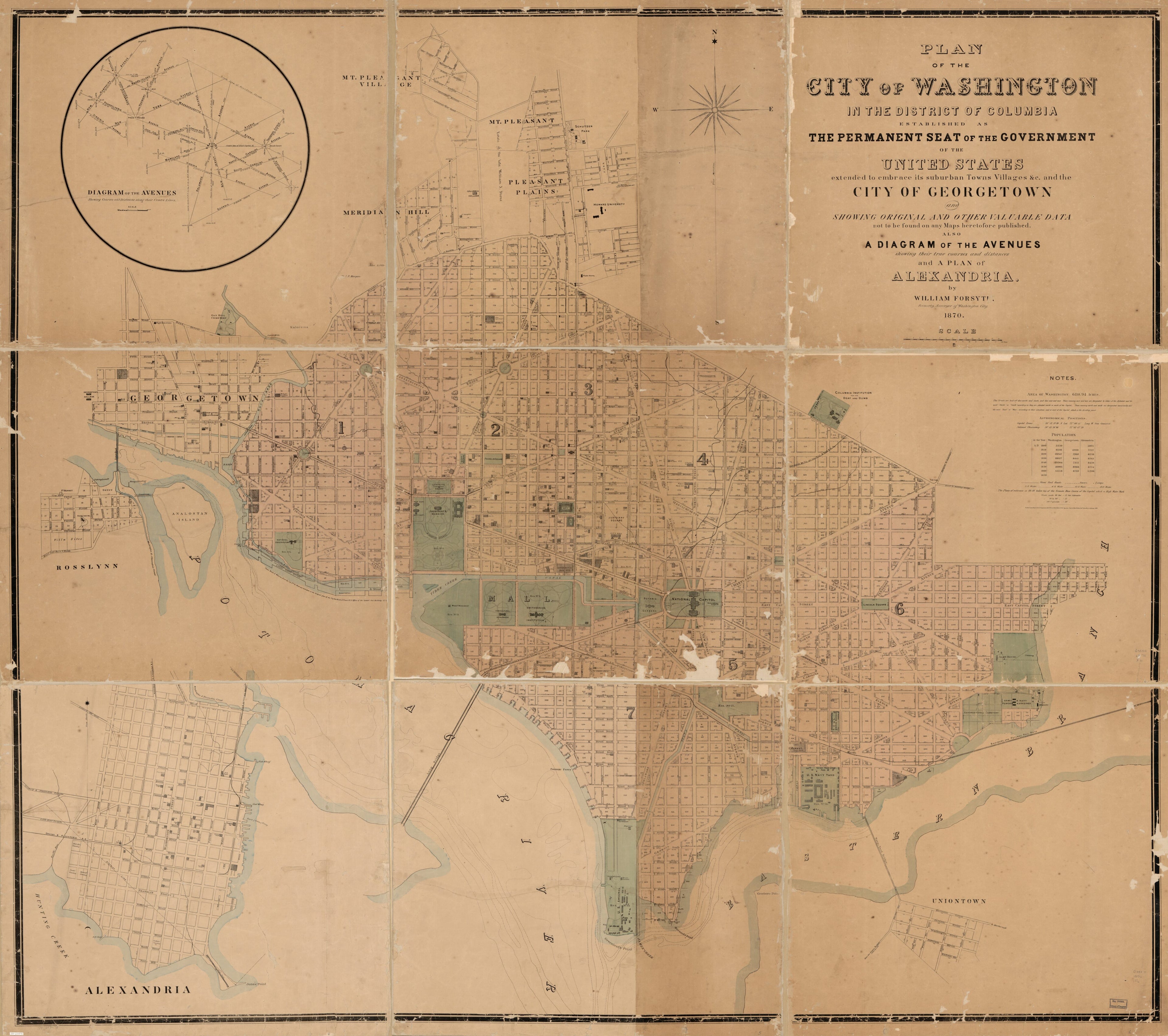
Plan of the City of Washington In the District of Columbia : Established As the Permanent Seat of the Government of the United States, Extended to Embrace Its Suburban Towns, Villages, &c. and the City of Georgetown and Showing Original and Other Valu...
- Regular price
-
$217.95 - Regular price
-
$212.95 - Sale price
-
$217.95
Shipping calculated at checkout.
Buy one map, get any other map in our collection for 50% OFF! Add to cart to see discount.
Couldn't load pickup availability
About This Map
Old map of Alexandria, Arlington, District of Columbia, Georgetown, Rosslyn, United States, Virginia, Washington, Washington D.C..
Created by William Forsyth in 1870.
Created by William Forsyth in 1870.
- Depths shown by contours.
- Also covers Rosslyn (Va.).
- Also shows wards, block numbers, water and sewer lines, streetlights, major buildings, and streetcar lines.
- "Entered according to Act of Congress in the Office of the Clerk of the Supreme Court of the District of Columbia in the year 1870."
- Includes notes, insets of D.C. avenues and Alexandria, and population table.
Map Sizing Information
- For the best legibility, order your map in the original size or larger. Most maps have intricate detail and small text that is best appreciated when the print size hasn't been reduced.
- Sizes labeled "Fits a Standard Frame" will drop right into any frame that you purchase in that size. The sizes that we offer are commonly available online and at most retail stores.
- Our standard sizes are recommendations based on the aspect ratio of the original map, but still may require some added "white space" in one dimension to fit.
- Non-standard sizes will require custom framing, and we suggest taking your print to the frame shop of your choice after you receive it for the best results.
- Custom sizes are available, simply contact us for a quote.
Below is an approximation of the scale of a few standard sizes, and how they might appear in your space.

