
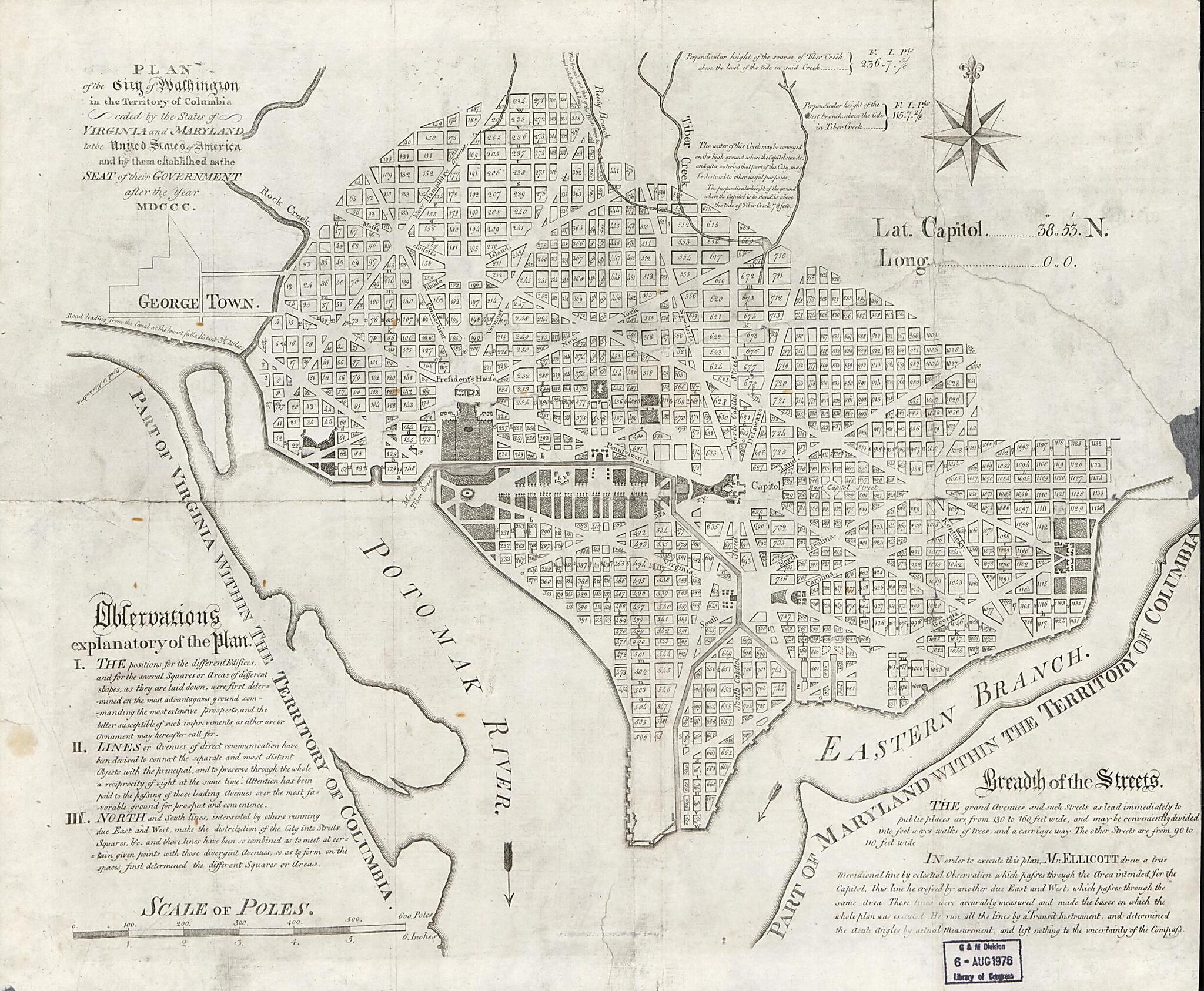
Plan of the City of Washington In the Territory of Columbia, Ceded by the States of Virginia and Maryland to the United States of America, and by Them Established As the Seat of Government After the Year MDCCC 1794
- Regular price
-
$52.95 - Regular price
-
$36.95 - Sale price
-
$52.95
Shipping calculated at checkout.
Buy one map, get any other map in our collection for 50% OFF! Add to cart to see discount.
Couldn't load pickup availability
About This Map
Old map of District of Columbia, United States, Washington, Washington D.C..
Created by Andrew Ellicott, Samuel Hill in 1794.
Created by Andrew Ellicott, Samuel Hill in 1794.
- Scale ca. 1:20,000.
- Has watermarks of 1794 appearing in each corner of the map.
- Shows block numbers and proposed government buildings.
- "In order to execute this plan, Mr. Ellicott ... made the bases on which the whole plan was executed."
- Based on Samuel Hill's Plan of the city of Washington, 1792.
- Same as other 1792 ed. (98-689552) except that it has the statement "Engraved for Encyclopædia Perthensis" removed from bottom of printing plate.
- Includes text and notes.
Map Subjects
District Of Columbia
Early Works To 1800
United States
Washington
Washington (D.C.)
Washington D.C.
Andrew Ellicott
Samuel Hill
1794
Map Sizing Information
- For the best legibility, order your map in the original size or larger. Most maps have intricate detail and small text that is best appreciated when the print size hasn't been reduced.
- Sizes labeled "Fits a Standard Frame" will drop right into any frame that you purchase in that size. The sizes that we offer are commonly available online and at most retail stores.
- Our standard sizes are recommendations based on the aspect ratio of the original map, but still may require some added "white space" in one dimension to fit.
- Non-standard sizes will require custom framing, and we suggest taking your print to the frame shop of your choice after you receive it for the best results.
- Custom sizes are available, simply contact us for a quote.
Below is an approximation of the scale of a few standard sizes, and how they might appear in your space.

