
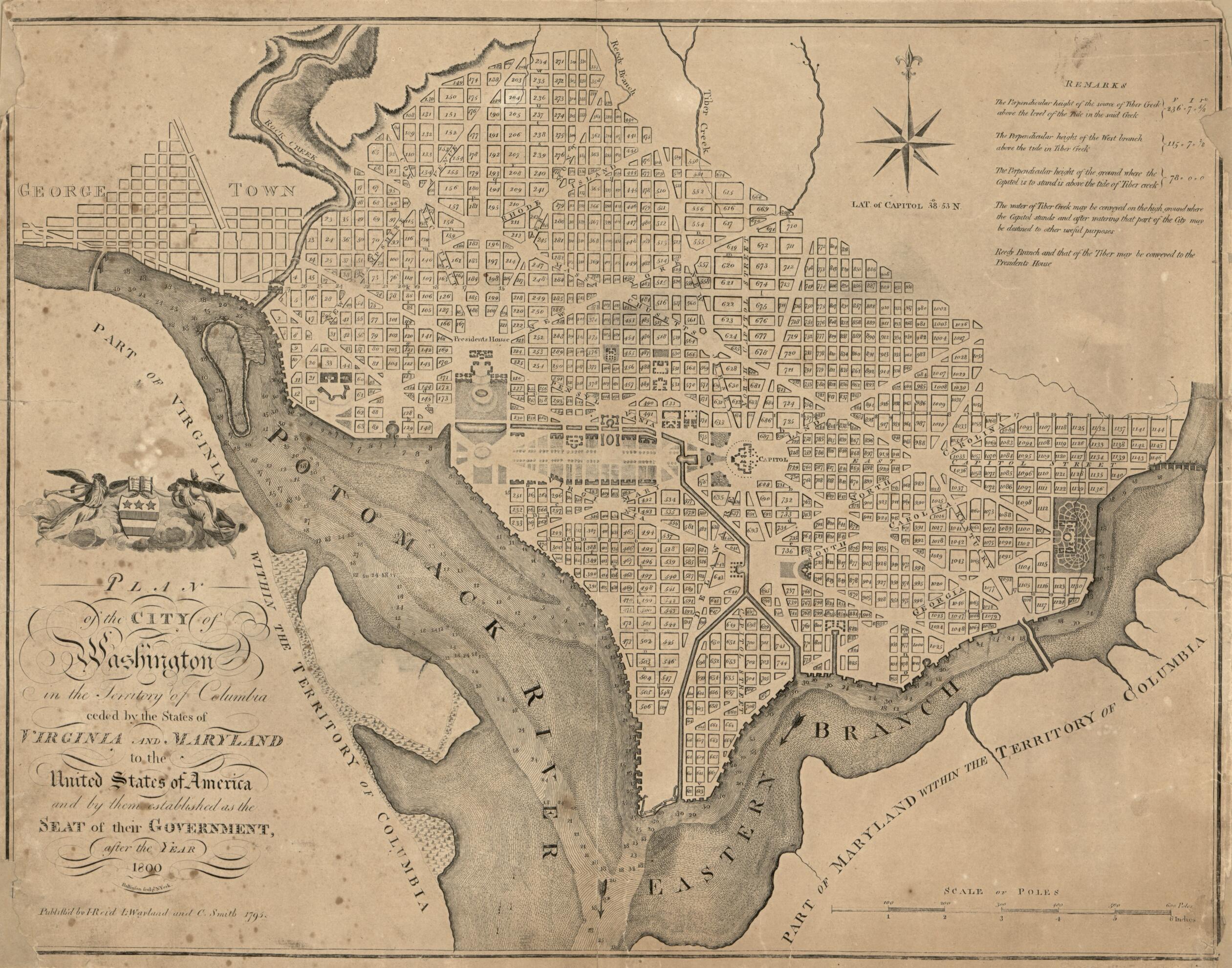
Plan of the City of Washington In the Territory of Columbia : Ceded by the States of Virginia and Maryland to the United States of America and by Them Established As the Seat of Their Government, After the Year 1800 1795
- Regular price
-
$52.95 - Regular price
-
$36.95 - Sale price
-
$52.95
Shipping calculated at checkout.
Buy one map, get any other map in our collection for 50% OFF! Add to cart to see discount.
Couldn't load pickup availability
About This Map
Old map of District of Columbia, Georgetown, Georgetown (Washington), United States, Washington, Washington D.C..
Created by John Reid, William Rollinson, Charles Smith, Levi Wayland in 1795.
Created by John Reid, William Rollinson, Charles Smith, Levi Wayland in 1795.
- Shows block numbers and proposed government buildings.
- Also covers Georgetown.
- Relief shown by hachures. Depths shown by soundings.
- Includes "Remarks" and coat-of-arms.
- Phillips. Washington 1295
- 2 copies
Map Sizing Information
- For the best legibility, order your map in the original size or larger. Most maps have intricate detail and small text that is best appreciated when the print size hasn't been reduced.
- Sizes labeled "Fits a Standard Frame" will drop right into any frame that you purchase in that size. The sizes that we offer are commonly available online and at most retail stores.
- Our standard sizes are recommendations based on the aspect ratio of the original map, but still may require some added "white space" in one dimension to fit.
- Non-standard sizes will require custom framing, and we suggest taking your print to the frame shop of your choice after you receive it for the best results.
- Custom sizes are available, simply contact us for a quote.
Below is an approximation of the scale of a few standard sizes, and how they might appear in your space.

