
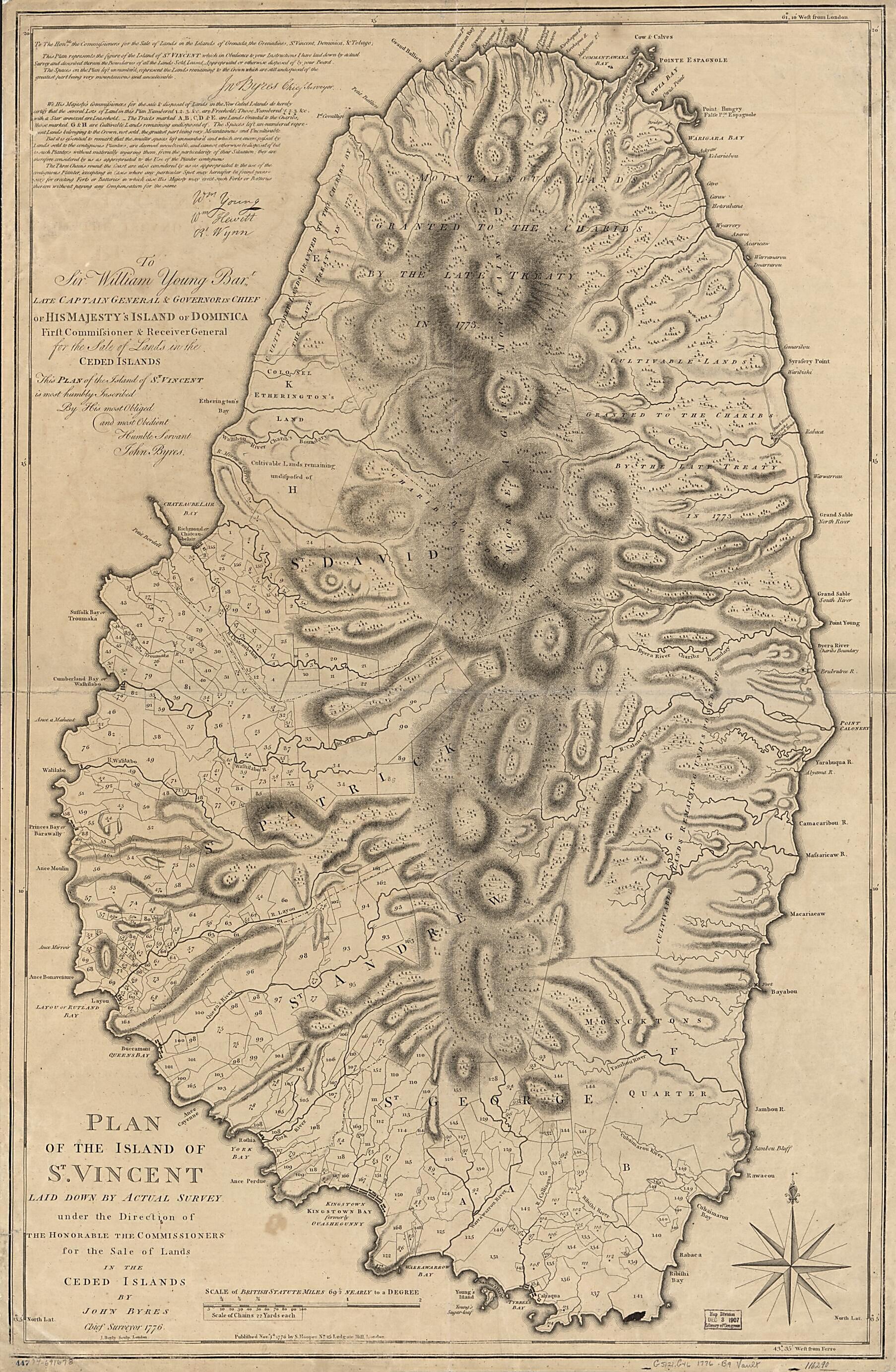
Plan of the Island of St. Vincent Laid Down by Actual Survey Under the Direction of the Honorable the Commissioners for the Sale of Lands In the Ceded Islands 1776
- Regular price
-
$95.95 - Regular price
-
$90.95 - Sale price
-
$95.95
Shipping calculated at checkout.
Buy one map, get any other map in our collection for 50% OFF! Add to cart to see discount.
Couldn't load pickup availability
About This Map
Old map of Saint Vincent, Saint Vincent and the Grenadines.
Created by J. Bayly, John Byres, S. (Samuel) Hooper in 1776.
Created by J. Bayly, John Byres, S. (Samuel) Hooper in 1776.
- Scale ca. 1:32,000.
- Relief shown by hachures.
- Prime meridian: Ferro.
- "To Sir William Young, Bart. ... this plan of the island of St. Vincent ... John Byres."
- Shows land granted to the Caribs, treaty boundaries, and boundaries of salable lands.
- Includes explanatory text.
Map Subjects
Early Works To 1800
Real Property
Saint Vincent
Saint Vincent And The Grenadines
J. Bayly
John Byres
S. (Samuel) Hooper
1776
Map Sizing Information
- For the best legibility, order your map in the original size or larger. Most maps have intricate detail and small text that is best appreciated when the print size hasn't been reduced.
- Sizes labeled "Fits a Standard Frame" will drop right into any frame that you purchase in that size. The sizes that we offer are commonly available online and at most retail stores.
- Our standard sizes are recommendations based on the aspect ratio of the original map, but still may require some added "white space" in one dimension to fit.
- Non-standard sizes will require custom framing, and we suggest taking your print to the frame shop of your choice after you receive it for the best results.
- Custom sizes are available, simply contact us for a quote.
Below is an approximation of the scale of a few standard sizes, and how they might appear in your space.

