
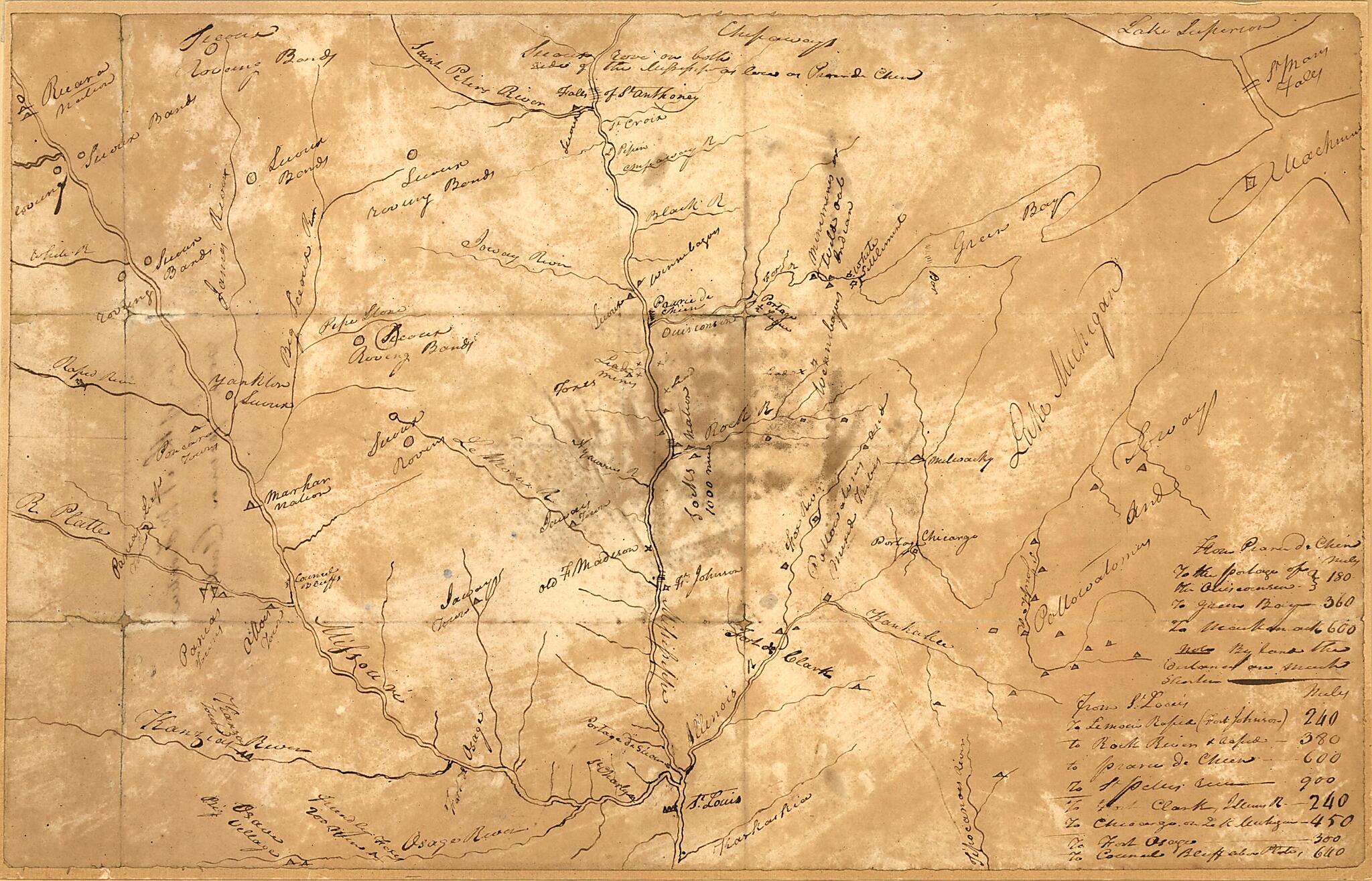
Plan of the N.W. Frontier (Plan of the Northwest Frontier) 1813
- Regular price
-
$49.95 - Regular price
-
$29.95 - Sale price
-
$49.95
Shipping calculated at checkout.
Buy one map, get any other map in our collection for 50% OFF! Add to cart to see discount.
Couldn't load pickup availability
About This Map
Old map of Mississippi River Valley, Missouri River Valley, United States.
Created by William Clark in 1813.
Created by William Clark in 1813.
- Shows the Mississippi River from St. Anthony Falls to St. Louis, the Missouri River west to South Dakota, the Illinois River east to Lake Michigan, and tributaries.
- Title from verso.
- Gift; Woodbury Blair, Minna Blair Richey, Gist Blair, and Montgomery Blair; 1903.
- Pen-and-ink, mounted on paper.
- Includes list of distances to various points via riverways from Prairie du Chien and St. Louis.
- This map has some imperfections: fold-lined, staining throughout, darkest in the middle. We'll do our best to restore the image before printing.
Map Subjects
Maps Manuscript
Mississippi River Valley
Missouri River Valley
United States
William Clark
1813
Map Sizing Information
- For the best legibility, order your map in the original size or larger. Most maps have intricate detail and small text that is best appreciated when the print size hasn't been reduced.
- Sizes labeled "Fits a Standard Frame" will drop right into any frame that you purchase in that size. The sizes that we offer are commonly available online and at most retail stores.
- Our standard sizes are recommendations based on the aspect ratio of the original map, but still may require some added "white space" in one dimension to fit.
- Non-standard sizes will require custom framing, and we suggest taking your print to the frame shop of your choice after you receive it for the best results.
- Custom sizes are available, simply contact us for a quote.
Below is an approximation of the scale of a few standard sizes, and how they might appear in your space.
