
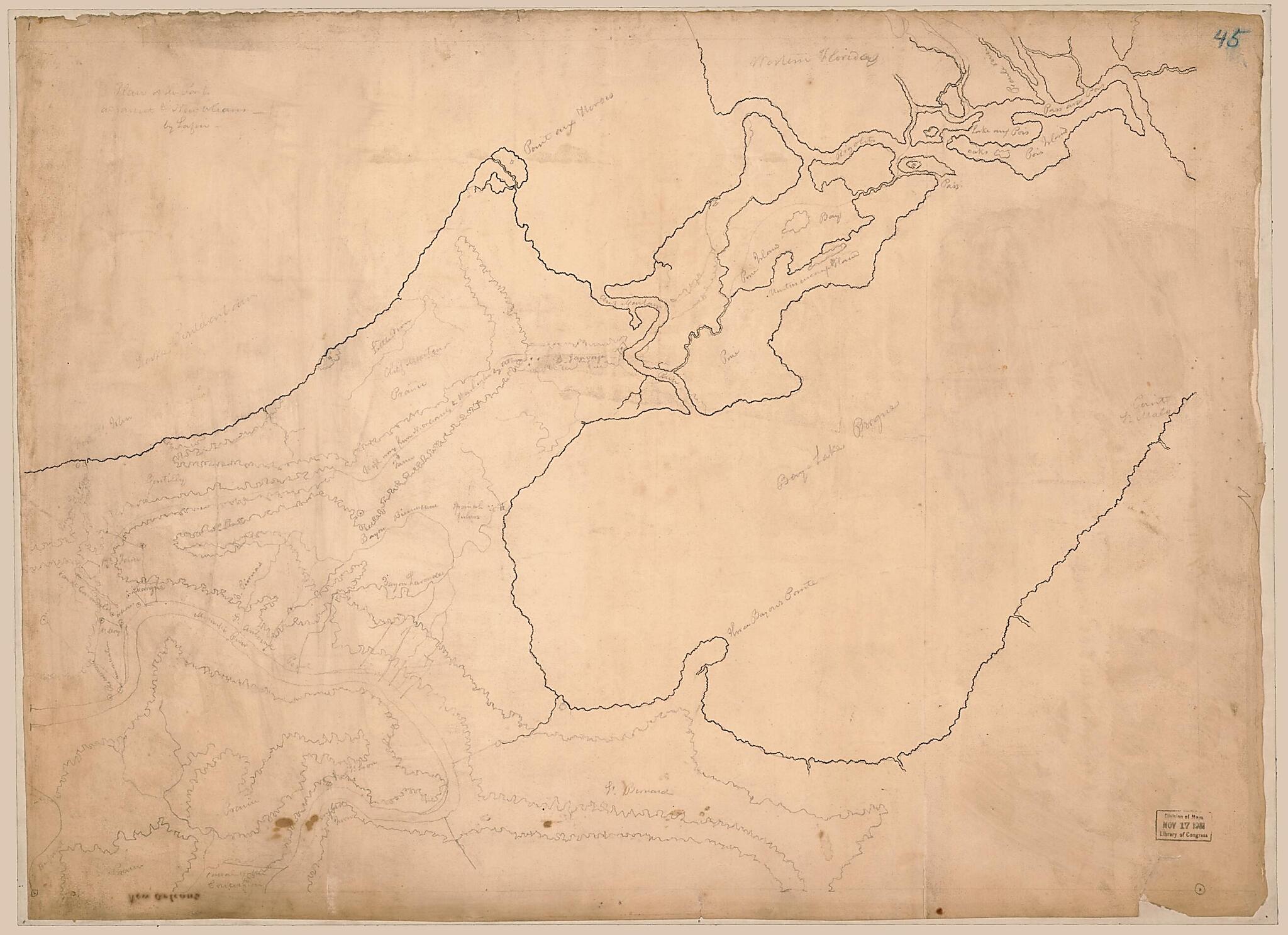
Plan of the posts Adjacent to New Orleans 1813
- Regular price
-
$60.95 - Regular price
-
$55.95 - Sale price
-
$60.95
Shipping calculated at checkout.
Buy one map, get any other map in our collection for 50% OFF! Add to cart to see discount.
Couldn't load pickup availability
About This Map
Old manuscript map of Louisiana, Orleans Parish, United States.
Created by Barthélémy Lafon, United States. War Department. Office of the Chief of Engineers in 1813.
Created by Barthélémy Lafon, United States. War Department. Office of the Chief of Engineers in 1813.
- Relief shown pictorially
- Pen-and-ink and pencil.
- Shows location of posts and ammunition stores in the vicinity of Orleans Parish from Lake Pontchartrain to St. Bernard Parish and from New Orleans to Saint Malo.
- "Office of chief of engineers, War Department. 58510 470" on verso.
- Minimal level cataloging record.
Map Subjects
History
Louisiana
Manuscript Maps
Orleans Parish
Orleans Parish (La.)
United States
War Of 1812
Barthélémy Lafon
United States. War Department. Office Of The Chief Of Engineers
1813
Map Sizing Information
- For the best legibility, order your map in the original size or larger. Most maps have intricate detail and small text that is best appreciated when the print size hasn't been reduced.
- Sizes labeled "Fits a Standard Frame" will drop right into any frame that you purchase in that size. The sizes that we offer are commonly available online and at most retail stores.
- Our standard sizes are recommendations based on the aspect ratio of the original map, but still may require some added "white space" in one dimension to fit.
- Non-standard sizes will require custom framing, and we suggest taking your print to the frame shop of your choice after you receive it for the best results.
- Custom sizes are available, simply contact us for a quote.
Below is an approximation of the scale of a few standard sizes, and how they might appear in your space.

