
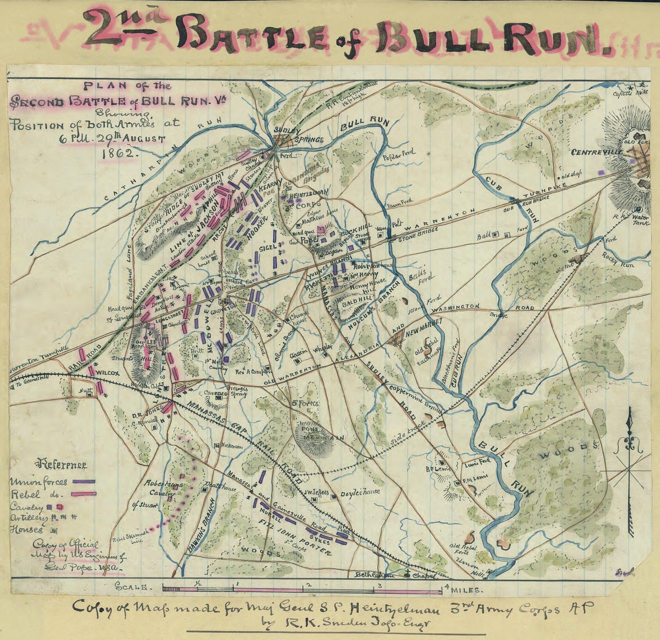
Plan of the Second Battle of Bull Run, Va. Showing Position of Both Armies at 6 P.m. 29th August 1862 08-29
- Regular price
-
$49.95 - Regular price
-
$29.95 - Sale price
-
$49.95
Shipping calculated at checkout.
Buy one map, get any other map in our collection for 50% OFF! Add to cart to see discount.
Couldn't load pickup availability
About This Map
Old map of Manassas Region, United States, Virginia.
Created by Robert Knox Sneden in 08-29.
Created by Robert Knox Sneden in 08-29.
- Below map: "Copy of map made for Maj. Genl. S.P. Heintzelman, 3rd Army Corps, AP, by R.K. Sneden, Topo. Engr."
- Lower left corner: "Copy of official map by U.S. Engineers of Genl. Pope, USA."
- Original scrapbook housed in the Museum Department of the Virginia Historical Society (1994.80.4-525) with restricted access.=500 \\ This item is from the collections of the Virginia Historical Society; please contact the institution for more information.
- Robert Knox Sneden diary (Mss5:1 Sn237:1), Virginia Historical Society.
- In the Robert Knox Sneden Scrapbook, 1870-1899 (p. 194).
Map Sizing Information
- For the best legibility, order your map in the original size or larger. Most maps have intricate detail and small text that is best appreciated when the print size hasn't been reduced.
- Sizes labeled "Fits a Standard Frame" will drop right into any frame that you purchase in that size. The sizes that we offer are commonly available online and at most retail stores.
- Our standard sizes are recommendations based on the aspect ratio of the original map, but still may require some added "white space" in one dimension to fit.
- Non-standard sizes will require custom framing, and we suggest taking your print to the frame shop of your choice after you receive it for the best results.
- Custom sizes are available, simply contact us for a quote.
Below is an approximation of the scale of a few standard sizes, and how they might appear in your space.

