
Plan of the Western Seat of War 1861
- Regular price
-
$53.95 - Regular price
-
$48.95 - Sale price
-
$53.95
Shipping calculated at checkout.
Buy one map, get any other map in our collection for 50% OFF! Add to cart to see discount.
Couldn't load pickup availability
About This Map
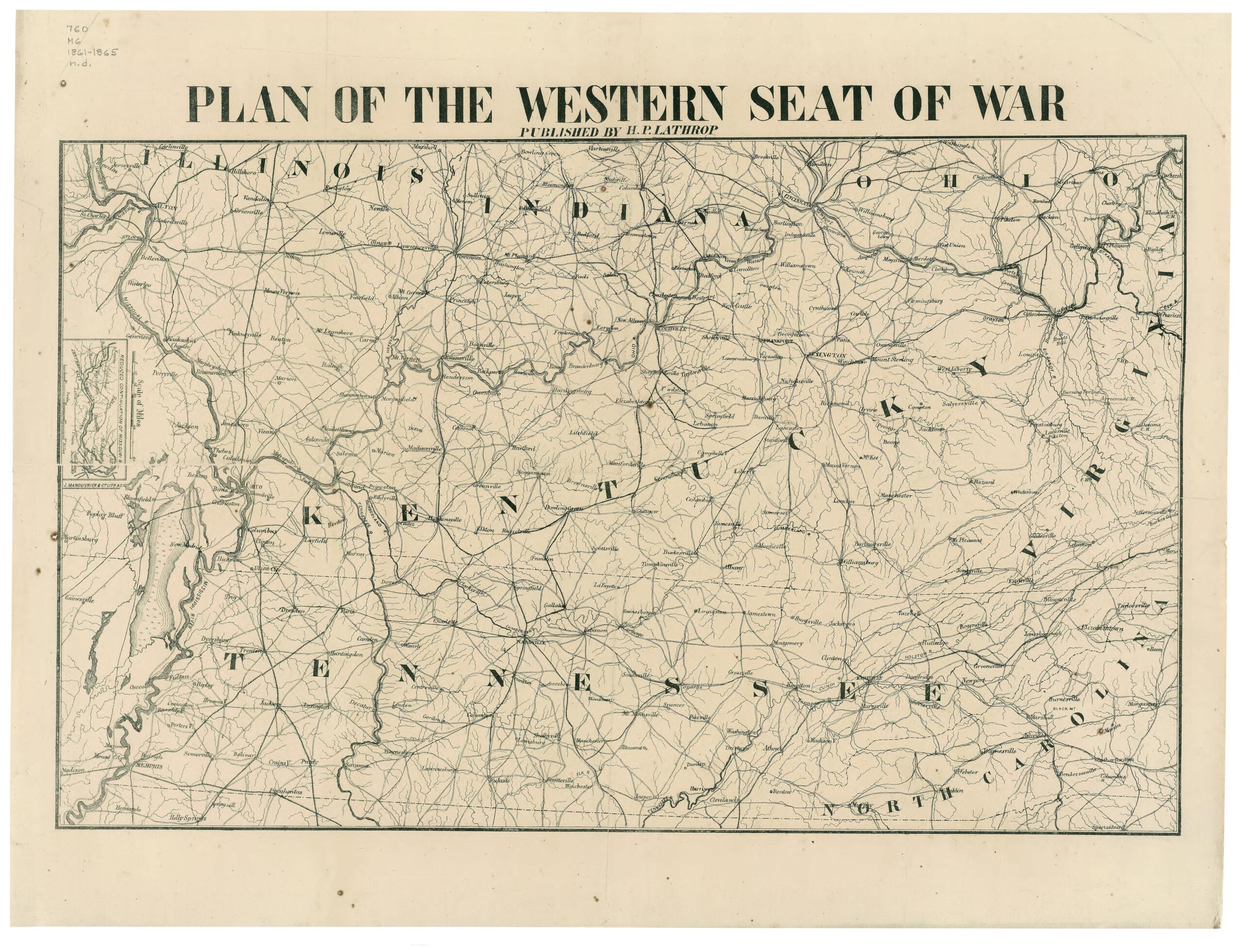
Old map of Southern States, United States.
Created by J. Manouvrier & Co., H. P. Lathrop in 1861.
Created by J. Manouvrier & Co., H. P. Lathrop in 1861.
- Description derived from published bibliography.
- General map of Kentucky, Tennessee, and parts of Illinois, Indiana, Ohio, Virginia, and North Carolina showing principal roads, railroads, towns, and rivers. Fortified sites and battlefields are not indicated.
- Inset: Reduced continuation of Missouri R. 4 x 7 cm.
- This item is in the Map Collection of the Library of Virginia; please contact the Library's Archives Research Services department for more information.
- Civil War Map
- Parrish & Willingham. Confederate imprints, 6180
- Swem, E.G. Maps relating to Virginia, 929
- June 1959, Goodspeed's, ca; Oct. 2003, Map Cataloging Team.
- Civil War project no.: lva00155.
- Conservation: restored May 1960; Etherington Conservation Center, Aug. 2003.
- Digital image available: 17.75 x 22 in.
- Map accession no. 1677 (1959).
- Previously filed as: 760 M6 1861-1865 n.d.
Map Sizing Information
- For the best legibility, order your map in the original size or larger. Most maps have intricate detail and small text that is best appreciated when the print size hasn't been reduced.
- Sizes labeled "Fits a Standard Frame" will drop right into any frame that you purchase in that size. The sizes that we offer are commonly available online and at most retail stores.
- Our standard sizes are recommendations based on the aspect ratio of the original map, but still may require some added "white space" in one dimension to fit.
- Non-standard sizes will require custom framing, and we suggest taking your print to the frame shop of your choice after you receive it for the best results.
- Custom sizes are available, simply contact us for a quote.
Below is an approximation of the scale of a few standard sizes, and how they might appear in your space.

