
Plan of Township No. 1, North of Phillips 1805
- Regular price
-
$54.95 - Regular price
-
$38.95 - Sale price
-
$54.95
Shipping calculated at checkout.
Buy one map, get any other map in our collection for 50% OFF! Add to cart to see discount.
Couldn't load pickup availability
About This Map
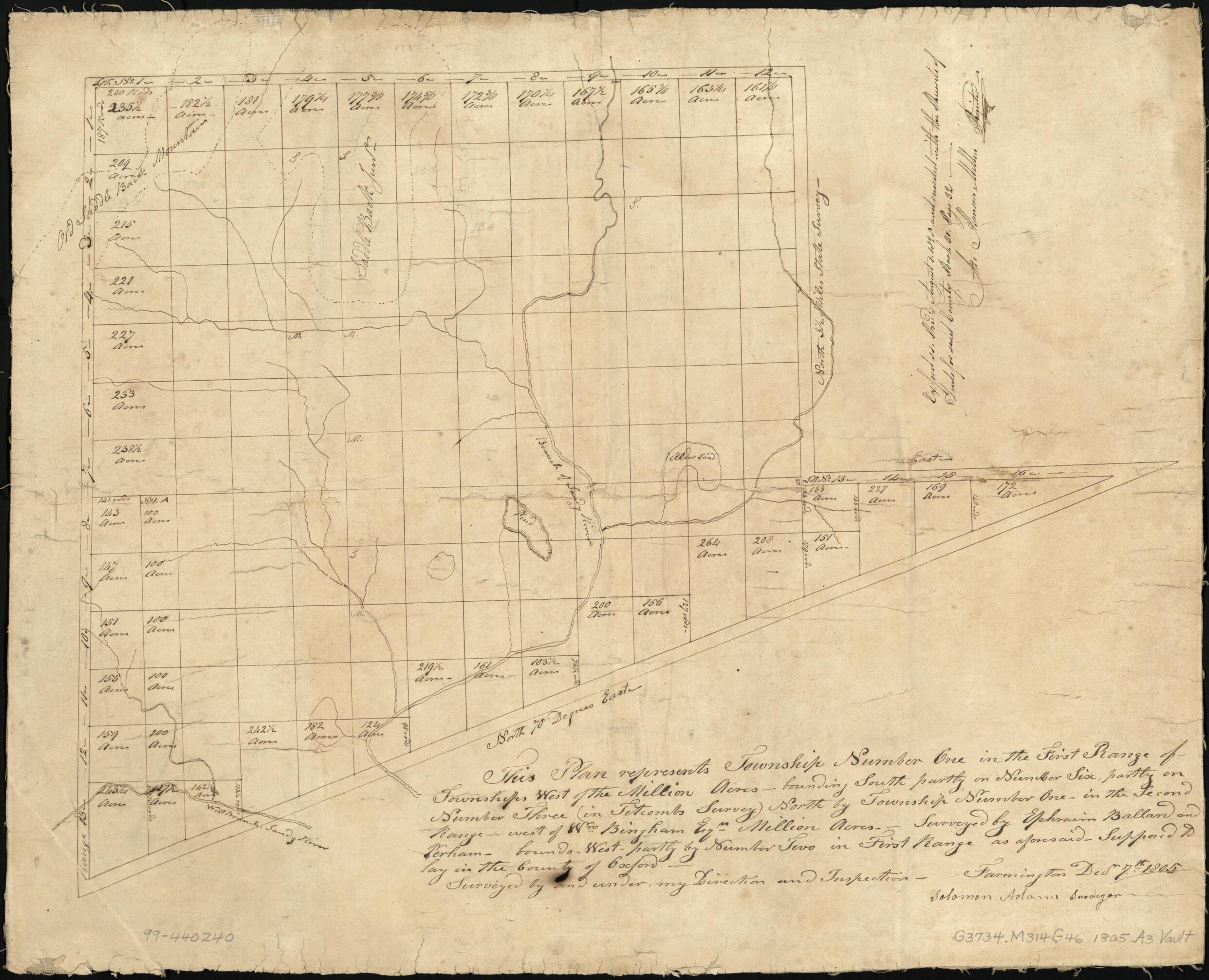
Old map of Madrid, Maine, Town, United States.
Created by Solomon Adams in 1805.
Created by Solomon Adams in 1805.
- Cadastral map of town of Madrid, Maine, showing numbered lots; acreage and dimensions given for some lots.
- "This plan represents township number one in the first range of townships west of the Million Acres ... supposed to lay in the county of Oxford."
- Title from verso.
- Pen-and-ink.
- Mounted on cloth backing.
- Note added to map after it was drawn: Oxford ss. recd. August 1, 1820 and recorded with the records of deeds for said county, book 30, page 32, att. Hanson Mellen, register.
- Copy This map has some imperfections: soiled, torn, small sections missing along edges of sheet. We'll do our best to restore the image before printing.
- Acquisitions control no. 83-56
Map Sizing Information
- For the best legibility, order your map in the original size or larger. Most maps have intricate detail and small text that is best appreciated when the print size hasn't been reduced.
- Sizes labeled "Fits a Standard Frame" will drop right into any frame that you purchase in that size. The sizes that we offer are commonly available online and at most retail stores.
- Our standard sizes are recommendations based on the aspect ratio of the original map, but still may require some added "white space" in one dimension to fit.
- Non-standard sizes will require custom framing, and we suggest taking your print to the frame shop of your choice after you receive it for the best results.
- Custom sizes are available, simply contact us for a quote.
Below is an approximation of the scale of a few standard sizes, and how they might appear in your space.

