
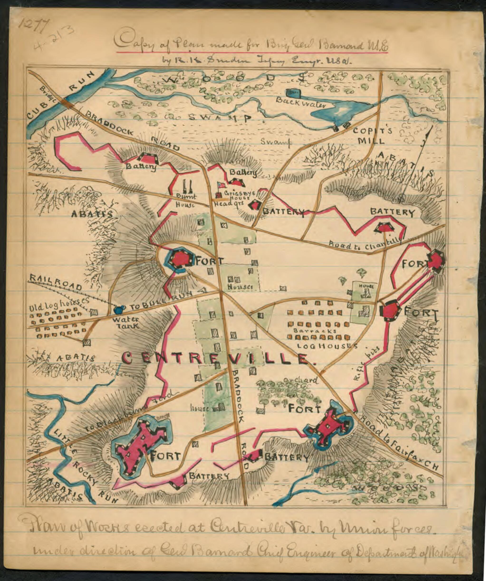
Plan of Works Erected at Centreville, Va., by Union Forces. Under Direction of Genl. Barnard Chief Engineer of Department of Washington 1861
- Regular price
-
$49.95 - Regular price
-
$29.95 - Sale price
-
$49.95
Shipping calculated at checkout.
Buy one map, get any other map in our collection for 50% OFF! Add to cart to see discount.
Couldn't load pickup availability
About This Map
Old map of Centreville, Fairfax County, United States, Virginia.
Map shows the area surrounding Centreville in Fairfax County , Va., and includes the locations of abandoned Confederate fortifications on the outskirts of the town.
Created by J. G. (John Gross) Barnard, Robert Knox Sneden in 1861.
Map shows the area surrounding Centreville in Fairfax County , Va., and includes the locations of abandoned Confederate fortifications on the outskirts of the town.
Created by J. G. (John Gross) Barnard, Robert Knox Sneden in 1861.
- "Copy of plan made for Brig. Genl. Barnard U.S.E. by R.K. Sneden Topy Engr. U.S.A." -- Page caption.
- Color coding indicates the location of Union fortifications.
- Relief shown by hachures.
- This item is from the collections of the Virginia Historical Society; please contact the institution for more information.
- In the Robert Knox Sneden Diary (Mss5:1 Sn237:1 v. 4, p. 213).
- Manuscripts
Map Sizing Information
- For the best legibility, order your map in the original size or larger. Most maps have intricate detail and small text that is best appreciated when the print size hasn't been reduced.
- Sizes labeled "Fits a Standard Frame" will drop right into any frame that you purchase in that size. The sizes that we offer are commonly available online and at most retail stores.
- Our standard sizes are recommendations based on the aspect ratio of the original map, but still may require some added "white space" in one dimension to fit.
- Non-standard sizes will require custom framing, and we suggest taking your print to the frame shop of your choice after you receive it for the best results.
- Custom sizes are available, simply contact us for a quote.
Below is an approximation of the scale of a few standard sizes, and how they might appear in your space.

