


Buy one map, get one map 50% off! Discount shown in cart.
Plan Zur Erlauterung Von Gen. Grant's Vicksburg Campagne Mai-Juli, in 1863
- Regular price
-
$39.95 - Regular price
-
$29.95 - Sale price
-
$39.95
Shipping calculated at checkout.
Couldn't load pickup availability
About This Map
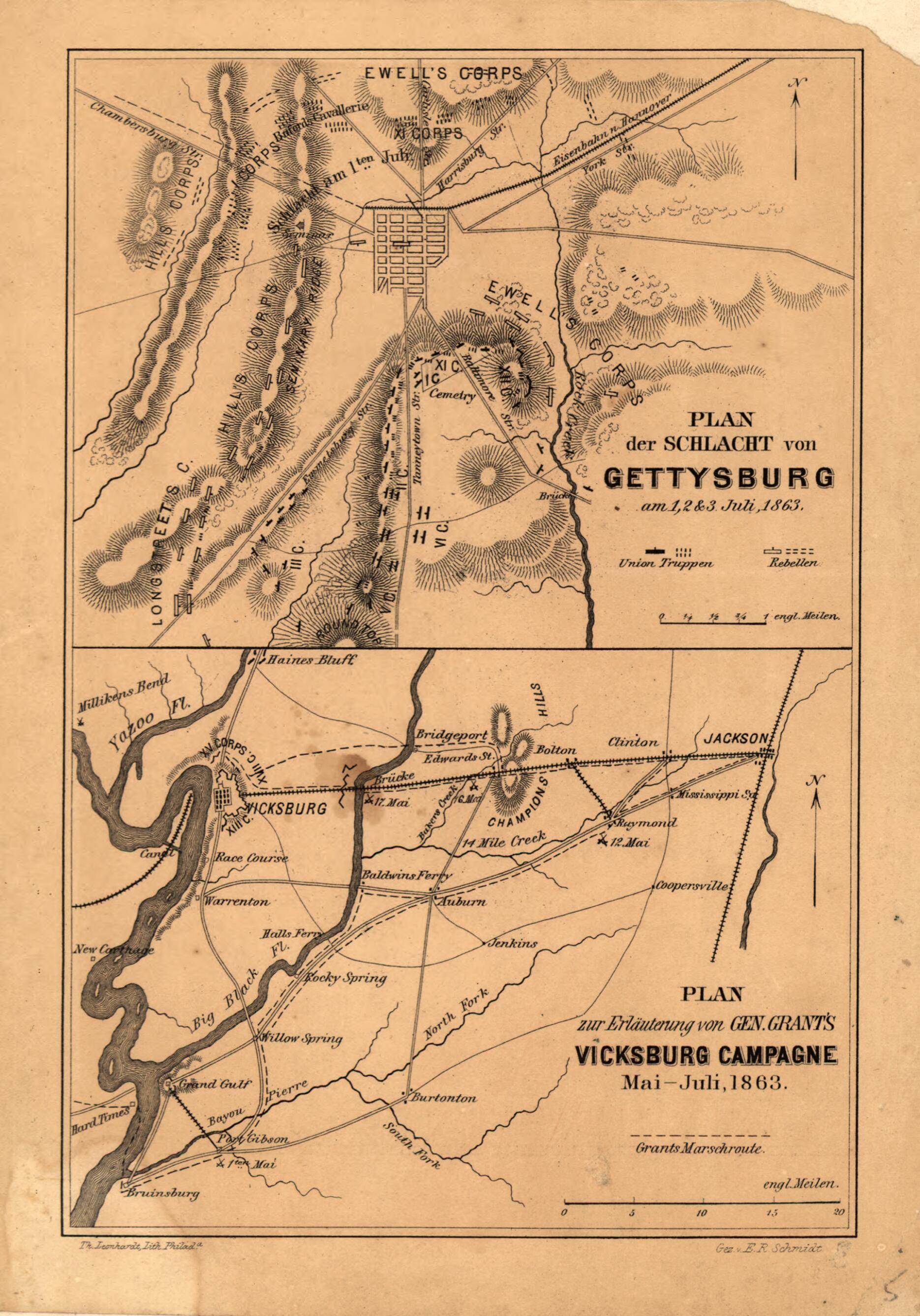
Old map of Gettysburg, Mississippi, Pennsylvania, United States, Vicksburg.
Created by Ernst Reinhold Schmidt in 1863.
Created by Ernst Reinhold Schmidt in 1863.
- Scales vary.
- Civil War Map
- From his Der Amerikanische Burgerkreig; Geschichte des Volks der Vereinigten Staaten vor, warhrend und nach der Rebellion. Philadelphia and Leipzig, Schafer und Koradi, 1867-69. facing p. 255.
- Gettysburg map shows the location of Union and Confederate corps. The Vicksburg campaign map indicates the route followed by General Grant.
- Description derived from published bibliography.
Map Tags
1863
Ernst Reinhold Schmidt
Gettysburg
Gettysburg (Pa.) Battle Of
Gettysburg Battle Of Gettysburg PA
History
Map
Maps
Mississippi
Pennsylvania
Siege
United States
Vicksburg
Vicksburg (Miss.)
Map Sizing Information
- For the best legibility, order your map in the original size or larger. Most maps have intricate detail and small text that is best appreciated when the print size hasn't been reduced.
- Sizes labeled "Fits a Standard Frame" will drop right into any frame that you purchase in that size. The sizes that we offer are commonly available online and at most retail stores.
- Our standard sizes are recommendations based on the aspect ratio of the original map, but still may require some added "white space" in one dimension to fit.
- Non-standard sizes will require custom framing, and we suggest taking your print to the frame shop of your choice after you receive it for the best results.
- Custom sizes are available, simply contact us for a quote.
Below is an approximation of the scale of a few standard sizes, and how they might appear in your space.
