
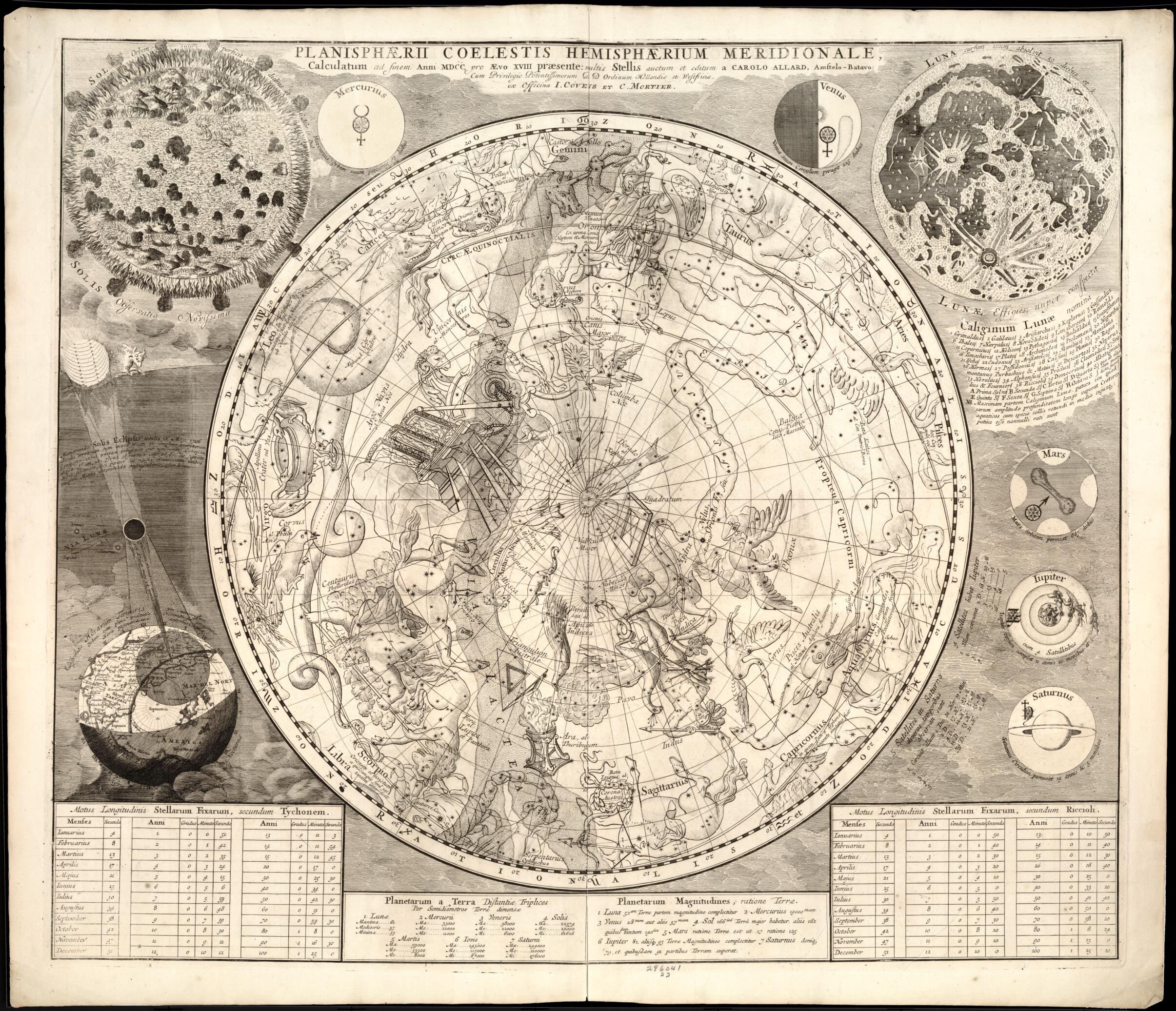
Planisphaerii Coelestis Hemisphaerium Meridionale : Calculatum Ad Finem Anni MDCC, Pro Aevo XVIII Praesente 1700
- Regular price
-
$102.95 - Regular price
-
$97.95 - Sale price
-
$102.95
Shipping calculated at checkout.
Buy one map, get any other map in our collection for 50% OFF! Add to cart to see discount.
Couldn't load pickup availability
About This Map
Old celestial chart of Universe.
Created by Carel Allard, Cóvens Et Mortier in 1700.
Created by Carel Allard, Cóvens Et Mortier in 1700.
- Shows hemispheric view with signs of the Zodiac and the constellations shown picorially.
- "Cum Privilegio Pontissimorum D D Ordinum Hollandiae et Westfrisiae".
- Appears in: Atlas nouveau contenant toutes les parties du monde, où sont exactement marqués les empires, monarchies, royaumes, états, républiques &c. Amsterdam: J. Cóvens et C. Mortier, [1683-1761].
- Includes tables and notes concerning stars.
- Insets: Solis observation novissima -- Lunae effigies, nuper conspecto -- Memoranda solis eclipsis -- Mercurius --Venus -- Mars -- Jupiter -- Saturnus.
Map Sizing Information
- For the best legibility, order your map in the original size or larger. Most maps have intricate detail and small text that is best appreciated when the print size hasn't been reduced.
- Sizes labeled "Fits a Standard Frame" will drop right into any frame that you purchase in that size. The sizes that we offer are commonly available online and at most retail stores.
- Our standard sizes are recommendations based on the aspect ratio of the original map, but still may require some added "white space" in one dimension to fit.
- Non-standard sizes will require custom framing, and we suggest taking your print to the frame shop of your choice after you receive it for the best results.
- Custom sizes are available, simply contact us for a quote.
Below is an approximation of the scale of a few standard sizes, and how they might appear in your space.

