
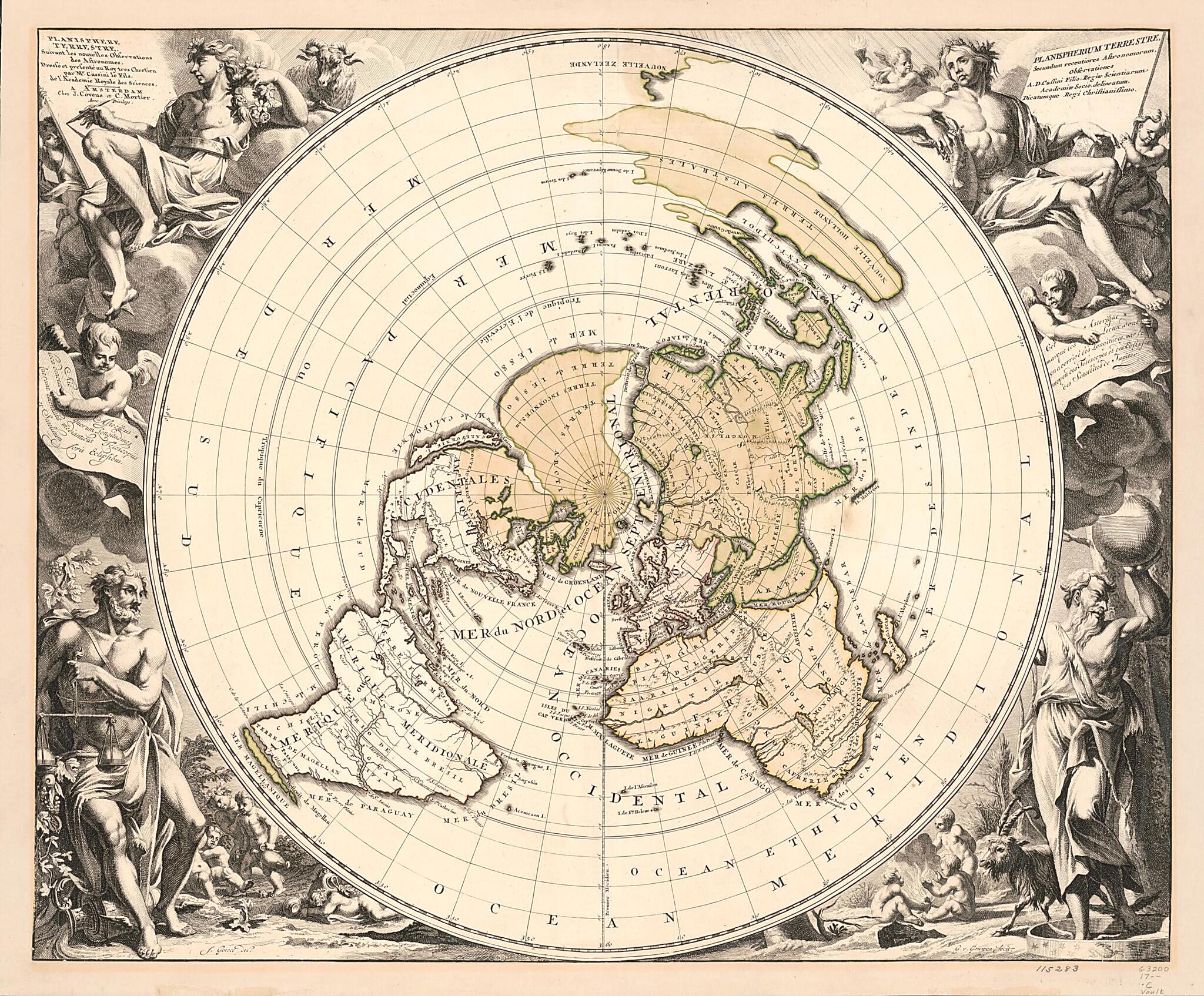
Planisphere Terrestre, Suivant Les Nouvelles Observations Des Astronomes (Planispherium Terrestre Secundum Recentiores Astronomorum Observationes) 1721
- Regular price
-
$72.95 - Regular price
-
$67.95 - Sale price
-
$72.95
Shipping calculated at checkout.
Buy one map, get any other map in our collection for 50% OFF! Add to cart to see discount.
Couldn't load pickup availability
About This Map
Old world map / early map of Earth (Planet).
Created by Jacques Cassini, Cóvens Et Mortier, Jan Goeree, Gilliam Van Der Gouwen, Nicolas Gueudeville, R. (Reinier) Ottens in 1721.
Created by Jacques Cassini, Cóvens Et Mortier, Jan Goeree, Gilliam Van Der Gouwen, Nicolas Gueudeville, R. (Reinier) Ottens in 1721.
- Relief shown pictorially.
- Centered on the North Pole.
- Includes illustrations and notes.
- A version of this map appears as map 2 in Gueudeville's Le nouveau theatre du monde of 1713, as map 27 in volume 1 of Ottens' Atlas maior, 1641-1729, and as map 5 in volume 1 of Covens and Mortier's Atlas nouveau, 1683-1761.
- French. Parallel title and notes also in Latin.
Map Subjects
Early Maps
Earth (Planet)
World Maps
World Maps
Early Maps
Jacques Cassini
Cóvens Et Mortier
Jan Goeree
Gilliam Van Der Gouwen
Nicolas Gueudeville
R. (Reinier) Ottens
1721
Map Sizing Information
- For the best legibility, order your map in the original size or larger. Most maps have intricate detail and small text that is best appreciated when the print size hasn't been reduced.
- Sizes labeled "Fits a Standard Frame" will drop right into any frame that you purchase in that size. The sizes that we offer are commonly available online and at most retail stores.
- Our standard sizes are recommendations based on the aspect ratio of the original map, but still may require some added "white space" in one dimension to fit.
- Non-standard sizes will require custom framing, and we suggest taking your print to the frame shop of your choice after you receive it for the best results.
- Custom sizes are available, simply contact us for a quote.
Below is an approximation of the scale of a few standard sizes, and how they might appear in your space.

