
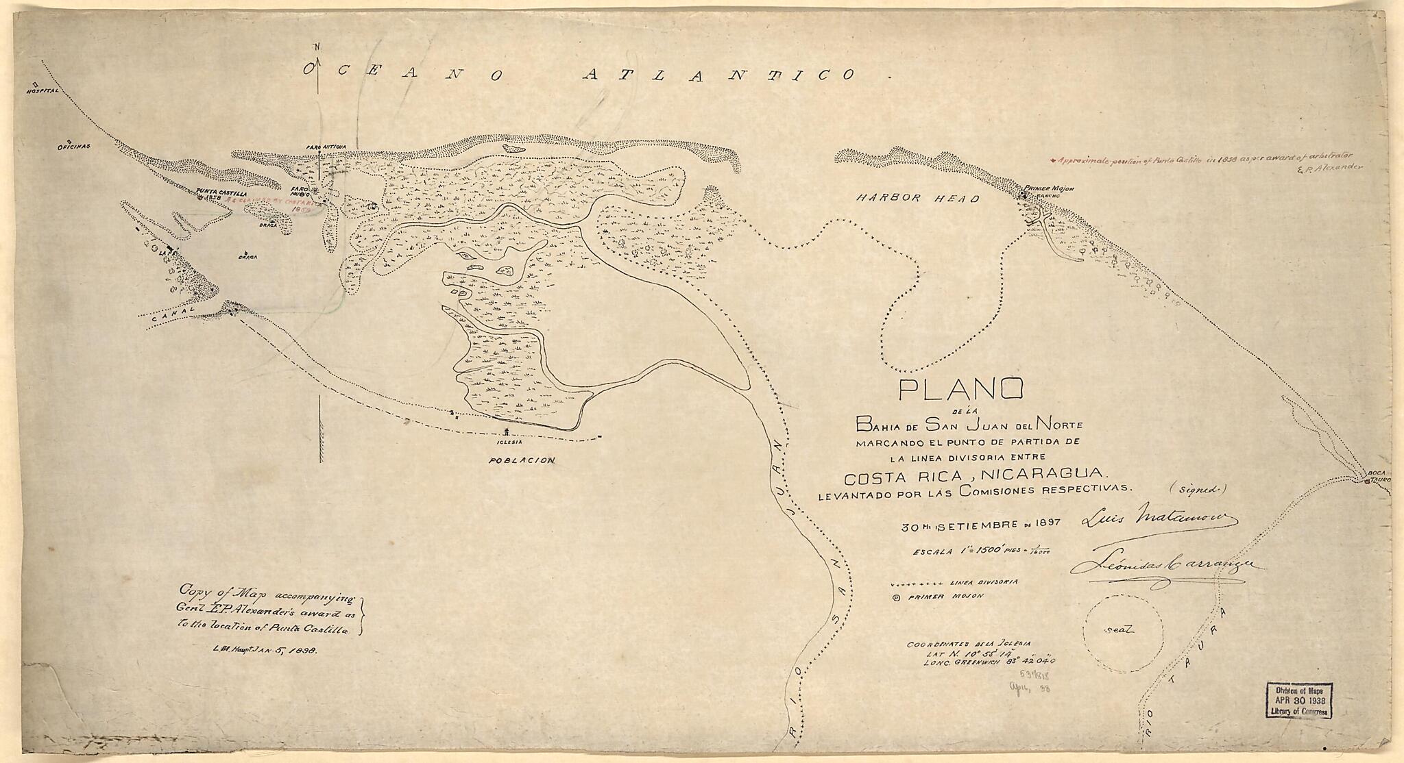
Plano De La Bahia De San Juan Del Norte, Marcando El Punto De Partida De La Linea Divisoria Entre Costa Rica, Nicaragua. Levantado Por Las Comisiones Respectivas 1898
- Regular price
-
$52.95 - Regular price
-
$36.95 - Sale price
-
$52.95
Shipping calculated at checkout.
Buy one map, get any other map in our collection for 50% OFF! Add to cart to see discount.
Couldn't load pickup availability
About This Map
Old map of Costa Rica, Nicaragua, San Juan River.
Created by Lewis M. (Lewis Muhlenberg) Haupt in 1898.
Created by Lewis M. (Lewis Muhlenberg) Haupt in 1898.
- "30th setiembre de 1897."
- Annotated in red ink: Approximate position of Puerto Castillo in 1858 as per award of arbitrator E.P. Alexander.
- Annotated in red ink: As claimed by Costa Rica, 1858.
Map Subjects
Boundaries
Costa Rica
Nicaragua
San Juan River
San Juan River (Nicaragua And Costa Rica)
Lewis M. (Lewis Muhlenberg) Haupt
1898
Map Sizing Information
- For the best legibility, order your map in the original size or larger. Most maps have intricate detail and small text that is best appreciated when the print size hasn't been reduced.
- Sizes labeled "Fits a Standard Frame" will drop right into any frame that you purchase in that size. The sizes that we offer are commonly available online and at most retail stores.
- Our standard sizes are recommendations based on the aspect ratio of the original map, but still may require some added "white space" in one dimension to fit.
- Non-standard sizes will require custom framing, and we suggest taking your print to the frame shop of your choice after you receive it for the best results.
- Custom sizes are available, simply contact us for a quote.
Below is an approximation of the scale of a few standard sizes, and how they might appear in your space.
