
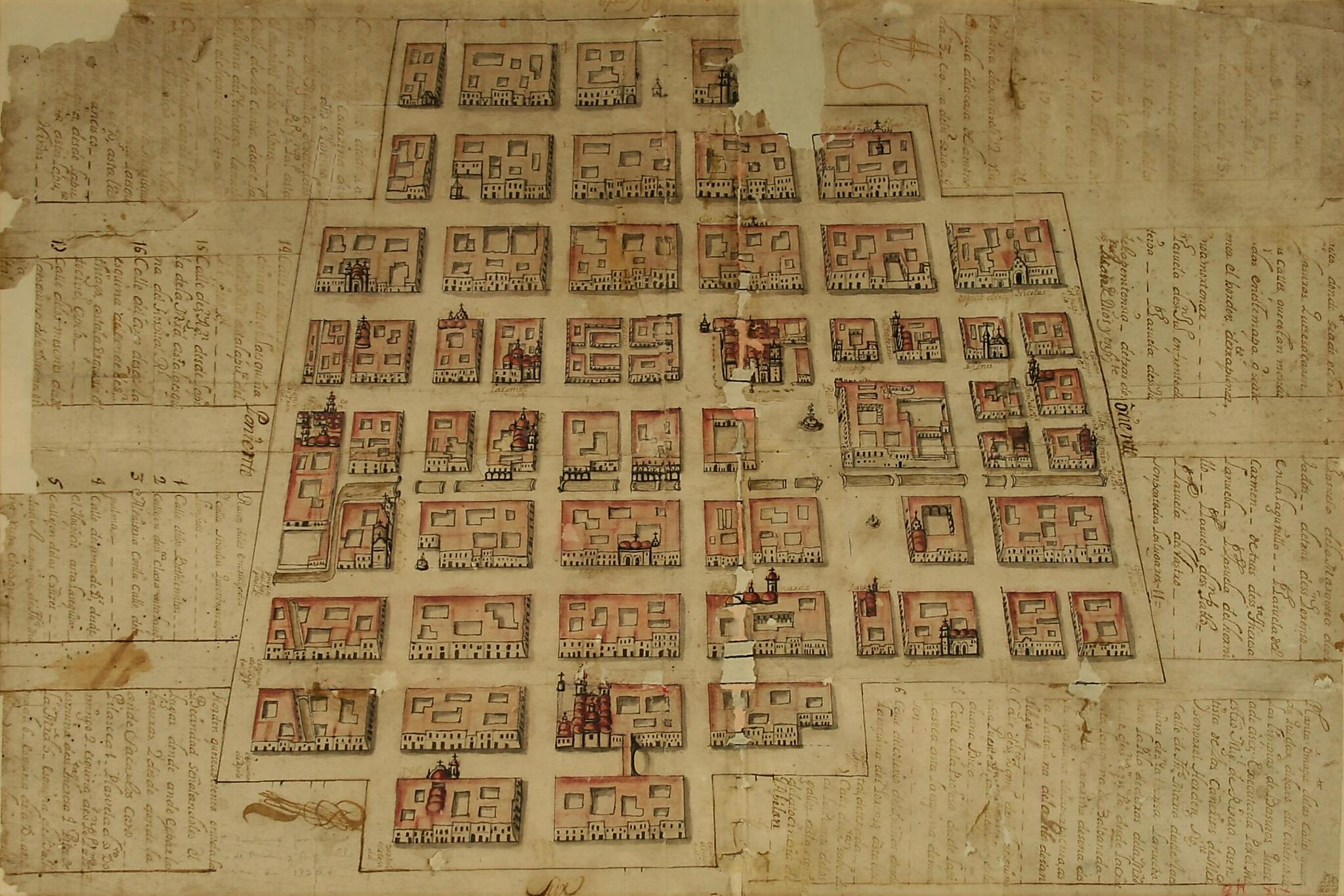
Map of Mexico City. (Plano De La Ciudad De México) 1720
- Regular price
-
$49.95 - Regular price
-
$34.95 - Sale price
-
$49.95
Buy one map, get any other map in our collection for 50% OFF! Add to cart to see discount.
Couldn't load pickup availability
About This Map
Discover the timeless beauty of our fine art quality printed reproduction of this antique map. Perfect for history enthusiasts, collectors, and interior decorators.
Restored with meticulous attention to detail by our team with over a decade of experience, this stunning reproduction captures the intricate artistry and historical significance of the original map.
Whether you're a collector or seeking a unique decor piece, this archival-quality map reproduction is a timeless addition to any space. Order now to bring history to life!
Old map of Distrito Federal, Mexico, Mexico City.Dated 1720, this map was produced by the government of Mexico City in order to improve urban sanitation through the collection of garbage. It shows the central part of the city in detail, including names of streets, plazas, hospitals, hospices, columns, small squares, arches, and other places.
Created by Antonio Alvarez, Miguel Rivera in 1720.
- Title devised, in English, by Library staff.
- Original resource extent: Ink on paper 59 x 42 centimeters.
- Original resource at: Center for the Study of the History of Mexico CARSO.
- Content in Spanish.
- Description based on data extracted from World Digital Library, which may be extracted from partner institutions.
Map Subjects
Colonies
Distrito Federal
Mexico
Mexico City
New Spain
Sanitation
Spain
Antonio Alvarez
Miguel Rivera
1720
- For the best legibility, order your map in the original size or larger. Most maps have intricate detail and small text that is best appreciated when the print size hasn't been reduced.
- Sizes labeled "Fits a Standard Frame" will drop right into any frame that you purchase in that size. The sizes that we offer are commonly available online and at most retail stores.
- Our standard sizes are recommendations based on the aspect ratio of the original map, but still may require some added "white space" in one dimension to fit.
- Non-standard sizes will require custom framing, and we suggest taking your print to the frame shop of your choice after you receive it for the best results.
- Custom sizes are available, simply contact us for a quote.
Below is an approximation of the scale of a few standard sizes, and how they might appear in your space.
