
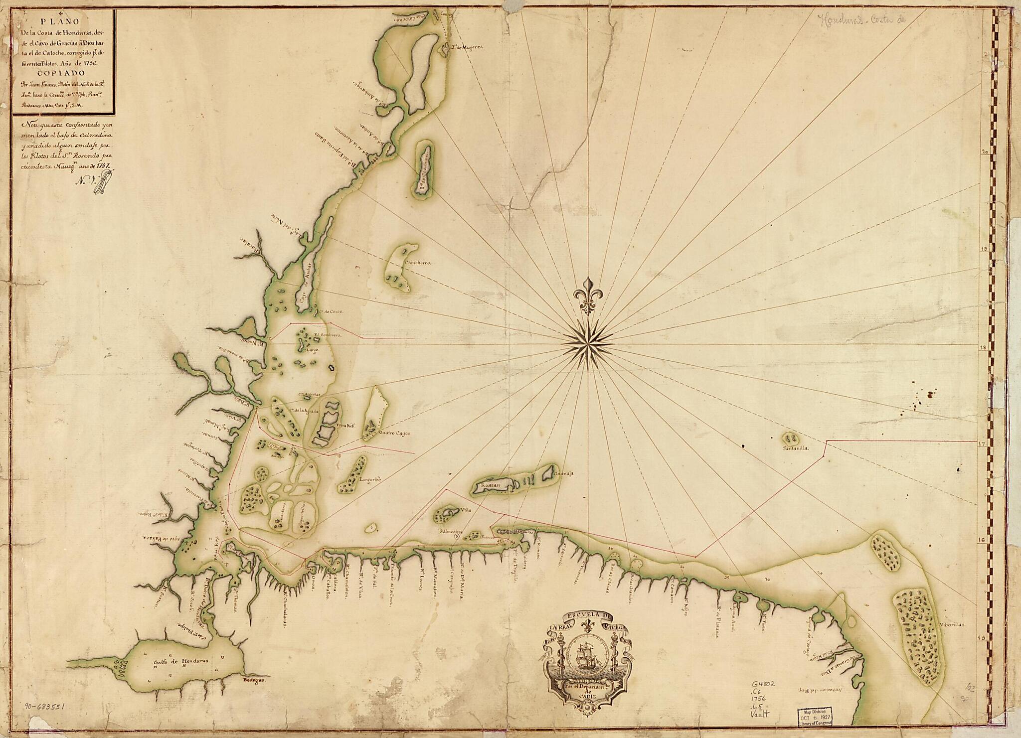
Plano De La Costa De Honduras Desde El Cavo De Gracias a Dios Hasta El De Catoche, Corregido Pr. Diferentes Pilotos, Año De 1756
- Regular price
-
$75.95 - Regular price
-
$70.95 - Sale price
-
$75.95
Shipping calculated at checkout.
Buy one map, get any other map in our collection for 50% OFF! Add to cart to see discount.
Couldn't load pickup availability
About This Map
Old map of Atlantic Coast, Central America, Yucatán Peninsula.
Created by Juan Linares, Spain) Real Escuela De Navegación (Cádiz in 1756.
Created by Juan Linares, Spain) Real Escuela De Navegación (Cádiz in 1756.
- Shows Atlantic coast of Central America covering Belize, Guatemala, Honduras, a small portion of Nicaragua, and a portion of the Yucatán Peninsula. Also shows routes of expeditions.
- Depths shown by soundings.
- Watermarks: IV; and, Strasburg fleur-de-lis.
- Pen-and-ink and watercolor.
- Mounted on cloth backing.
- Includes note. Date in the note: 1757.
- Annotated in black ink in upper left corner: N. 1 [indecipherable].
- Maggs number annotated in pencil in lower right corner: 102.
Map Subjects
Atlantic Coast
Atlantic Coast (Central America)
Central America
Coasts
Discovery And Exploration
Early Works To 1800
Manuscript Maps
Maps Manuscript
Yucatán Peninsula
Juan Linares
Spain) Real Escuela De Navegación (Cádiz
1756
Map Sizing Information
- For the best legibility, order your map in the original size or larger. Most maps have intricate detail and small text that is best appreciated when the print size hasn't been reduced.
- Sizes labeled "Fits a Standard Frame" will drop right into any frame that you purchase in that size. The sizes that we offer are commonly available online and at most retail stores.
- Our standard sizes are recommendations based on the aspect ratio of the original map, but still may require some added "white space" in one dimension to fit.
- Non-standard sizes will require custom framing, and we suggest taking your print to the frame shop of your choice after you receive it for the best results.
- Custom sizes are available, simply contact us for a quote.
Below is an approximation of the scale of a few standard sizes, and how they might appear in your space.

