
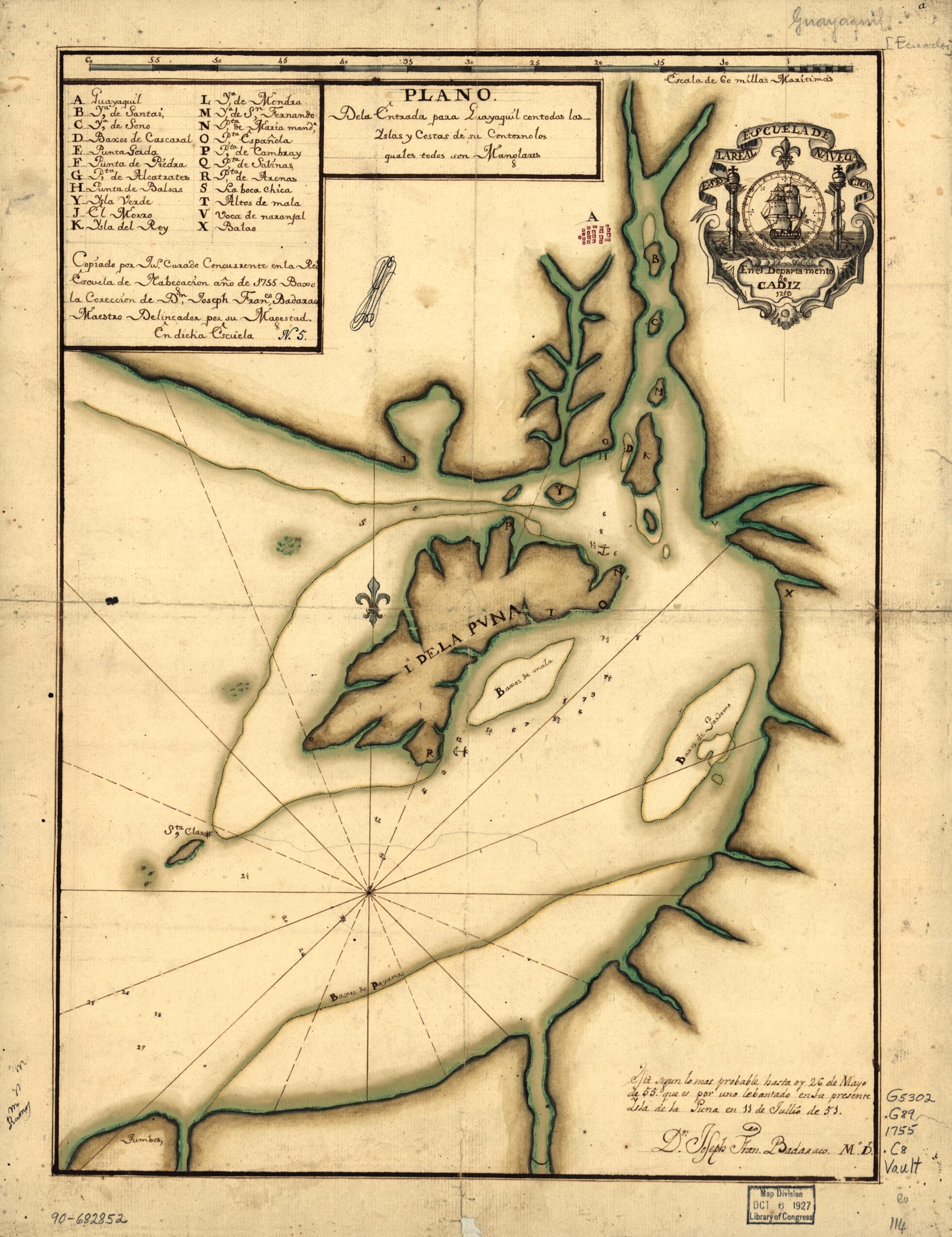
Plano De La Entrada Para Guayaquil Con Todas Las Yslas Y Costas De Su Contorno Los Quales Todaos Son Manglares 1755
- Regular price
-
$49.95 - Regular price
-
$34.95 - Sale price
-
$49.95
Shipping calculated at checkout.
Buy one map, get any other map in our collection for 50% OFF! Add to cart to see discount.
Couldn't load pickup availability
About This Map
Old map of Guayaquil, Gulf Of., Gulf of Guayaquil.
Created by Juan Manuel Curado in 1755.
Created by Juan Manuel Curado in 1755.
- Depths shown by soundings.
- Watermarks: IV; and, fleur-de-lis.
- Pen-and-ink and watercolor.
- Mounted on cloth backing.
- Indexed.
- Written and signed in lower right corner: Esta segun lo mas probable hasta oy 26 de mayo de 55 que es por uno lebantado en la presente Ysla de la Puna en 11 de jullio de 51. Dn. Joseph Franco. Badaraco, mo. dr.
- Annotated in black ink: N. 5 [indecipherable].
- Maggs number annotated in pencil in lower right corner: 114.
Map Sizing Information
- For the best legibility, order your map in the original size or larger. Most maps have intricate detail and small text that is best appreciated when the print size hasn't been reduced.
- Sizes labeled "Fits a Standard Frame" will drop right into any frame that you purchase in that size. The sizes that we offer are commonly available online and at most retail stores.
- Our standard sizes are recommendations based on the aspect ratio of the original map, but still may require some added "white space" in one dimension to fit.
- Non-standard sizes will require custom framing, and we suggest taking your print to the frame shop of your choice after you receive it for the best results.
- Custom sizes are available, simply contact us for a quote.
Below is an approximation of the scale of a few standard sizes, and how they might appear in your space.

