
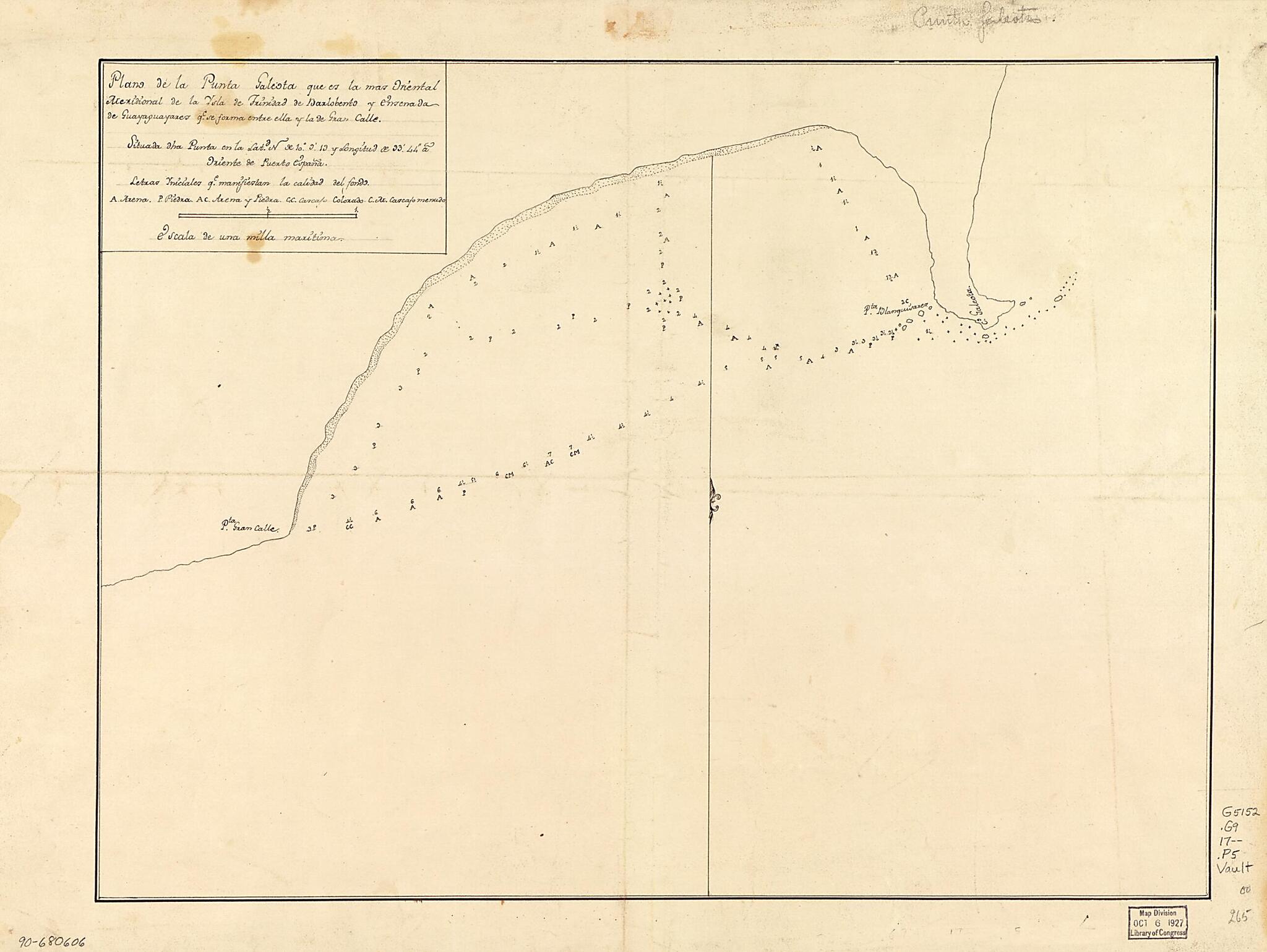
Plano De La Punta Galeota Que Es La Mas Oriental Meridional De La Ysla De Trinidad De Barlobento Y Ensenada De Guayaguayares Qe. Se Forma Entre Ella Y La De Gran Calle, Situada Dha. Punta En La Latd. N. De 10⁰9ʹ13 Y Longitud De 33ʹ44ʺ a Oriente D...
- Regular price
-
$53.95 - Regular price
-
$37.95 - Sale price
-
$53.95
Shipping calculated at checkout.
Buy one map, get any other map in our collection for 50% OFF! Add to cart to see discount.
Couldn't load pickup availability
About This Map
Old map of Guayaguayare Bay, Tobago, Trinidad, Trinidad and Tobago.
- Shows Guayaguayare Bay between Gran Cayo Point and Galeota Point.
- Depths shown by soundings.
- Prime meridian: Port of Spain.
- Watermark: J. Whatman.
- Pen-and-ink.
- Mounted on cloth backing.
- Maggs number annotated in pencil in lower right margin: 265.
Map Subjects
Coasts
Early Works To 1800
Guayaguayare Bay
Guayaguayare Bay (Trinidad And Tobago)
Maps Manuscript
Trinidad And Tobago
Tobago
Trinidad
1700
Map Sizing Information
- For the best legibility, order your map in the original size or larger. Most maps have intricate detail and small text that is best appreciated when the print size hasn't been reduced.
- Sizes labeled "Fits a Standard Frame" will drop right into any frame that you purchase in that size. The sizes that we offer are commonly available online and at most retail stores.
- Our standard sizes are recommendations based on the aspect ratio of the original map, but still may require some added "white space" in one dimension to fit.
- Non-standard sizes will require custom framing, and we suggest taking your print to the frame shop of your choice after you receive it for the best results.
- Custom sizes are available, simply contact us for a quote.
Below is an approximation of the scale of a few standard sizes, and how they might appear in your space.

