
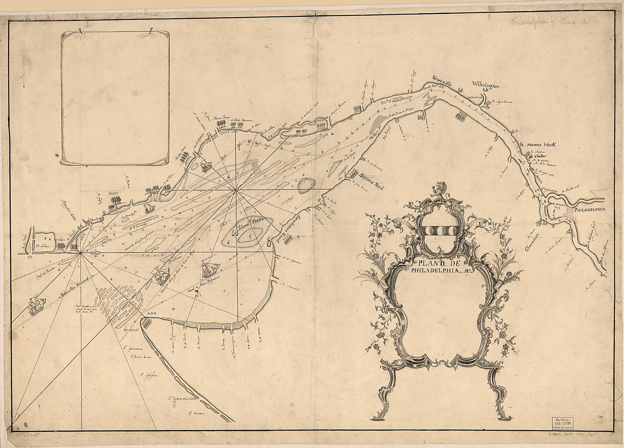
Plano De Philadelphia 1756
- Regular price
-
$71.95 - Regular price
-
$66.95 - Sale price
-
$71.95
Shipping calculated at checkout.
Buy one map, get any other map in our collection for 50% OFF! Add to cart to see discount.
Couldn't load pickup availability
About This Map
Old map of Delaware, Delaware Bay, Delaware River Watershed, New Jersey, New York, New York (State), United States.
Created by Joshua Fisher in 1756.
Created by Joshua Fisher in 1756.
- Scale ca. 1:220,000.
- Manuscript, pen and ink.
- Copied from Joshua Fishers' "To the merchants & insurers of the city of Philadelphia, this chart of Delaware Bay and river."
- Depths shown in fathoms.
- Oriented with north to the right.
- Shows shipping channels.
Map Subjects
Delaware
Delaware Bay
Delaware Bay (Del. And N.J.)
Delaware River Watershed
DEL. And N.J.)
Early Works To 1800
Maps Manuscript
Nautical Charts
New Jersey
New York (State)
United States
New York
Joshua Fisher
1756
Map Sizing Information
- For the best legibility, order your map in the original size or larger. Most maps have intricate detail and small text that is best appreciated when the print size hasn't been reduced.
- Sizes labeled "Fits a Standard Frame" will drop right into any frame that you purchase in that size. The sizes that we offer are commonly available online and at most retail stores.
- Our standard sizes are recommendations based on the aspect ratio of the original map, but still may require some added "white space" in one dimension to fit.
- Non-standard sizes will require custom framing, and we suggest taking your print to the frame shop of your choice after you receive it for the best results.
- Custom sizes are available, simply contact us for a quote.
Below is an approximation of the scale of a few standard sizes, and how they might appear in your space.

