
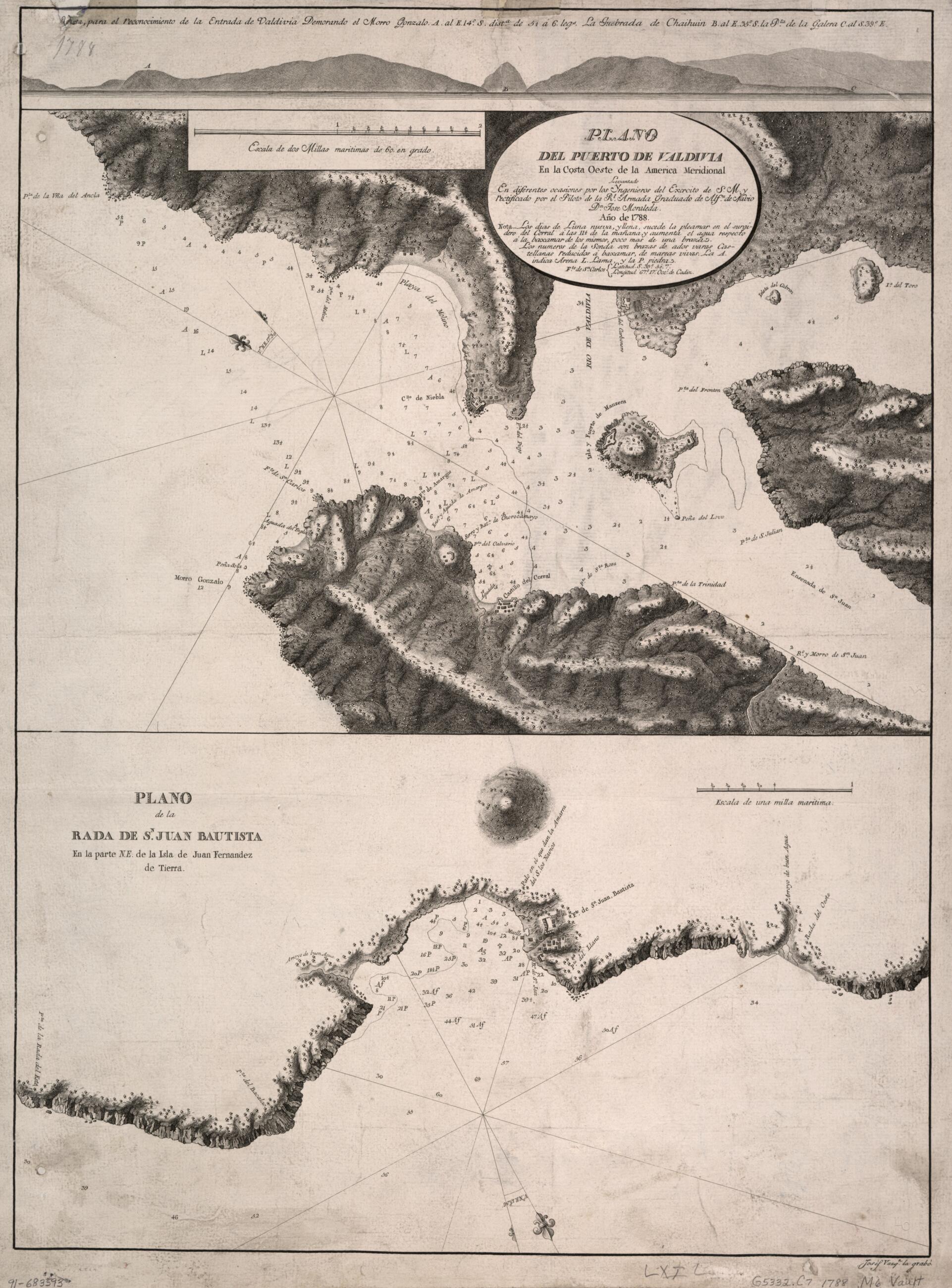
Plano Del Puerto De Valdivia En La Costa Oeste De La América Meridional 1788
- Regular price
-
$79.95 - Regular price
-
$74.95 - Sale price
-
$79.95
Shipping calculated at checkout.
Buy one map, get any other map in our collection for 50% OFF! Add to cart to see discount.
Couldn't load pickup availability
About This Map
Old early map of Chile, Corral Bay, Pacific Coast.
Created by José Manuel De Moraleda in 1788.
Created by José Manuel De Moraleda in 1788.
- Shows Corral Bay near the mouth of Valdivia River.
- Relief shown by hachures. Depths shown by soundings.
- Prime meridian: Cádiz.
- Oriented with north toward the upper left.
- Includes ancillary map "Plano de la rada de Sn. Juan Bautista en la parte N.E. de la Isla de Juan Fernandez de Tierra" and view "Vista, para el reconocimiento de la entrada de Valdivia ..."
- Acquisitions control no. 23-86
Map Sizing Information
- For the best legibility, order your map in the original size or larger. Most maps have intricate detail and small text that is best appreciated when the print size hasn't been reduced.
- Sizes labeled "Fits a Standard Frame" will drop right into any frame that you purchase in that size. The sizes that we offer are commonly available online and at most retail stores.
- Our standard sizes are recommendations based on the aspect ratio of the original map, but still may require some added "white space" in one dimension to fit.
- Non-standard sizes will require custom framing, and we suggest taking your print to the frame shop of your choice after you receive it for the best results.
- Custom sizes are available, simply contact us for a quote.
Below is an approximation of the scale of a few standard sizes, and how they might appear in your space.

