
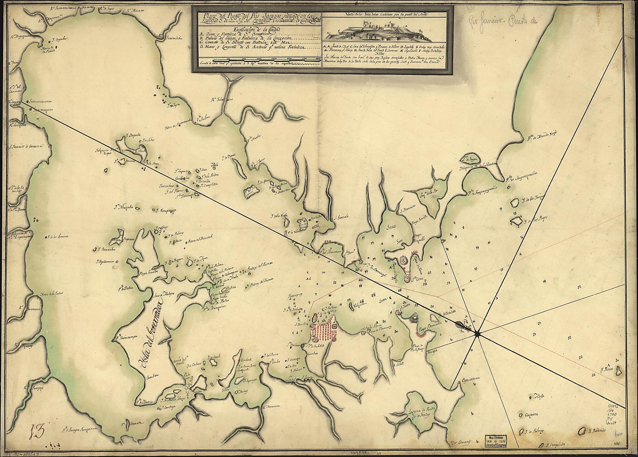
Plano Del Puerto Del Rio Janeiro Situado En La Latitud S. De 22⁰54ʹ10ʺ Longitud Occidental De Cádiz 36⁰31ʹ 1780
- Regular price
-
$73.95 - Regular price
-
$68.95 - Sale price
-
$73.95
Shipping calculated at checkout.
Buy one map, get any other map in our collection for 50% OFF! Add to cart to see discount.
Couldn't load pickup availability
About This Map
Old map of Brazil, Guanabara Bay, Rio De Janeiro.
- Depths shown by soundings.
- Prime meridian: Cádiz.
- Oriented with north toward the upper left.
- Pen-and-ink and watercolor.
- Mounted on cloth backing.
- Includes index and indexed inset showing view of fortified Culebras Island.
- Printed label describing the map mounted on verso.
- Annotated in brown ink in lower left corner: 13.
- Maggs number annotated in pencil in lower right corner: 44.
Map Subjects
Brazil
Early Works To 1800
Guanabara Bay
Guanabara Bay (Brazil)
Harbors
Maps Manuscript
Rio De Janeiro
1780
Map Sizing Information
- For the best legibility, order your map in the original size or larger. Most maps have intricate detail and small text that is best appreciated when the print size hasn't been reduced.
- Sizes labeled "Fits a Standard Frame" will drop right into any frame that you purchase in that size. The sizes that we offer are commonly available online and at most retail stores.
- Our standard sizes are recommendations based on the aspect ratio of the original map, but still may require some added "white space" in one dimension to fit.
- Non-standard sizes will require custom framing, and we suggest taking your print to the frame shop of your choice after you receive it for the best results.
- Custom sizes are available, simply contact us for a quote.
Below is an approximation of the scale of a few standard sizes, and how they might appear in your space.

